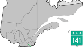
Quebec Route 141
Route 141 is a north/south highway in Quebec on the south shore of the Saint Lawrence River. Its northern terminus is in Magog at the junction of Route 112 and Autoroute 10, and the southern terminus is in Saint-Herménégilde at the United States border in Canaan, Vermont.
| ||||
|---|---|---|---|---|
 | ||||
| Route information | ||||
| Maintained by Transports Québec | ||||
| Length | 80.8 km[1] (50.2 mi) | |||
| Major junctions | ||||
| South end | ||||
| North end | ||||
| Location | ||||
| Counties | Coaticook / Memphrémagog | |||
| Highway system | ||||
| ||||

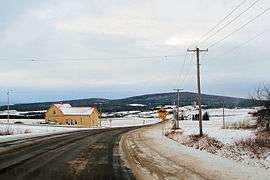
Route 141 at St-Herménégilde
Municipalities along Route 141
- Saint-Herménégilde
- Dixville
- Coaticook
- Barnston-Ouest
- Stanstead-Est
- Ayer's Cliff
- Sainte-Catherine-de-Hatley
- Magog
- Orford
Major intersections
| RCM or ET | Municipality | Km | Junction | Notes |
|---|---|---|---|---|
Southern terminus of Route 141 | ||||
| Coaticook | Saint-Herménégilde | 0.0 | 141 SOUTH: to Canaan, Vermont and | |
| 17.7 | 251 NORTH: to Sainte-Edwidge-de-Clifton | |||
| Coaticook | 26.0 | 147 SOUTH: to Dixville | ||
| 27.9 | 206 EAST: to Sainte-Edwidge-de-Clifton | |||
| 28.4 | 147 NORTH: to Compton | |||
| Memphrémagog | Stanstead-East | 47.9 | 143 SOUTH: to Stanstead 143 NORTH: to Hatley | |
| Ayer's Cliff | 50.4 | 208 EAST: to Hatley | ||
| Sainte-Catherine-de-Hatley | 54.1 54.3 |
55 NORTH: to Magog 55 SOUTH: to Stanstead-Est | ||
| Magog | 66.7 | 247 SOUTH: to Stanstead Township | ||
| 67.0(*) | 112 WEST: to Austin 112 EAST: to Sherbrooke | |||
| 70.2 70.5 |
10 EAST: to Sherbrooke 10 WEST: to Austin | |||
| 80.8 | 112 WEST: to Austin 112 EAST: to Sherbrooke | |||
Northern terminus of Route 141 | ||||
gollark: It's one of those accursed perluous things where you need runtime information to parse.
gollark: Still, I also don't think I can arbitrarily edit more abstract beliefs either.
gollark: I guess beliefs like "objects are not yellow" are among the harder-to-edit kinds since they're directly contradicted by the evidence in font of me.
gollark: Yes, and?
gollark: I can't really just go "hmm, today I will believe that all objects are yellow"; I can think about stuff like "what if all objects ever were yellow", but that isn't the same.
See also
References
- Ministère des transports, "Distances routières", page 69, Les Publications du Québec, 2005
External links
- Provincial Route Map (Courtesy of the Quebec Ministry of Transportation) (in French)
- Route 141 on Google Maps
This article is issued from Wikipedia. The text is licensed under Creative Commons - Attribution - Sharealike. Additional terms may apply for the media files.