Quebec Route 139
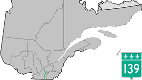
Route 139 is a north/south highway on the south shore of the Saint Lawrence River. Its northern terminus is in Saint-Nicéphore, now part of Drummondville, at the junction of Route 143, and the southern terminus is in Abercorn at the border with Richford, Vermont at the Richford–Abercorn Border Crossing.
| ||||
|---|---|---|---|---|
 | ||||
| Route information | ||||
| Maintained by Transports Québec | ||||
| Length | 124.1 km[1] (77.1 mi) | |||
| Major junctions | ||||
| South end | ||||
| North end | ||||
| Location | ||||
| Counties | Brome-Missisquoi / La Haute-Yamaska / Acton / Drummond | |||
| Highway system | ||||
| ||||

Municipalities along Route 139
.jpg)
Quebec Route 139 at Acton Vale
- Abercorn
- Sutton
- Brome Lake
- Cowansville
- East Farnham
- Brigham
- Bromont
- Saint-Alphonse-de-Granby
- Granby
- Roxton Pond
- Roxton
- Roxton Falls
- Acton Vale
- Saint-Théodore-d'Acton
- Wickham
- Saint-Nicéphore (Drummondville)
Major intersections
| RCM or ET | Municipality | Km | Junction | Notes |
|---|---|---|---|---|
Southern terminus of Route 139 | ||||
| Brome-Missisquoi | Abercorn | 0.0 | SOUTH: to Richford, Vermont | |
| Sutton | 11.5 | 215 NORTH: to Brome | ||
| Cowansville | 24.0 | 104 EAST: to Brome Lake | ||
| 26.7 | 241 NORTH: to Bromont | |||
| 31.8 | 202 WEST: to Dunham | |||
| 34.7 | 104 WEST: to Farnham | |||
| East-Farnham | 40.0 | Avenue-des-Érables | WEST: to Brigham | |
| La Haute-Yamaska | Saint-Alphonse-de-Granby | 49.9 50.3 |
10 EAST: to Bromont 10 WEST: to Ange-Gardien | |
| Granby | 58.3 | 112 WEST: to Saint-Paul-d'Abbotsford 112 EAST: to Waterloo | ||
| Acton | Roxton Falls | 88.8 | 241 SOUTH: to Saint-Joachim-de-Shefford | |
| 89.4 | 222 EAST: to Sainte-Christine | |||
| Acton Vale | 98.3 99.1 |
116 WEST: to Upton 116 EAST: to Durham-Sud | ||
| Drummond | Wickham | 114.0 | Rue Blanchard | SOUTH: to Lefebvre |
| Saint-Nicéphore | 122.1 122.6 |
55 SOUTH: to L'Avenir 55 NORTH: to Drummondville | ||
| 124.1 | 143 SOUTH: to L'Avenir 143 NORTH: to Drummondville | |||
Northern terminus of Route 139 | ||||
gollark: But I'm in the UK, what am I meant to do? HELP ME!
gollark: Or "Golang", since "Go" is an awful name and unsearchable.
gollark: yep.
gollark: The server/reverse proxy is in (*oh, the horror*) Go.
gollark: Even osmarks.tk supports Unicode!
See also
References
- Ministère des transports, "Distances routières", page 69, Les Publications du Québec, 2005
External links
- Provincial Route Map (Courtesy of the Quebec Ministry of Transportation) (in French)
- Route 139 on Google Maps
This article is issued from Wikipedia. The text is licensed under Creative Commons - Attribution - Sharealike. Additional terms may apply for the media files.