Little Yarra River
The Little Yarra River is a perennial river of the Port Phillip catchment, located in the Greater Metropolitan Melbourne region of the Australian state of Victoria.
| Little Yarra | |
|---|---|
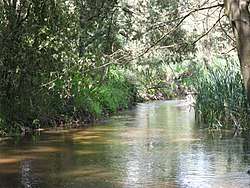 Little Yarra River at Yarra Junction, in 2009. | |
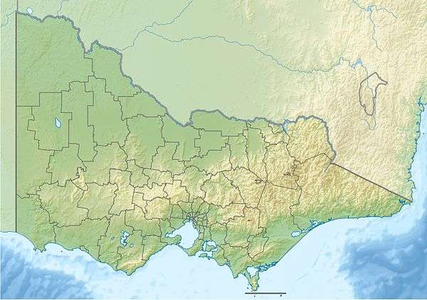 Location of the Little Yarra River mouth in Victoria | |
| Location | |
| Country | Australia |
| State | Victoria |
| Region | South Eastern Highlands (IBRA), Greater Metropolitan Melbourne |
| LGA | Yarra Ranges Shire |
| Townships | Powelltown, Gilderoy, Gladysdale, Yarra Junction |
| Physical characteristics | |
| Source | Yarra Ranges |
| • location | east of Powelltown |
| • coordinates | 37°51′59″S 145°46′18″E |
| • elevation | 254 m (833 ft) |
| Mouth | confluence with the Yarra River |
• location | west of Yarra Junction |
• coordinates | 37°46′28″S 145°35′20″E |
• elevation | 107 m (351 ft) |
| Length | 24 km (15 mi) |
| Basin features | |
| River system | Port Phillip catchment |
| Tributaries | |
| • right | Britannia Creek |
| [1][2] | |
Location and features
The Little Yarra River rises in native forests in the Yarra Ranges around Powelltown in east–central Victoria. The river flows generally west by north, passing through rural areas and joined by one minor tributary, before reaching its confluence with the Yarra River west of the town of Yarra Junction.[3][4] The river descends 147 metres (482 ft) over its 24 kilometres (15 mi) course.[2]
The river is traversed by the Warburton Highway east of Yarra Junction.[2]
gollark: It's entirely possible that these aren't very popular because, despite probably being substantially more energy-efficient than most things, they seem incredibly eldritch to program and describe C as a "high-level language".
gollark: It says> As of Spring 2021, shipments of the EVB002 evaluation kit and of G144A12 chips continue to be made. The arrayForth 3 integrated development system is in use with no reported problems. Design of a new chip, G144A2x, continues; this will be upward compatible with the G144A12, with significant improvements. Development of Application Notes, including that of a solftware defined GPS receiver, continues. on there.
gollark: <@131368513871806464> http://www.greenarraychips.com/
gollark: I think you're anthropomorphizing them too much.
gollark: Reinforcement learning is a field which exists, though.
References
- "Little Yarra River: 19740". Vicnames. Government of Victoria. 2 May 1966. Archived from the original on 8 April 2014. Retrieved 7 April 2014.
- "Map of Little Yarra River, VIC". Bonzle Digital Atlas of Australia. Retrieved 7 April 2014.
- Melbourne Water; Port Phillip and Westernport Catchment Management Authority. "Port Phillip and Westernport Regional River Health Strategy". Archived from the original on 31 January 2011. Retrieved 8 February 2011.
- Melbourne Water; Port Phillip and Westernport Catchment Management Authority (2004). "Melbourne's Rivers and Creeks 2004" (PDF) (PDF). Archived from the original (PDF) on 26 February 2011. Retrieved 8 February 2011.
Waterways of the Greater Melbourne catchment, Victoria, Australia | |
|---|---|
| Ocean inlets, harbours and bays | |
| Rivers | |
| Creeks |
|
| Lagoons and lakes | |
| Adjoining rivers and bays | |
| |
| Port Phillip sub-catchment |
|
|---|---|
| Western Port sub-catchment | |
| |
This article is issued from Wikipedia. The text is licensed under Creative Commons - Attribution - Sharealike. Additional terms may apply for the media files.