Aberfeldy River
The Aberfeldy River is a perennial river[3] of the West Gippsland catchment, located in the Alpine region of the Australian state of Victoria.
| Aberfeldy | |
|---|---|
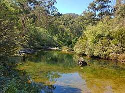 View of the Aberfeldy River from Aberfeldy Bridge at Baw Baw National Park. | |
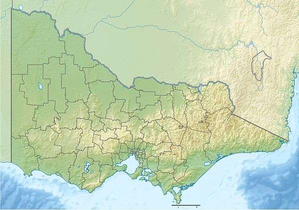 Location of the Aberfeldy River mouth in Victoria | |
| Native name | Nambruc[1][2] |
| Location | |
| Country | Australia |
| State | Victoria |
| Region | Victorian Alps (IBRA), West Gippsland |
| Local government area | Shire of Baw Baw |
| Physical characteristics | |
| Source confluence | North and South Branches of the Aberfeldy River |
| • location | below Mount Selma |
| • coordinates | 37°39′16″S 146°25′48″E |
| • elevation | 662 m (2,172 ft) |
| Mouth | confluence with the Thomson River |
• location | north of Rawson |
• coordinates | 37°44′39″S 146°21′41″E |
• elevation | 253 m (830 ft) |
| Length | 49 km (30 mi) |
| Basin features | |
| River system | West Gippsland catchment |
| [3][4] | |
Features and location
Formed by the confluence of the North and South branches of the river, the Aberfeldy River rises in a state forestry area below Mount Selma on part of the Great Dividing Range. The river flows generally southwest then south, joined by two minor tributaries, before reaching its confluence with the Thomson River north of Rawson, in the Shire of Baw Baw. The river descends 409 metres (1,342 ft) over its 49-kilometre (30 mi) course.[4]
Etymology
In the Australian Aboriginal Brataualung language the river is named Nambruc, meaning "plenty of black opossums".[1][2]
gollark: Where is it?
gollark: Cool.
gollark: I think there's a rule about defacing the environment, but that means it's fine to mine out everything under y=40 or so because nobody looks there.
gollark: It might be annoying to route around claims. But I think you could do it if they also had a block scanner (or a few did) or pickaxes.
gollark: With some Wojbie2-style setup to attain fire aspect books it would probably be possible to get more lasers than that, and the bot could also supervise the turtles so no human input is needed.
See also
- Rivers of Victoria
References
- "Aberfeldy River: 9139: Traditional name: Nambruc". Vicnames. Government of Victoria. 12 May 2011. Archived from the original on 22 February 2014. Retrieved 13 February 2014.
- "Aberfeldy River: 9139: Traditional name: Nambruc". Vicnames. Government of Victoria. 12 August 2011. Archived from the original on 22 February 2014. Retrieved 13 February 2014.
- "Aberfeldy River: 9139". Vicnames. Government of Victoria. 2 May 1966. Archived from the original on 22 February 2014. Retrieved 13 February 2014.
- "Map of Aberfeldy River, VIC". Bonzle Digital Atlas of Australia. Retrieved 14 February 2014.
External links
- "West Gippsland Regional Catchment Strategy (2013 - 2019)" (PDF – 4MB). West Gippsland Catchment Management Authority. 2012. ISBN 978-0-9805562-8-5.
- "Latrobe Catchment Ecosystem" (PDF). West Gippsland Catchment Management Authority. 2012. Archived from the original (PDF) on 6 April 2011.
Rivers of the West Gippsland catchment, Victoria, Australia | |
|---|---|
|
This article is issued from Wikipedia. The text is licensed under Creative Commons - Attribution - Sharealike. Additional terms may apply for the media files.