List of listed buildings in Selkirk, Scottish Borders
List
| Name | Location | Date Listed | Grid Ref. [note 1] | Geo-coordinates | Notes | LB Number [note 2] | Image |
|---|---|---|---|---|---|---|---|
| Ettrick Terrace, Ettrick Lodge, Ettrick Dene And Coach House With Boundary Wall, Railings And Gateways | 55°32′57″N 2°50′32″W | Category B | 43748 |  | |||
| 2 And 4 Kirk Wynd | 55°32′48″N 2°50′29″W | Category C(S) | 43790 | | |||
| 7 Market Place, Fleece Hotel | 55°32′50″N 2°50′32″W | Category B | 43794 | 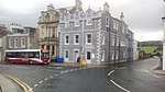 | |||
| Scotts Place, Victoria Halls With Boundary Wall, Gatepiers, Railings And Fountain | 55°32′59″N 2°50′19″W | Category B | 43811 | | |||
| 9 Scotts Place | 55°33′00″N 2°50′16″W | Category C(S) | 43812 | | |||
| Station Road, Waterworks And Mill Lade Bridge | 55°32′58″N 2°50′46″W | Category C(S) | 43819 | | |||
| 1 Thornfield Avenue, Former Lodge With Former Stable And Coach House, Outbuildings And Gatepiers | 55°33′06″N 2°50′06″W | Category C(S) | 43821 | | |||
| 23-29 (Odd Nos) West Port | 55°32′48″N 2°50′35″W | Category C(S) | 43832 | | |||
| 2 And 4 West Port | 55°32′49″N 2°50′33″W | Category C(S) | 43838 | | |||
| 3-11 (Odd Nos) High Street, The County Hotel | 55°32′52″N 2°50′29″W | Category C(S) | 40572 | | |||
| 36 And 37 Market Place | 55°32′48″N 2°50′30″W | Category C(S) | 40582 | | |||
| Ruined Cottage, Foulshiels | 55°33′23″N 2°54′59″W | Category B | 19725 | | |||
| Broomhill House With Walled Garden And Horsemill | 55°33′28″N 2°49′16″W | Category B | 19726 | | |||
| Aikwood Tower | 55°31′29″N 2°55′13″W | Category A | 15195 | .jpg) | |||
| High Sunderland, Galashiels, Including Boundary Walls And Gate Piers | 55°34′28″N 2°50′12″W | Category A | 50862 | 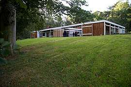 | |||
| Viewfield (Andrew Lang Unit), With Gatepiers And Boundary Walls | 55°33′00″N 2°50′23″W | Category C(S) | 44179 | | |||
| Ettrick Terrace, Wellwood With Boundary Walls And Gatepiers | 55°33′05″N 2°50′32″W | Category B | 43750 | | |||
| 29 And 31 High Street | 55°32′52″N 2°50′27″W | Category C(S) | 43764 | | |||
| 35-39 (Odd Nos) High Street | 55°32′53″N 2°50′27″W | Category C(S) | 43765 | | |||
| 103 High Street, Presbytery | 55°32′55″N 2°50′23″W | Category C(S) | 43774 | | |||
| 109 High Street | 55°32′55″N 2°50′21″W | Category C(S) | 43776 | | |||
| 6 High Street | 55°32′51″N 2°50′27″W | Category C(S) | 43778 | | |||
| 38 High Street | 55°32′53″N 2°50′24″W | Category C(S) | 43782 | | |||
| 50 And 52 High Street | 55°32′53″N 2°50′23″W | Category B | 43783 | 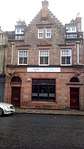 | |||
| High Street, Council Buildings | 55°32′55″N 2°50′19″W | Category B | 43786 | 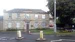 | |||
| 14 Market Place | 55°32′51″N 2°50′29″W | Category C(S) | 43798 | | |||
| 34 And 35 Market Place And Buildings In Close To Rear | 55°32′48″N 2°50′30″W | Category C(S) | 43801 | | |||
| 40, 41 And 42 Market Place | 55°32′48″N 2°50′31″W | Category C(S) | 43803 | | |||
| 49 And 50 Market Place | 55°32′49″N 2°50′32″W | Category C(S) | 43805 | | |||
| Scotts Place, Plaque To J B Selkirk (James Brown) | 55°32′57″N 2°50′18″W | Category C(S) | 43810 | | |||
| Shawpark Road, Brierylaw And Shawfield Cemeteries With Boundary Walls, Quadrants, Railings, Gates And Gatepiers | 55°33′10″N 2°49′47″W | Category C(S) | 43818 | | |||
| 31 And 33 West Port | 55°32′47″N 2°50′35″W | Category B | 43833 | 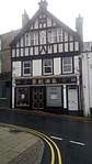 | |||
| 37 West Port | 55°32′47″N 2°50′36″W | Category C(S) | 43835 | | |||
| 41 West Port With Boundary Walls | 55°32′47″N 2°50′36″W | Category C(S) | 43837 | | |||
| Dunsdale Road, Forest Mill | 55°33′00″N 2°50′46″W | Category B | 40580 | | |||
| Ettrick Terrace, War Memorial | 55°32′52″N 2°50′34″W | Category A | 40581 | .jpg) | |||
| 40-44 (Even Nos) High Street | 55°32′53″N 2°50′24″W | Category B | 40584 | 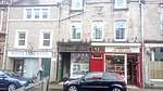 | |||
| Ettrick Terrace,Sheriff Court With Boundary Walls, Railings And Gatepiers | 55°32′54″N 2°50′35″W | Category B | 43747 | | |||
| 3 And 5 Heatherlie Park, Woodburn House Hotel And Gatepiers | 55°32′43″N 2°50′56″W | Category C(S) | 43756 | | |||
| 4 High Street | 55°32′51″N 2°50′27″W | Category C(S) | 43777 | | |||
| 54 And 56 High Street | 55°32′53″N 2°50′23″W | Category C(S) | 43784 | | |||
| 8-10 (Inclusive Nos) Market Place And 4 Ettrick Terrace | 55°32′50″N 2°50′31″W | Category C(S) | 43795 | | |||
| 13 Market Place | 55°32′51″N 2°50′29″W | Category C(S) | 43797 | | |||
| 21-24 (Inclusive Nos) Market Place | 55°32′50″N 2°50′28″W | Category C(S) | 43800 | | |||
| Mavis Bank, Beech Villa And Belmont | 55°33′11″N 2°50′17″W | Category C(S) | 43806 | | |||
| 15 Scotts Place, With Outbuilding And Timber Shed | 55°33′00″N 2°50′15″W | Category C(S) | 43813 | | |||
| 35 West Port | 55°32′47″N 2°50′36″W | Category C(S) | 43834 | | |||
| 6-10 (Even Nos) West Port | 55°32′49″N 2°50′33″W | Category C(S) | 43839 | | |||
| Bleachfield Road, St John's Episcopal Church With Church Hall And Boundary Walls | 55°33′06″N 2°50′04″W | Category B | 43743 | | |||
| Market Place, Pant Well | 55°32′49″N 2°50′31″W | Category B | 40568 | | |||
| Yarrowford, Broadmeadows East Lodge | 55°33′37″N 2°55′54″W | Category B | 19477 | | |||
| Bridgelands Including Quadrant Walls, Gatepiers And Gates | 55°33′52″N 2°49′30″W | Category B | 15202 | | |||
| Old Broadmeadows Dovecot | 55°33′47″N 2°55′41″W | Category C(S) | 13855 | | |||
| Scott's Place, North Side, Wall Letter Box, Opposite Bowling Club | 55°33′04″N 2°50′08″W | Category C(S) | 49849 | | |||
| 12 Ettrick Terrace | 55°32′53″N 2°50′33″W | Category C(S) | 43751 | | |||
| 40 Ettrick Terrace With Boundary Walls And Railings | 55°32′59″N 2°50′29″W | Category C(S) | 43753 | | |||
| 15 And 17 High Street | 55°32′52″N 2°50′28″W | Category C(S) | 43762 | | |||
| 55-59 (Odd Nos) High Street | 55°32′53″N 2°50′25″W | Category C(S) | 43771 | | |||
| 73-99 (Odd Nos) High Street | 55°32′54″N 2°50′24″W | Category C(S) | 43773 | | |||
| Shawpark Road, Hillcrest, Former Rectory And Boundary Walls | 55°33′08″N 2°50′01″W | Category C(S) | 43815 | | |||
| 8, 10 And 12 Shawpark Road, Dandswall With Lamp Standard, Boundary Wall And Gatepiers | 55°33′09″N 2°49′57″W | Category C(S) | 43816 | | |||
| 69 Tower Street With Boundary Wall, Gatepiers And Railings | 55°32′51″N 2°50′17″W | Category C(S) | 43824 | | |||
| 9 And 11 West Port | 55°32′48″N 2°50′33″W | Category C(S) | 43830 | | |||
| Craig Brown Avenue, Reservoir | 55°32′47″N 2°50′09″W | Category C(S) | 43744 | | |||
| The Green, The Haining North Gate And Policy Walls | 55°32′45″N 2°50′41″W | Category B | 40576 | | |||
| 101 High Street, Hermitage House | 55°32′55″N 2°50′24″W | Category B | 40583 | | |||
| Newark Castle | 55°33′17″N 2°55′11″W | Category A | 15197 | | |||
| Caterhaugh Bridge | 55°31′49″N 2°54′17″W | Category B | 13866 | | |||
| Broadmeadows Bridge, Near Bowhill North Lodge | 55°33′36″N 2°55′53″W | Category C(S) | 13868 | | |||
| 100, 102 And 104 Ettrick Terrace Including Railings And Boundary Walls | 55°33′17″N 2°50′12″W | Category C(S) | 49846 | | |||
| 94 (Part) - 110 (Even Nos) Forest Road, And 52 And 54 (Part) Mill Street | 55°32′55″N 2°50′46″W | Category C(S) | 43754 | | |||
| 13 High Street | 55°32′52″N 2°50′28″W | Category C(S) | 43761 | | |||
| 23, 25 And 27 High Street | 55°32′52″N 2°50′27″W | Category C(S) | 43763 | | |||
| 69 And 71 High Street | 55°32′54″N 2°49′55″W | Category C(S) | 43772 | | |||
| 16 And 18 High Street | 55°32′52″N 2°50′26″W | Category C(S) | 43779 | | |||
| 32 High Street | 55°32′53″N 2°50′24″W | Category C(S) | 43781 | | |||
| 62-70 (Even Nos) High Street | 55°32′54″N 2°50′22″W | Category C(S) | 43785 | | |||
| High Street, Selkirk Parish Church (Church Of Scotland), Former Lawson Memorial Church With Boundary Walls, Gatepiers And Railings | 55°32′56″N 2°50′16″W | Category B | 43787 | 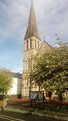 | |||
| 3 And Market Place | 55°32′50″N 2°50′33″W | Category C(S) | 43792 | | |||
| 20 Market Place | 55°32′50″N 2°50′28″W | Category C(S) | 43799 | | |||
| 66-74 (Even Nos) Mill Street | 55°32′57″N 2°50′45″W | Category C(S) | 43807 | | |||
| Old Bridge Road, Bridge Park | 55°33′02″N 2°50′33″W | Category C(S) | 43808 | | |||
| Scotts Place, Selkirk Congregational Church With Boundary Walls, Railings And Gatepiers | 55°33′00″N 2°50′14″W | Category C(S) | 43814 | | |||
| 14 Shawpark Road, Dandswall Lodge, Stable And Coach Block With Court, Gatepiers And Railings | 55°33′08″N 2°49′54″W | Category B | 43817 | | |||
| 6, 8 And 10 Viewfield Lane, Elm Park | 55°33′04″N 2°50′23″W | Category B | 43828 | | |||
| 19 And 21 West Port | 55°32′48″N 2°50′34″W | Category B | 43831 | | |||
| 12-18 (Even Nos) West Port | 55°32′49″N 2°50′34″W | Category C(S) | 43840 | | |||
| Yarrow Terrace, Heatherlie Manse With Boundary Wall And Gatepiers | 55°32′51″N 2°51′05″W | Category B | 43842 | | |||
| Kirk Wynd, Auld Kirkyard, Old Parish Kirk, Boundary Wall, Railings, Gates And Gateway | 55°32′47″N 2°50′29″W | Category B | 40567 | 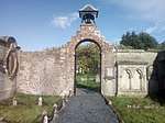 | |||
| Scotts Place, Flodden Monument, "Fletcher" | 55°32′58″N 2°50′17″W | Category B | 40574 | | |||
| Dunsdale Road, Ettrick Mill | 55°33′16″N 2°50′21″W | Category A | 40578 | 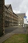 | |||
| High Sunderland, The Studio (Former Bernat Klein Studio) | 55°34′24″N 2°50′10″W | Category A | 19484 |  | |||
| The Haining, Including Railed Screen Wall And Terrace Statues | 55°32′35″N 2°50′35″W | Category A | 15190 | | |||
| Sunderland Hall Including Terraced Gardens | 55°34′39″N 2°49′29″W | Category B | 15201 | | |||
| Philiphaugh Estate Sawmill | 55°32′24″N 2°52′19″W | Category B | 15203 | | |||
| Philiphaugh Policies, West Lodge Including Boundary Walls And Gatepiers | 55°32′37″N 2°53′58″W | Category C(S) | 49227 | | |||
| Ettrick Terrace, Greenbank With Boundary Walls, Gig House And Wall-Mounted Letter-Box | 55°33′02″N 2°50′31″W | Category B | 43749 | | |||
| 19 Heatherlie Park With Gate, Gatepiers, Boundary Walls And Outbuildings | 55°32′49″N 2°50′59″W | Category C(S) | 43757 | | |||
| High School Lane, Old High School With Boundary Walls, Gatepiers And Outbuildings | 55°32′55″N 2°49′55″W | Category C(S) | 43759 | | |||
| 51 And 53 High Street | 55°32′53″N 2°50′26″W | Category C(S) | 43770 | | |||
| 105 High Street, Church Of Our Lady And St Joseph (Roman Catholic) And Boundary Walls | 55°32′56″N 2°50′24″W | Category C(S) | 43775 | | |||
| 28 And 30 High Street | 55°32′52″N 2°50′25″W | Category C(S) | 43780 | | |||
| 28 Hillside Terrace, Rosemount And Boundary Walls | 55°32′53″N 2°50′03″W | Category C(S) | 43788 | | |||
| 2 And 4 Market Place | 55°32′49″N 2°50′33″W | Category C(S) | 43791 | | |||
| 6 Market Place, Bank Of Scotland, With Railings | 55°32′50″N 2°50′32″W | Category B | 43793 | 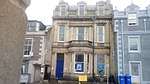 | |||
| 21 Tower Street | 55°32′52″N 2°50′23″W | Category C(S) | 43823 | | |||
| 4 Viewfield Lane, Elm Park Lodge With Boundary Walls, Gatepiers And Court | 55°33′01″N 2°50′22″W | Category B | 43827 | | |||
| 1-7 (Odd Nos) West Port | 55°32′48″N 2°50′33″W | Category C(S) | 43829 | | |||
| Back Row, Former Masonic Hall | 55°32′52″N 2°50′19″W | Category C(S) | 43742 | | |||
| Ettrick Road, Forest Lodge With Boundary Wall | 55°32′45″N 2°51′03″W | Category C(S) | 43745 | | |||
| Market Place, Town House, Old Sheriff Court And Boundary Walls | 55°32′50″N 2°50′28″W | Category A | 40569 | 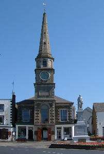 | |||
| Market Place, Sir Walter Scott Memorial | 55°32′50″N 2°50′30″W | Category B | 40571 | | |||
| High Street And Back Row, Mungo Park (Monument) | 55°32′55″N 2°50′21″W | Category B | 40573 | 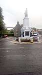 | |||
| Fauldshope Bridge | 55°31′05″N 2°55′30″W | Category C(S) | 15194 | | |||
| Bowhill | 55°32′26″N 2°54′41″W | Category A | 15196 | | |||
| General's Bridge | 55°32′36″N 2°54′02″W | Category C(S) | 13854 | | |||
| Bowhill Policies, Icehouse | 55°32′28″N 2°54′14″W | Category C(S) | 13867 | | |||
| Ettrick Terrace, Former Jail, Now Incorporating Public Library, Boundary Walls And Entrance Arch With 1 Chapel Street And Screen Wall | 55°32′54″N 2°50′32″W | Category B | 43752 | | |||
| Hallidays Park, Old Manse With Boundary Walls | 55°32′56″N 2°50′28″W | Category C(S) | 43755 | | |||
| 41-49 (Odd Nos) High Street | 55°32′53″N 2°50′26″W | Category C(S) | 43769 | | |||
| 38 And 39 Market Place And Halliwell's Close | 55°32′48″N 2°50′30″W | Category B | 43802 | | |||
| Station Road, Station Hotel And Gatepiers | 55°32′59″N 2°50′49″W | Category C(S) | 43820 | | |||
| Viewfield Lodge With Gatepiers And Railings | 55°32′59″N 2°50′18″W | Category C(S) | 43826 | | |||
| 22-26 (Even Nos) West Port | 55°32′48″N 2°50′35″W | Category C(S) | 43841 | | |||
| Yarrow Terrace, Glen Hotel, With Boundary Walls And Gatepiers | 55°32′48″N 2°51′09″W | Category B | 43844 | | |||
| 1 Market Place, Town Arms Inn | 55°32′49″N 2°50′33″W | Category B | 43277 | 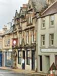 | |||
| Dunsdale Road, Riverside Or Dunsdale Mill | 55°33′25″N 2°50′10″W | Category B | 40577 | | |||
| The Stables, Haining | 55°32′35″N 2°50′40″W | Category A | 15191 | 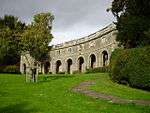 | |||
| The Haining, Deer Larder | 55°32′35″N 2°50′38″W | Category C(S) | 15192 | | |||
| 1 - 14 (Even Nos) Heatherlie Terrace | 55°32′51″N 2°50′52″W | Category C(S) | 43758 | | |||
| 1 High Street | 55°32′51″N 2°50′29″W | Category C(S) | 43760 | | |||
| 32 Hillside Terrace With Boundary Wall And Gatepiers | 55°32′52″N 2°50′02″W | Category C(S) | 43789 | | |||
| 11 And 12 Market Place | 55°32′51″N 2°50′30″W | Category C(S) | 43796 | | |||
| 47 And 48 Market Place | 55°32′48″N 2°50′32″W | Category C(S) | 43804 | | |||
| 6 Russell Place, The Floors With Boundary Wall, Railings And Gatepiers | 55°32′50″N 2°50′03″W | Category C(S) | 43809 | | |||
| 9, 10 And 11 Thornfield Avenue, Thornfield House | 55°33′07″N 2°50′17″W | Category B | 43822 | | |||
| 39 West Port | 55°32′47″N 2°50′36″W | Category C(S) | 43836 | | |||
| Back Row, Drill Hall And Boundary Wall | 55°32′52″N 2°50′18″W | Category C(S) | 43741 | | |||
| 33 Market Place | 55°32′49″N 2°50′29″W | Category B | 40570 | | |||
| Sunderland Hall | 55°34′39″N 2°49′32″W | Category B | 15200 | | |||
| 106 Ettrick Terrace Including Outbuildings And Wall Letter Box | 55°33′18″N 2°50′11″W | Category C(S) | 49847 | | |||
| 108 And 110 Ettrick Terrace | 55°33′18″N 2°50′11″W | Category C(S) | 49848 | |
Key
The scheme for classifying buildings in Scotland is:
- Category A: "buildings of national or international importance, either architectural or historic; or fine, little-altered examples of some particular period, style or building type."[1]
- Category B: "buildings of regional or more than local importance; or major examples of some particular period, style or building type, which may have been altered."[1]
- Category C: "buildings of local importance; lesser examples of any period, style, or building type, as originally constructed or moderately altered; and simple traditional buildings which group well with other listed buildings."[1]
In March 2016 there were 47,288 listed buildings in Scotland. Of these, 8% were Category A, and 50% were Category B, with the remaining 42% being Category C.[2]
Notes
- Sometimes known as OSGB36, the grid reference (where provided) is based on the British national grid reference system used by the Ordnance Survey.
• "Guide to National Grid". Ordnance Survey. Retrieved 12 December 2007.
• "Get-a-map". Ordnance Survey. Retrieved 17 December 2007. - Historic Environment Scotland assign a unique alphanumeric identifier to each designated site in Scotland, for listed buildings this always begins with "LB", for example "LB12345".
gollark: But it's cooler.
gollark: This is F# anyway.
gollark: ```fsharplet f x = let y = 1 let z = 3 x y z```
gollark: Well, it does, because you can do stuff.
gollark: `let f x = x 5 9` is cooler.
References
- All entries, addresses and coordinates are based on data from Historic Scotland. This data falls under the Open Government Licence
- "What is Listing?". Historic Environment Scotland. Retrieved 29 May 2018.
- Scotland's Historic Environment Audit 2016 (PDF). Historic Environment Scotland and the Built Environment Forum Scotland. pp. 15–16. Retrieved 29 May 2018.
This article is issued from Wikipedia. The text is licensed under Creative Commons - Attribution - Sharealike. Additional terms may apply for the media files.