List of listed buildings in Melrose, Scottish Borders
List
| Name | Location | Date Listed | Grid Ref. [note 1] | Geo-coordinates | Notes | LB Number [note 2] | Image |
|---|---|---|---|---|---|---|---|
| East Port And Scott's Place (Property Belonging To District Council, Formerly Toc-H Rooms Belonging To Mr Neil) | 55°35′49″N 2°43′08″W | Category B | 37766 |  | |||
| Harleyburn Stables | 55°35′44″N 2°44′01″W | Category C(S) | 37768 | | |||
| Harleyburn Gate-Lodge And Gates | 55°35′47″N 2°44′20″W | Category B | 37769 | | |||
| High Cross Avenue The Anchorage And Kotagiri | 55°35′57″N 2°43′44″W | Category B | 37776 | | |||
| High Street, South Side The Pendstead, To Rear Of Ormiston And Renwick Nurserymen | 55°35′51″N 2°43′16″W | Category C(S) | 37779 | | |||
| High Street, South Side, George And Abbotsford Hotel | 55°35′52″N 2°43′14″W | Category B | 37780 | | |||
| Tweedmouth Road, "Tweedknowe" And "Tweedmount" | 55°36′02″N 2°43′53″W | Category C(S) | 37806 | | |||
| 1, Buccleugh Street, K6 Telephone Kiosk At Post Office | 55°35′55″N 2°43′14″W | Category B | 37819 | | |||
| Buccleuch Street, Abbey Coffee Shop And Flats Over | 55°35′55″N 2°43′12″W | Category C(S) | 37740 | | |||
| Cloisters Road Abbey Park | 55°35′58″N 2°42′58″W | Category C(S) | 37746 | | |||
| Buckholm Tower | 55°37′55″N 2°49′23″W | Category A | 19716 | 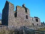 | |||
| Drygrange, Walled Garden | 55°36′36″N 2°40′10″W | Category B | 18836 | | |||
| Drygrange, South Lodge Including Gates, Gatepiers And Quadrant Walls | 55°36′25″N 2°40′27″W | Category C(S) | 18841 | | |||
| Hillslap Tower | 55°38′44″N 2°46′30″W | Category B | 15130 | | |||
| Leadervale House Including Walled Garden | 55°38′49″N 2°41′41″W | Category B | 15148 | | |||
| Gattonside, The Rigg | 55°36′27″N 2°43′31″W | Category B | 50861 |  | |||
| Gattonside, Allerly House Including Stable Block, Garden Wall, Lodge And Gatepiers | 55°36′28″N 2°43′11″W | Category B | 51560 | | |||
| Newton St Boswells, Auction Mart, Livestock Ring | 55°34′38″N 2°40′15″W | Category B | 51565 | | |||
| Ravenswood House | 55°35′58″N 2°40′08″W | Category B | 51569 | | |||
| East Port, North Side, Adjoining Ship Inn Houses Belonging To Mr D C King And Mr J S Crawford | 55°35′49″N 2°43′07″W | Category C(S) | 37765 | | |||
| High Cross Avenue. Ashby, Melrose And District Abbeyfield | 55°35′56″N 2°43′56″W | Category B | 37778 | | |||
| High Street, St Mary's Preparatory School 'Hugh Fraser Buildings' | 55°35′58″N 2°43′22″W | Category C(S) | 37792 | | |||
| Market Square, (South Side) J G Lindsay And Sons And Empty Flats Over | 55°35′49″N 2°43′09″W | Category C(S) | 37795 | | |||
| Market Square, (North Side) 'Clinkscale Radio And Musical' | 55°35′51″N 2°43′09″W | Category C(S) | 37800 | | |||
| Market Square, (North Side), Bank Of Scotland,J L Crosbie, Newsagent And Tsb | 55°35′51″N 2°43′10″W | Category B | 37801 | | |||
| 3 Market Square, Millars Hotel, (Former Bon Accord Hotel) Incorporating Ground Floor Shop | 55°35′52″N 2°43′11″W | Category B | 37802 | | |||
| St Mary's Road, Harmony Hall Stables | 55°36′00″N 2°43′16″W | Category C(S) | 37805 | | |||
| Waverley Road, Darnlee | 55°36′10″N 2°44′46″W | Category B | 37810 | | |||
| Weirhill Place, Weirknowe | 55°36′03″N 2°43′39″W | Category C(S) | 37816 | | |||
| Buccleuch Street Bellenden | 55°35′54″N 2°43′11″W | Category C(S) | 37742 | | |||
| Leaderfoot Viaduct | 55°36′16″N 2°40′41″W | Category A | 15145 | 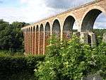 | |||
| Chiefswood Road, Former Dingleton Hospital Boiler House Including Boundary Walls | 55°35′28″N 2°43′44″W | Category B | 51064 | 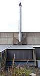 | |||
| Ravenswood, Summerhouse | 55°36′02″N 2°39′09″W | Category C(S) | 51573 | | |||
| Darnick Village No 8 Abbotsford Road (E Side) And Glenmore Cottage (Hastie) | 55°36′03″N 2°44′42″W | Category C(S) | 37750 | | |||
| Darnick Village Tower Road Darnick Tower | 55°36′03″N 2°44′39″W | Category A | 37756 | 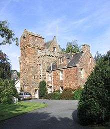 | |||
| Darnick Village, Tower Road And Abbotsford Road, Darnick Tower And Garden Walls | 55°36′03″N 2°44′39″W | Category B | 37758 | | |||
| Dingleton Road, Eildon House (Formerly Rosebank) | 55°35′47″N 2°43′13″W | Category B | 37763 | | |||
| High Cross Avenue East And West Fordel | 55°36′00″N 2°43′42″W | Category C(S) | 37772 | | |||
| High Street, (South Side) Church Place | 55°35′57″N 2°43′33″W | Category B | 37787 | | |||
| Huntly Road, Abbotsknowe | 55°35′56″N 2°43′37″W | Category C(S) | 37793 | | |||
| Market Square, Corn Exchange And K H Thorburn, Chemist | 55°35′50″N 2°43′11″W | Category B | 37797 | | |||
| Market Square, (South Side) Burt's Hotel | 55°35′50″N 2°43′13″W | Category B | 37799 | | |||
| Waverley Road, 'Old Abbey School' And Boundary Wall To Waverley Road | 55°35′59″N 2°43′52″W | Category C(S) | 37809 | | |||
| Waverley Road, Tweed Cottage (2 Dwellings) | 55°36′05″N 2°43′57″W | Category B | 37812 | | |||
| Abbey Street (West Side) 'Clinkscales' | 55°35′51″N 2°43′09″W | Category C(S) | 37731 | | |||
| Abbey Street, Abbey House | 55°35′56″N 2°43′10″W | Category B | 37733 | | |||
| Abbey Street, Priorwood, Cottage And Walled Garden, Walls To Prior's Walk And Abbey Street | 55°35′54″N 2°43′07″W | Category C(S) | 37735 | | |||
| Buccleuch Street, Post Office | 55°35′55″N 2°43′13″W | Category C(S) | 37738 | | |||
| Melrose Bridge | 55°36′18″N 2°45′00″W | Category B | 19719 | | |||
| Drygrange, Former Steading (Including 1 And 2 Drygrange Cottages And Drygrange Stables Cottage) | 55°36′44″N 2°40′21″W | Category B | 18838 | | |||
| Abbotsford Including House, Walled Gardens And Courtyards, Conservatory, Bothies, Game Larder, Ice House, Terraces, Gate Lodge, Boundary Walls, Gardener's Cottage, Stable Block, Garden Statuary And All Other Ancillary Structures | 55°35′58″N 2°46′56″W | Category A | 15104 | 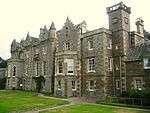 | |||
| Huntlyburn With Walled Garden And Bothy, Former Stables, Cottage And Mounting Block | 55°35′37″N 2°44′47″W | Category B | 15105 | | |||
| Darnick Village Abbotsford Road (E Side) Tower Cottage | 55°36′04″N 2°44′37″W | Category B | 37749 | | |||
| Darnick Village Tower Road Darnick Tower Ruined Tower | 55°36′01″N 2°44′39″W | Category B | 37757 | | |||
| Darnick Village Tower Road Aldie Cottage | 55°36′00″N 2°44′30″W | Category C(S) | 37760 | | |||
| Dingleton Road Station Hotel | 55°35′49″N 2°43′10″W | Category C(S) | 37761 | | |||
| Harley Burn | 55°35′44″N 2°44′05″W | Category B | 37767 | | |||
| High Cross Avenue, St. Cuthbert's Rc Church | 55°35′56″N 2°43′50″W | Category B | 37777 | | |||
| High Street, (South Side) The Shoe Shop | 55°35′53″N 2°43′18″W | Category C(S) | 37783 | | |||
| High Street, (South Side) Elliotlea And Booklaws | 55°35′58″N 2°43′34″W | Category C(S) | 37789 | | |||
| Buccleuch Street St Margarets (Borders Regional Council Special Educational Services And Countryside Ranger) | 55°35′55″N 2°43′14″W | Category C(S) | 37737 | | |||
| Chain Bridge | 55°36′10″N 2°43′24″W | Category B | 37744 | | |||
| Drygrange, North Lodge (Former Factor's House) Including Gates, Gatepiers And Enclosing Walls | 55°36′51″N 2°40′38″W | Category C(S) | 18840 | | |||
| Drygrange Old Bridge | 55°36′14″N 2°40′32″W | Category A | 15106 | | |||
| Gattonside, Abbotsmeadow Including Walled Garden | 55°36′28″N 2°43′24″W | Category C(S) | 15147 | | |||
| Newtown St Boswells, Melbourne Place And Railway Court, Railway Hotel Including Railings | 55°34′35″N 2°40′17″W | Category C(S) | 47392 | | |||
| Newton St Boswells, Tweedside Road, Newton House Including Boundary Wall | 55°34′35″N 2°40′10″W | Category C(S) | 51567 | | |||
| Darnick Village Smith's Road The Gables | 55°35′59″N 2°44′41″W | Category C(S) | 37754 | | |||
| Darnick Village Smith's Road Darnick Dairies | 55°35′58″N 2°44′42″W | Category C(S) | 37755 | | |||
| High Street, (South Side) The Kings Arms Hotel | 55°35′53″N 2°43′16″W | Category B | 37781 | | |||
| High Street, (South Side) Borders Regional Council Social Work Department | 55°35′54″N 2°43′20″W | Category C(S) | 37784 | | |||
| High Street (South Side) 'Choice Furnishers' And West End House | 55°35′55″N 2°43′21″W | Category C(S) | 37785 | | |||
| High Street, (South Side) Douglas Cottage | 55°35′58″N 2°43′35″W | Category C(S) | 37790 | | |||
| Melrose Railway Station | 55°35′48″N 2°43′14″W | Category A | 37803 | | |||
| Tweedmouth Road, St Cuthbert's Manse | 55°36′04″N 2°43′54″W | Category C(S) | 37807 | | |||
| 8 Weirhill Place | 55°36′02″N 2°43′39″W | Category C(S) | 37815 | | |||
| Melrose Abbey 'The Cloisters' | 55°35′58″N 2°43′01″W | Category C(S) | 37730 | | |||
| Abbey Street, (West Side) Former Town House (Army Cadet Corps) | 55°35′52″N 2°43′09″W | Category C(S) | 37732 | | |||
| Buccleuch Street Dunfermline House | 55°35′54″N 2°43′12″W | Category C(S) | 37743 | | |||
| Wooplaw House | 55°40′06″N 2°47′44″W | Category B | 19115 | | |||
| Drygrange, No 4 Drygrange Stable Cottages (House To North Of Steading) | 55°36′45″N 2°40′21″W | Category C(S) | 18839 | | |||
| Appletree Leaves Former Stable And Remains Of Ladhope Tower | 55°37′16″N 2°48′14″W | Category C(S) | 15102 | | |||
| Gattonside House Including Chapel, Former Coach House, Cottage, Walled Garden And Boundary Walls | 55°36′20″N 2°44′07″W | Category B | 15103 | | |||
| Pavilion (Incorporating 1 Pavilion, The Clock House, Stables House And Ruaival Cottage) | 55°36′32″N 2°44′59″W | Category C(S) | 15133 | | |||
| Leaderfoot Bridge | 55°36′15″N 2°40′17″W | Category B | 15146 | | |||
| Chapel On Leader Stables Including Garden Cottage, Water Tower, Boundary Walls, Railings, Gatepiers And Gates | 55°39′56″N 2°42′03″W | Category C(S) | 50606 | | |||
| Gattonside, Bakers Road, Hassendean Cottage | 55°36′19″N 2°43′42″W | Category B | 51562 | | |||
| Gattonside House, East Lodge Including Gatepiers | 55°36′21″N 2°44′15″W | Category C(S) | 51563 | | |||
| Ravenswood, Stables | 55°35′59″N 2°40′17″W | Category C(S) | 51572 | | |||
| The Roan Including Cottage And Walled Garden | 55°41′09″N 2°42′53″W | Category C(S) | 51574 | | |||
| Darnick Village Abbotsford Road (W Side) West House | 55°36′02″N 2°44′42″W | Category C(S) | 37753 | | |||
| Dingleton Road Mavisbank | 55°35′46″N 2°43′09″W | Category B | 37762 | | |||
| High Cross Avenue Mansefield | 55°36′00″N 2°43′40″W | Category C(S) | 37771 | | |||
| High Street, (North Side.) Abbey Park, St Mary's Preparatory School | 55°35′59″N 2°43′19″W | Category B | 37791 | | |||
| Market Square, Market Cross | 55°35′50″N 2°43′10″W | Category A | 37794 | | |||
| Market Square, (South Side) The Ormiston | 55°35′50″N 2°43′12″W | Category B | 37798 | | |||
| Waverley Castle Hotel, Including Original Lamp Standards And Statue Of Sir Walter Scott | 55°36′12″N 2°44′34″W | Category B | 37808 | | |||
| Weirhill, Eildon Bank | 55°36′00″N 2°43′37″W | Category C(S) | 37813 | | |||
| Weirhill Place, Weirhill Cottage | 55°36′02″N 2°43′40″W | Category C(S) | 37817 | | |||
| Weirhill Place, Ellwood | 55°36′01″N 2°43′40″W | Category C(S) | 37818 | | |||
| Market Square, K6 Telephone Kiosk | 55°35′50″N 2°43′10″W | Category B | 37820 | | |||
| Melrose Abbey Former Brewery Warehouse Now Store | 55°35′58″N 2°43′00″W | Category C(S) | 37728 | | |||
| Melrose Abbey Commendators House | 55°36′00″N 2°43′06″W | Category B | 37729 | | |||
| Drygrange House (Grangehall Care Home, Formerly St Andrew's College) Including Garden Terrace Walls To South | 55°36′39″N 2°40′18″W | Category B | 18835 | | |||
| Chiefswood, Including Monks Well, Bridge And Walled Garden | 55°35′38″N 2°44′30″W | Category B | 15107 | | |||
| Eildon, Nos 1, 2 And 3 Greenwells Cottages | 55°34′47″N 2°41′43″W | Category C(S) | 51559 | | |||
| Gattonside, Bakers Road, Achnachairidh | 55°36′20″N 2°43′51″W | Category B | 51561 | | |||
| Gattonside Toll | 55°36′21″N 2°44′57″W | Category C(S) | 51564 | | |||
| Newton St Boswells, Newtown Parish Church (Church Of Scotland) Including Boundary Walls And Railings (Former United Presbyterian) | 55°34′32″N 2°40′00″W | Category C(S) | 51566 | | |||
| Newton St Boswells, Tweedside Road, Taynuilt Including Garage, Gatepiers And Boundary Walls | 55°34′36″N 2°40′03″W | Category C(S) | 51568 | | |||
| Darnick Village Abbotsford Road (E Side) Gate House | 55°36′03″N 2°44′41″W | Category C(S) | 37751 | | |||
| Darnick Village Tower Road House (Virginia Cottage) | 55°36′01″N 2°44′37″W | Category C(S) | 37759 | | |||
| East Port The Ship Inn | 55°35′49″N 2°43′08″W | Category C(S) | 37764 | | |||
| High Cross Avenue Holy Trinity Episcopal Church | 55°35′58″N 2°43′53″W | Category B | 37775 | | |||
| High Street, (South Side) A Dalgetty And Sons | 55°35′53″N 2°43′17″W | Category C(S) | 37782 | | |||
| High Street, (South Side) St Dunstan's House | 55°35′55″N 2°43′22″W | Category C(S) | 37786 | | |||
| St Cuthbert's Parish Church, Weirhill | 55°36′02″N 2°43′35″W | Category B | 37804 | | |||
| Waverley Road, St Helen's | 55°36′14″N 2°44′14″W | Category A | 37811 | | |||
| Abbey Street, (East Side) Clinkscales Organ Studio | 55°35′51″N 2°43′08″W | Category C(S) | 37734 | | |||
| Chain Bridge Farm Former Toll-House | 55°36′08″N 2°43′23″W | Category B | 37745 | | |||
| Drygrange, Summerhouse | 55°36′36″N 2°40′12″W | Category C(S) | 18837 | | |||
| Chapel On Leader House, Walled Garden | 55°39′54″N 2°42′06″W | Category C(S) | 50607 | | |||
| Eildon Hall: East Lodge Including Gatepiers | 55°35′10″N 2°40′55″W | Category C(S) | 51557 | | |||
| Eildon Hall, Garden House And Walled Garden | 55°34′57″N 2°41′57″W | Category C(S) | 51558 | | |||
| Threepwood House Including Stable, Cartshed And Boundary Walls | 55°40′35″N 2°46′45″W | Category C(S) | 51575 | | |||
| Darnick Village Aldie Crescent Aldie And Lower Aldie | 55°35′58″N 2°44′33″W | Category C(S) | 37748 | | |||
| Darnick Village Abbotsford Road Darnick Cottage | 55°36′00″N 2°44′38″W | Category C(S) | 37752 | | |||
| Harmony Hall | 55°36′00″N 2°43′13″W | Category B | 37770 | | |||
| High Cross Avenue Weirdlaw | 55°35′59″N 2°43′44″W | Category C(S) | 37773 | | |||
| High Cross Avenue Holy Trinity Rectory | 55°35′58″N 2°43′51″W | Category B | 37774 | | |||
| High Street, (South Side) Westhill | 55°35′58″N 2°43′33″W | Category B | 37788 | | |||
| Market Square, (South Side) Branch Library And Flat, (Guthrie) | 55°35′50″N 2°43′11″W | Category C(S) | 37796 | | |||
| Weirhill, Weirhill House And 1 Weirhill Place | 55°36′00″N 2°43′38″W | Category C(S) | 37814 | | |||
| Melrose Abbey | 55°35′57″N 2°43′05″W | Category A | 37726 | 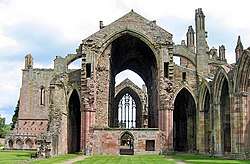 | |||
| Melrose Abbey Doocot And Byre Range Adjoining | 55°36′01″N 2°43′06″W | Category B | 37727 | 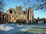 | |||
| Buccleuch Street St Mary's School (Buccleuch House) | 55°35′55″N 2°43′15″W | Category B | 37736 | | |||
| Buccleuch Street, Braidwood | 55°35′55″N 2°43′12″W | Category C(S) | 37739 | | |||
| Buccleuch Street Runcie | 55°35′54″N 2°43′14″W | Category C(S) | 37741 | | |||
| Cloisters Road Abbey Parks Gatepiers | 55°35′58″N 2°42′59″W | Category C(S) | 37747 | | |||
| Friar's Hall | 55°36′24″N 2°42′59″W | Category B | 19718 | | |||
| Eildon Hall Including Stable Block | 55°35′00″N 2°41′48″W | Category B | 15134 | | |||
| Ravenswood, North Lodge Including Gates And Railings | 55°36′01″N 2°40′18″W | Category B | 51570 | | |||
| Ravenswood, South Lodge | 55°35′51″N 2°40′16″W | Category C(S) | 51571 | | |||
| Whitelee House, By Galashiels | 55°38′43″N 2°51′03″W | Category C(S) | 51576 | |
Key
The scheme for classifying buildings in Scotland is:
- Category A: "buildings of national or international importance, either architectural or historic; or fine, little-altered examples of some particular period, style or building type."[1]
- Category B: "buildings of regional or more than local importance; or major examples of some particular period, style or building type, which may have been altered."[1]
- Category C: "buildings of local importance; lesser examples of any period, style, or building type, as originally constructed or moderately altered; and simple traditional buildings which group well with other listed buildings."[1]
In March 2016 there were 47,288 listed buildings in Scotland. Of these, 8% were Category A, and 50% were Category B, with the remaining 42% being Category C.[2]
Notes
- Sometimes known as OSGB36, the grid reference (where provided) is based on the British national grid reference system used by the Ordnance Survey.
• "Guide to National Grid". Ordnance Survey. Retrieved 2007-12-12.
• "Get-a-map". Ordnance Survey. Retrieved 2007-12-17. - Historic Environment Scotland assign a unique alphanumeric identifier to each designated site in Scotland, for listed buildings this always begins with "LB", for example "LB12345".
gollark: Hmm. Perhaps it would be best to write the indexer thing in superior Rust.
gollark: Yes.
gollark: Possibly.
gollark: Nope. UEFI.
gollark: Horse = bee neuron data (78EB)
References
- All entries, addresses and coordinates are based on data from Historic Scotland. This data falls under the Open Government Licence
- "What is Listing?". Historic Environment Scotland. Retrieved 29 May 2018.
- Scotland's Historic Environment Audit 2016 (PDF). Historic Environment Scotland and the Built Environment Forum Scotland. pp. 15–16. Retrieved 29 May 2018.
This article is issued from Wikipedia. The text is licensed under Creative Commons - Attribution - Sharealike. Additional terms may apply for the media files.