List of listed buildings in Kelso, Scottish Borders
List
| Name | Location | Date Listed | Grid Ref. [note 1] | Geo-coordinates | Notes | LB Number [note 2] | Image |
|---|---|---|---|---|---|---|---|
| 13, 15, 17 Horsemarket | 55°35′56″N 2°25′58″W | Category B | 35753 |  | |||
| 2, 4, 6 Horsemarket | 55°35′56″N 2°26′00″W | Category B | 35756 | | |||
| 46-48 Horsemarket | 55°35′58″N 2°25′55″W | Category C(S) | 35759 | | |||
| Maxwell Lane 'Dalveen' | 55°35′52″N 2°25′45″W | Category C(S) | 35768 | | |||
| Maxwell Lane, Maxwell Place And Bellachroy | 55°35′52″N 2°25′44″W | Category B | 35769 | | |||
| 3, 4, And 5, 6 Maxwellheugh Terrace | 55°35′33″N 2°25′52″W | Category B | 35772 | 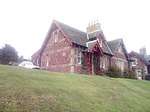 | |||
| 1, 3, 5 Roxburgh Street | 55°35′55″N 2°26′06″W | Category B | 35783 | | |||
| 9 Roxburgh Street | 55°35′56″N 2°26′06″W | Category C(S) | 35784 | | |||
| 31-33 Sheddon Park Road | 55°35′57″N 2°25′44″W | Category C(S) | 35815 | | |||
| 10, 11 The Square | 55°35′53″N 2°26′03″W | Category B | 35832 | | |||
| 15 The Square | 55°35′53″N 2°26′04″W | Category B | 35833 | | |||
| 18, 19 The Square | 55°35′54″N 2°26′04″W | Category B | 35834 | | |||
| 21, 22 The Square, Kelso Savings Bank | 55°35′54″N 2°26′05″W | Category C(S) | 35837 | | |||
| 38, 39, 40 The Square | 55°35′56″N 2°26′03″W | Category B | 35843 | | |||
| 42, 44, 45, 46 The Square | 55°35′56″N 2°26′02″W | Category B | 35844 | | |||
| Teviot Bridge | 55°35′41″N 2°26′46″W | Category A | 35847 | .jpg) | |||
| 9, 11, 13, 15 Union Street | 55°35′58″N 2°26′07″W | Category C(S) | 35849 | | |||
| 21 And 23 Woodmarket Sinclair Mcgill, Nursery-Men And Seedsmen | 55°35′55″N 2°25′58″W | Category B | 35857 | | |||
| 15, 16, 26, 28, 30 Abbey Court, Belmont Place And Gatepiers | 55°35′46″N 2°26′00″W | Category B | 35693 | | |||
| Bridge Street, Abbey House (Offices Of Croall & Bryson) | 55°35′49″N 2°25′58″W | Category B | 35723 | | |||
| Bridge Street, Queens Head Hotel | 55°35′51″N 2°26′00″W | Category B | 35729 | 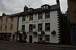 | |||
| 36, 38 Bridge Street | 55°35′51″N 2°25′59″W | Category C(S) | 35731 | | |||
| Bridge Street Kelso Abbey | 55°35′50″N 2°25′57″W | Category A | 35734 | 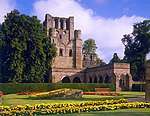 | |||
| Hermitage Lane Pointfield | 55°35′55″N 2°25′33″W | Category B | 35750 | | |||
| 1, 3 Horsemarket | 55°35′55″N 2°26′00″W | Category B | 35751 | | |||
| Crawford Street, Red Lion Inn | 55°35′57″N 2°26′05″W | Category C(S) | 51109 | | |||
| 12, 14 Woodmarket Border Hotel | 55°35′55″N 2°25′59″W | Category C(S) | 35864 | 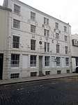 | |||
| 40-42 Woodmarket | 55°35′56″N 2°25′56″W | Category C(S) | 35867 | | |||
| 50 Horsemarket | 55°35′59″N 2°25′55″W | Category C(S) | 35760 | | |||
| Jedburgh Road Maxwellheugh Cottage | 55°35′35″N 2°25′56″W | Category B | 35763 | | |||
| Mill Wynd, Kelso Mills, (John Hogarth Ltd) | 55°35′52″N 2°26′08″W | Category B | 35775 | | |||
| 9, 11 Oven Wynd (North Side) And Unnumbered House (Veitch) | 55°35′52″N 2°26′05″W | Category C(S) | 35778 | | |||
| 13, 15 Oven Wynd (North Side) | 55°35′52″N 2°26′06″W | Category C(S) | 35779 | | |||
| Oven Wynd, (South Side) Premises Of J Utterson And J Walker, Plumbers And Slaters | 55°35′52″N 2°26′04″W | Category C(S) | 35782 | | |||
| 48 Roxburgh Street | 55°35′58″N 2°26′11″W | Category B | 35796 | | |||
| 132-134 Roxburgh Street | 55°36′06″N 2°26′24″W | Category C(S) | 35804 | | |||
| 15-23 Sheddon Park Road (Odd Nos) | 55°35′56″N 2°25′47″W | Category C(S) | 35812 | | |||
| Shedden Park Road Tweedbank With Walled Garden, Boundary Walls And Gatepiers | 55°36′00″N 2°25′34″W | Category B | 35819 | | |||
| Shedden Park Road, Rosebank | 55°36′05″N 2°25′24″W | Category B | 35820 | | |||
| The Square, Kelso Town Hall | 55°35′55″N 2°26′01″W | Category B | 35828 | 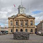 | |||
| 33, 34, 35 The Square | 55°35′56″N 2°26′05″W | Category B | 35841 | | |||
| 47, 48, 49 The Square | 55°35′56″N 2°26′01″W | Category B | 35845 | | |||
| 7 Woodmarket | 55°35′54″N 2°25′59″W | Category B | 35854 | | |||
| 7 Abbey Court | 55°35′49″N 2°26′01″W | Category B | 35687 | | |||
| 10 Abbey Row | 55°35′54″N 2°25′58″W | Category B | 35695 | | |||
| Abbotsford Grove Korea House | 55°35′52″N 2°25′37″W | Category B | 35698 | | |||
| 3, 4, 5, 6, Bowmont Street | 55°35′56″N 2°26′01″W | Category C(S) | 35699 | | |||
| 22 Bowmont Street Bowmont House | 55°35′59″N 2°26′06″W | Category B | 35703 | | |||
| Bowmont Street Orchard House, Orchard Cottage, And Dovecot | 55°36′11″N 2°26′29″W | Category B | 35711 | | |||
| 1 Bridge Street | 55°35′52″N 2°26′03″W | Category B | 35713 | | |||
| Bridge Street, Ednam House Hotel Gatepiers | 55°35′48″N 2°26′01″W | Category B | 35719 | | |||
| 40 - 44 (Even Nos) Bridge Street And 2, 2A Abbey Row | 55°35′50″N 2°25′59″W | Category B | 35732 | .jpg) | |||
| Broomlands House | 55°36′24″N 2°25′21″W | Category B | 35738 | | |||
| Edenside Road Edenside | 55°36′10″N 2°25′47″W | Category B | 35747 | | |||
| Hermitage Lane Hermitage | 55°35′58″N 2°25′35″W | Category B | 35749 | | |||
| Horsemarket, Black Swan | 55°35′55″N 2°25′59″W | Category C(S) | 35752 | | |||
| Springwood Estate, (Springwood Caravan Park), Walled Garden | 55°35′38″N 2°27′16″W | Category B | 12954 | | |||
| Springwood Estate, Springwood Home Farm | 55°35′23″N 2°27′06″W | Category B | 12955 | | |||
| 65 Horsemarket | 55°35′59″N 2°25′53″W | Category C(S) | 35755 | | |||
| 44 Horsemarket Former Post Office | 55°35′58″N 2°25′56″W | Category B | 35758 | | |||
| The Knowes, Waverley Lodge | 55°35′51″N 2°25′46″W | Category C(S) | 35767 | | |||
| 7, 8 Maxwellheugh Terrace | 55°35′34″N 2°25′53″W | Category B | 35773 | 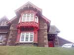 | |||
| Oven Wynd, Ramsay Lodge | 55°35′52″N 2°26′08″W | Category B | 35780 | | |||
| 3, 4 Oven Wynd (South Side) | 55°35′52″N 2°26′03″W | Category C(S) | 35781 | | |||
| 2, 4 Roxburgh Street | 55°35′55″N 2°26′06″W | Category B | 35792 | | |||
| 18, 20, 22, 24 Roxburgh Street | 55°35′56″N 2°26′08″W | Category B | 35795 | | |||
| 60 Roxburgh Street | 55°35′59″N 2°26′11″W | Category B | 35798 | | |||
| 126 Roxburgh Street | 55°36′05″N 2°26′22″W | Category B | 35803 | | |||
| 142 Roxburgh Street | 55°36′07″N 2°26′28″W | Category C(S) | 35808 | | |||
| 51 Sheddon Park Road, Lyme House | 55°35′59″N 2°25′39″W | Category C(S) | 35817 | | |||
| 3 Simon Square | 55°35′56″N 2°25′53″W | Category B | 35825 | | |||
| 3, 4, 5, 6 Winchester Row | 55°36′04″N 2°26′16″W | Category C(S) | 35852 | | |||
| Abbey Court St Andrew's Episcopal Church And Churyard Walls | 55°35′47″N 2°26′01″W | Category B | 35689 | | |||
| Bridge Street, Ednam House Hotel | 55°35′51″N 2°26′04″W | Category A | 35716 | 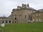 | |||
| Bridge Street Bridge-End Cottage | 55°35′45″N 2°25′58″W | Category A | 35724 | | |||
| 4, 6, 8 Bridge Street | 55°35′53″N 2°26′01″W | Category B | 35725 | 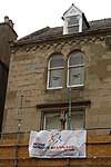 | |||
| 14 Bridge Street | 55°35′52″N 2°26′00″W | Category C(S) | 35727 | | |||
| Edenside Road Kerfield | 55°36′08″N 2°25′45″W | Category B | 35746 | | |||
| Springwood Estate (Springwood Caravan Park), Scott-Douglas Mausoleum | 55°35′42″N 2°27′18″W | Category A | 12952 | 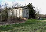 | |||
| Wooden House | 55°35′47″N 2°24′47″W | Category B | 10471 | | |||
| Steward's House In Floors Castle Policies | 55°36′25″N 2°28′06″W | Category B | 10478 | | |||
| 8, 10 Woodmarket | 55°35′55″N 2°26′00″W | Category C(S) | 35863 | | |||
| 32-38 Woodmarket (Even Nos.) | 55°35′56″N 2°25′57″W | Category B | 35866 | | |||
| 44-50 Woodmarket (Even Nos.) | 55°35′57″N 2°25′55″W | Category C(S) | 35868 | | |||
| The Square, K6 Telephone Kiosk Adjacent To Town Hall | 55°35′55″N 2°26′01″W | Category B | 35870 | | |||
| 52 Horsemarket | 55°35′59″N 2°25′55″W | Category C(S) | 35761 | | |||
| Kelso Bridge | 55°35′43″N 2°26′00″W | Category A | 35764 | | |||
| The Knowes; Abbey Bank | 55°35′50″N 2°25′49″W | Category B | 35765 | | |||
| 21 Roxburgh Street | 55°35′57″N 2°26′07″W | Category B | 35785 | | |||
| 47-49 Roxburgh Street | 55°35′58″N 2°26′08″W | Category C(S) | 35789 | | |||
| 108 Roxburgh Street Falcon Hall | 55°36′04″N 2°26′18″W | Category B | 35802 | | |||
| Roxburgh Street Walton Hall, And Stable Wing | 55°36′06″N 2°26′26″W | Category A | 35805 | | |||
| Roxburgh Street Walton Hall, Entrance Gateways And Wall | 55°36′06″N 2°26′26″W | Category A | 35806 | | |||
| 1 The Square And Abbey Row | 55°35′54″N 2°25′59″W | Category B | 35829 | | |||
| 20 The Square | 55°35′54″N 2°26′04″W | Category B | 35835 | | |||
| The Square, Robert Macdonald(Now Peter Dominic) | 55°35′54″N 2°26′05″W | Category B | 35836 | | |||
| 26, 27, 29 The Square | 55°35′55″N 2°26′06″W | Category B | 35839 | | |||
| 1 Union Street | 55°35′58″N 2°26′08″W | Category C(S) | 35848 | | |||
| 8 Abbey Court Turret House | 55°35′48″N 2°26′00″W | Category B | 35692 | | |||
| 7 Bowmont Street Commercial Inn | 55°35′57″N 2°26′02″W | Category C(S) | 35700 | | |||
| 5, 7 Bridge Street | 55°35′52″N 2°26′02″W | Category C(S) | 35714 | | |||
| 31 Bridge Street Wares And Mcdonald | 55°35′50″N 2°26′00″W | Category B | 35722 | | |||
| 46 Bridge Street And 1 Abbey Row | 55°35′50″N 2°25′58″W | Category C(S) | 35733 | .jpg) | |||
| Butts, Property Of 2Nd Roxburghe Discretionary Trust | 55°35′53″N 2°25′49″W | Category C(S) | 35740 | 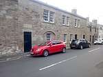 | |||
| 1 Cross Street | 55°35′59″N 2°25′53″W | Category C(S) | 35743 | | |||
| Wooden Gardener's House, Icehouse | 55°35′51″N 2°24′41″W | Category C(S) | 10472 | | |||
| Kelso Racecourse, Grandstand | 55°36′46″N 2°26′12″W | Category A | 51742 | | |||
| 41 Woodmarket | 55°35′56″N 2°25′54″W | Category C(S) | 35861 | | |||
| 2, 6 Woodmarket | 55°35′55″N 2°26′00″W | Category C(S) | 35862 | | |||
| Mill Wynd, Kelso Mills, Offices | 55°35′52″N 2°26′09″W | Category B | 35776 | | |||
| 37, 39, 41, 43 Roxburgh Street | 55°35′58″N 2°26′08″W | Category B | 35788 | | |||
| 6, 12 Roxburgh Street | 55°35′55″N 2°26′07″W | Category C(S) | 35793 | | |||
| 14, 16, Roxburgh Street | 55°35′55″N 2°26′07″W | Category C(S) | 35794 | | |||
| 106 Roxburgh Street And Ormiston Cottage | 55°36′03″N 2°26′18″W | Category B | 35801 | | |||
| 146 Roxburgh Street | 55°36′07″N 2°26′29″W | Category B | 35810 | | |||
| 47-49 Sheddon Park Road | 55°35′59″N 2°25′40″W | Category C(S) | 35816 | | |||
| Shedden Park Road Rosebank, Lodge And Gatepiers | 55°36′06″N 2°25′27″W | Category C(S) | 35821 | | |||
| Shedden Park Road Gateway To Shedden Park | 55°36′00″N 2°25′40″W | Category B | 35822 | | |||
| Sprouston Road Pinnaclehill Lodge And Gatepiers | 55°35′35″N 2°25′41″W | Category C(S) | 35827 | | |||
| 30, 31, 32 The Square | 55°35′56″N 2°26′05″W | Category B | 35840 | | |||
| The Square Cross Keys Hotel | 55°35′56″N 2°26′03″W | Category B | 35842 | 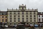 | |||
| 4 Union Street | 55°35′58″N 2°26′08″W | Category C(S) | 35850 | | |||
| 6 Union Street | 55°35′59″N 2°26′08″W | Category C(S) | 35851 | | |||
| 1, 3, 5 Woodmarket | 55°35′54″N 2°26′00″W | Category B | 35853 | | |||
| 13, 15, 17, 19 Woodmarket | 55°35′54″N 2°25′59″W | Category B | 35856 | | |||
| Woodmarket, Corn Exchange | 55°35′55″N 2°25′56″W | Category B | 35859 | | |||
| 3 Abbey Court | 55°35′49″N 2°26′00″W | Category B | 35685 | | |||
| Bowmont Street R C Church Of The Immaculate Conception | 55°36′09″N 2°26′24″W | Category C(S) | 35707 | | |||
| Bowmont Street, Kelso High School, Formerly Kelso Academy | 55°36′12″N 2°26′21″W | Category B | 35712 | | |||
| Bridge Street Ednam House Hotel, Garden House | 55°35′51″N 2°26′07″W | Category B | 35717 | | |||
| Bridge Street Ednam House Hotel, Garden Walls And Terrace Walls | 55°35′48″N 2°26′01″W | Category B | 35718 | | |||
| 21 And 23-25 Bridge Street | 55°35′50″N 2°26′00″W | Category B | 35720 | | |||
| 10, 12 Bridge Street | 55°35′52″N 2°26′01″W | Category C(S) | 35726 | 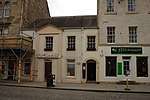 | |||
| 30,32 Bridge Street | 55°35′51″N 2°25′59″W | Category B | 35730 |  | |||
| East Bowmont Street. Former Trinity North Church Of Scotland And Church Halls | 55°35′59″N 2°26′01″W | Category B | 35744 | | |||
| 4 East Bowmont Street (Colesdale House) | 55°36′01″N 2°26′01″W | Category B | 35745 | | |||
| Sharpitlaw House | 55°36′32″N 2°24′41″W | Category B | 10473 | | |||
| Hendersyde Park, Hendersyde West Lodge Including Quadrant Walls, Gatepiers And Part Boundary Wall | 55°36′25″N 2°24′50″W | Category C(S) | 10475 | | |||
| Woodside House Hotel | 55°36′14″N 2°25′36″W | Category B | 35869 | | |||
| Cauld On River Tweed | 55°36′00″N 2°26′22″W | Category B | 35871 | | |||
| 22 Horsemarket | 55°35′57″N 2°25′58″W | Category C(S) | 35757 | | |||
| The Knowes; Walton Grove | 55°35′50″N 2°25′47″W | Category C(S) | 35766 | | |||
| Maxwell Lane, St Leonards | 55°35′53″N 2°25′41″W | Category B | 35770 | | |||
| 1, 2 Maxwellheugh Terrace | 55°35′32″N 2°25′51″W | Category C(S) | 35771 |  | |||
| Roxburgh Street Selkirk And Kelso Society Co-Op | 55°35′57″N 2°26′07″W | Category C(S) | 35786 | | |||
| 51 Roxburgh Street | 55°35′58″N 2°26′09″W | Category B | 35790 | | |||
| 66 Roxburgh Street | 55°36′00″N 2°26′12″W | Category C(S) | 35799 | | |||
| Roxburgh Street St John's Edenside And Ednam Church Of Scotland | 55°36′02″N 2°26′13″W | Category A | 35800 | .jpg) | |||
| 1 Simon Square | 55°35′56″N 2°25′53″W | Category C(S) | 35824 | | |||
| Springwood Park, Gateway And Gates | 55°35′38″N 2°26′08″W | Category A | 35826 | | |||
| 27 Woodmarket, Wm Roxburgh (Lauder Bros Ltd) And N B Douglas Also Frazer Tennant Ltd | 55°35′55″N 2°25′57″W | Category B | 35858 | | |||
| Abbey Court, Gardens Shop | 55°35′49″N 2°26′00″W | Category C(S) | 35684 | | |||
| 5 Abbey Court | 55°35′49″N 2°26′01″W | Category B | 35686 | | |||
| 6 Abbey Court | 55°35′48″N 2°26′00″W | Category C(S) | 35691 | | |||
| Abbey Row And The Butts, Kelso Old Parish Church, Church-Yard Wall And Gates | 55°35′55″N 2°25′54″W | Category C(S) | 35697 | | |||
| 20 Bowmont Street | 55°35′59″N 2°26′05″W | Category C(S) | 35702 | | |||
| 36 Bowmont Street | 55°36′02″N 2°26′11″W | Category C(S) | 35704 | | |||
| 38 Bowmont Street | 55°36′02″N 2°26′11″W | Category C(S) | 35705 | | |||
| 20 Bridge Street | 55°35′52″N 2°26′00″W | Category B | 35728 |  | |||
| Chalkheugh Terrace Royal British Legion Club | 55°36′00″N 2°26′12″W | Category C(S) | 35742 | | |||
| 22, 24 Woodmarket | 55°35′56″N 2°25′58″W | Category B | 35865 | | |||
| 56 Horsemarket | 55°35′59″N 2°25′55″W | Category C(S) | 35762 | | |||
| 4, 5, 6, Mill Wynd | 55°35′53″N 2°26′05″W | Category C(S) | 35774 | | |||
| 35 Roxburgh Street | 55°35′57″N 2°26′07″W | Category B | 35787 | | |||
| 50 Roxburgh Street | 55°35′58″N 2°26′10″W | Category C(S) | 35797 | | |||
| 144 Roxburgh Street | 55°36′07″N 2°26′28″W | Category B | 35809 | | |||
| 53 Sheddon Park Road, Lyme Cottage | 55°35′59″N 2°25′38″W | Category C(S) | 35818 | | |||
| Shedden Park Road Shedden Park Pavilion Or Keeper's Lodge | 55°35′59″N 2°25′47″W | Category B | 35823 | | |||
| Abbey Row Masonic Lodge | 55°35′54″N 2°25′58″W | Category C(S) | 35694 | | |||
| Abbey Row Kelso Old Parish Church | 55°35′53″N 2°25′52″W | Category A | 35696 | | |||
| 13, 14, 16 Bowmont Street | 55°35′58″N 2°26′04″W | Category B | 35701 | | |||
| 46 Bowmont Street Allanbank | 55°36′04″N 2°26′14″W | Category C(S) | 35706 | | |||
| 23 Bowmont Street | 55°36′01″N 2°26′04″W | Category B | 35709 | | |||
| 9, 11 Bridge Street Robert Swan, Cycle And Sports Depot | 55°35′51″N 2°26′02″W | Category B | 35715 | | |||
| 27-29 Bridge Street W & M Cockburn | 55°35′50″N 2°26′00″W | Category B | 35721 | | |||
| Bridge Street, Kelso Abbey, Monument To The Dukes Of Roxburghe | 55°35′49″N 2°25′56″W | Category B | 35735 |  | |||
| Chalkheugh Terrace Duncan House | 55°35′58″N 2°26′11″W | Category B | 35741 | | |||
| Edenside Road Edenside, Stables And Gatepiers | 55°36′08″N 2°25′47″W | Category C(S) | 35748 | | |||
| Wooden Estate, Stable Court And Coachhouse Range | 55°35′47″N 2°24′43″W | Category B | 12953 | | |||
| Floors Castle | 55°36′17″N 2°27′36″W | Category A | 10480 | | |||
| 61 Horsemarket | 55°35′58″N 2°25′53″W | Category C(S) | 35754 | | |||
| 1 Oven Wynd (North Side) And Pettigrew's Property | 55°35′53″N 2°26′03″W | Category C(S) | 35777 | | |||
| 53 Roxburgh Street | 55°35′59″N 2°26′09″W | Category C(S) | 35791 | | |||
| 140 Roxburgh Street, Haybank | 55°36′07″N 2°26′28″W | Category C(S) | 35807 | | |||
| Roxburgh Street Floors Castle Gates And Gate Lodges | 55°36′09″N 2°26′34″W | Category A | 35811 | 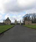 | |||
| 3, 4 The Square | 55°35′53″N 2°26′00″W | Category C(S) | 35830 | | |||
| 8, 9 The Square, Bank Of Scotland | 55°35′53″N 2°26′01″W | Category B | 35831 | 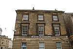 | |||
| 23-25 The Square | 55°35′54″N 2°26′06″W | Category C(S) | 35838 | | |||
| 50, 51, 52 The Square | 55°35′55″N 2°26′00″W | Category C(S) | 35846 | | |||
| 9-11 Woodmarket | 55°35′54″N 2°25′59″W | Category B | 35855 | | |||
| 33-35 Woodmarket, The Priory | 55°35′56″N 2°25′55″W | Category B | 35860 | | |||
| Abbey Court, Ednam House Hotel, Boundary Walls, Gates And Gatepiers | 55°35′48″N 2°26′01″W | Category B | 35688 | | |||
| Bowmont Street Public Library | 55°36′00″N 2°26′04″W | Category B | 35708 | | |||
| 29 Bowmont Street | 55°36′01″N 2°26′07″W | Category C(S) | 35710 | | |||
| Bridge Street, War Memorial | 55°35′48″N 2°25′56″W | Category B | 35736 | 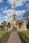 | |||
| Bridge Street, Manse | 55°35′48″N 2°25′53″W | Category B | 35737 | | |||
| Broomlands House Walled Gardens | 55°36′27″N 2°25′23″W | Category C(S) | 35739 | | |||
| Sydenham House | 55°37′18″N 2°25′50″W | Category B | 10477 | |
Key
The scheme for classifying buildings in Scotland is:
- Category A: "buildings of national or international importance, either architectural or historic; or fine, little-altered examples of some particular period, style or building type."[1]
- Category B: "buildings of regional or more than local importance; or major examples of some particular period, style or building type, which may have been altered."[1]
- Category C: "buildings of local importance; lesser examples of any period, style, or building type, as originally constructed or moderately altered; and simple traditional buildings which group well with other listed buildings."[1]
In March 2016 there were 47,288 listed buildings in Scotland. Of these, 8% were Category A, and 50% were Category B, with the remaining 42% being Category C.[2]
Notes
- Sometimes known as OSGB36, the grid reference (where provided) is based on the British national grid reference system used by the Ordnance Survey.
• "Guide to National Grid". Ordnance Survey. Retrieved 12 December 2007.
• "Get-a-map". Ordnance Survey. Retrieved 17 December 2007. - Historic Environment Scotland assign a unique alphanumeric identifier to each designated site in Scotland, for listed buildings this always begins with "LB", for example "LB12345".
gollark: ***THE MISINTERPRETED RULES ARE ETERNALTHERE IS NO ESCAPETHERE IS NO HOPETHERE IS NOWHERE TO GO***
gollark: There is still no escape.
gollark: It helps people know what you want, but under the moderators' stupidly overextended and munged rules, you're "harassing the owner of F***" or something.
gollark: On the other hand, it's not technically banned to write sweary things in the box.
gollark: There is even less escape!
References
- All entries, addresses and coordinates are based on data from Historic Scotland. This data falls under the Open Government Licence
- "What is Listing?". Historic Environment Scotland. Retrieved 29 May 2018.
- Scotland's Historic Environment Audit 2016 (PDF). Historic Environment Scotland and the Built Environment Forum Scotland. pp. 15–16. Retrieved 29 May 2018.
This article is issued from Wikipedia. The text is licensed under Creative Commons - Attribution - Sharealike. Additional terms may apply for the media files.