List of listed buildings in Coldstream, Scottish Borders
List
| Name | Location | Date Listed | Grid Ref. [note 1] | Geo-coordinates | Notes | LB Number [note 2] | Image |
|---|---|---|---|---|---|---|---|
| High Street Town Hall | 55°39′07″N 2°15′04″W | Category B | 23072 |  | |||
| 81 High Street, Victoria House | 55°39′09″N 2°15′03″W | Category B | 23073 | | |||
| 2 High Street | 55°38′59″N 2°15′21″W | Category C(S) | 23074 | | |||
| 8 High Street | 55°38′59″N 2°15′20″W | Category C(S) | 23077 | | |||
| 54-56 (Even) High Street | 55°39′04″N 2°15′10″W | Category C(S) | 23086 | | |||
| 66, 68 High Street | 55°39′05″N 2°15′06″W | Category C(S) | 23090 | | |||
| Kelso Road ,The Lees, Temple | 55°38′40″N 2°15′11″W | Category B | 23107 | | |||
| Market Square, Cameron House | 55°39′00″N 2°15′04″W | Category B | 23114 | | |||
| 2 Willowbank | 55°39′01″N 2°14′59″W | Category C(S) | 23124 | | |||
| Court House Lodge, Court House Place | 55°39′01″N 2°15′21″W | Category C(S) | 23038 | | |||
| 1 High Street | 55°39′00″N 2°15′21″W | Category C(S) | 23049 | | |||
| 23 High Street | 55°39′02″N 2°15′17″W | Category C(S) | 23059 | | |||
| 25 High Street | 55°39′03″N 2°15′16″W | Category B | 23060 | | |||
| 6 High Street, White Swan | 55°38′59″N 2°15′20″W | Category C(S) | 23076 | | |||
| 24, 26 High Street | 55°39′01″N 2°15′17″W | Category C(S) | 23079 | | |||
| 28 High Street | 55°39′01″N 2°15′17″W | Category C(S) | 23080 | | |||
| 38 High Street | 55°39′02″N 2°15′15″W | Category C(S) | 23082 | | |||
| 84 High Street | 55°39′06″N 2°15′03″W | Category C(S) | 23098 | | |||
| Church Lane Cornstore | 55°39′04″N 2°15′08″W | Category C(S) | 23035 | | |||
| 1, 2 Court House Place | 55°39′01″N 2°15′20″W | Category C(S) | 23036 | | |||
| 5, 6 Court House Place | 55°39′01″N 2°15′20″W | Category C(S) | 23037 | | |||
| 3 High Street | 55°39′00″N 2°15′21″W | Category C(S) | 23050 | | |||
| 15 High Street | 55°39′02″N 2°15′18″W | Category B | 23055 | | |||
| 51, 53 High Street | 55°39′05″N 2°15′08″W | Category B | 23067 | | |||
| 61-67 (Odd Nos) High Street | 55°39′06″N 2°15′06″W | Category B | 23070 | | |||
| The Hirsel, Homestead | 55°39′18″N 2°16′30″W | Category B | 4070 | | |||
| 69 High Street | 55°39′06″N 2°15′05″W | Category B | 23071 | | |||
| 10 High Street | 55°39′00″N 2°15′19″W | Category C(S) | 23078 | | |||
| 46 High Street | 55°39′03″N 2°15′13″W | Category B | 23084 | | |||
| 58, 60 High Street | 55°39′04″N 2°15′09″W | Category C(S) | 23087 | | |||
| 80 High Street | 55°39′06″N 2°15′04″W | Category C(S) | 23096 | | |||
| Kelso Road, Lees Farm, East Range | 55°38′59″N 2°15′25″W | Category C(S) | 23110 | | |||
| 12, 13 Market Square, Guards House | 55°39′02″N 2°15′03″W | Category B | 23113 | | |||
| 23 Market Square, Crown Hotel | 55°39′00″N 2°15′04″W | Category C(S) | 23116 | | |||
| Abbey Road Abbey House | 55°39′00″N 2°14′58″W | Category B | 23034 | | |||
| 31 Duke Street | 55°38′58″N 2°15′18″W | Category C(S) | 23041 | | |||
| 17 High Street | 55°39′02″N 2°15′18″W | Category B | 23056 | | |||
| 31-35 (Odd) High Street | 55°39′04″N 2°15′12″W | Category C(S) | 23064 | | |||
| The Hirsel | 55°39′36″N 2°16′22″W | Category A | 4069 | 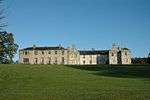 | |||
| Milne Graden | 55°41′29″N 2°11′51″W | Category B | 4072 | 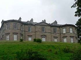 | |||
| The Marriage House, Colstream Bridge | 55°39′18″N 2°14′32″W | Category B | 4074 | | |||
| 50 High Street, Newcastle Arms | 55°39′03″N 2°15′11″W | Category C(S) | 23085 | | |||
| 62, 64 High Street | 55°39′05″N 2°15′08″W | Category B | 23088 | | |||
| 74 High Street | 55°39′06″N 2°15′05″W | Category C(S) | 23093 | | |||
| 78 High Street | 55°39′06″N 2°15′04″W | Category C(S) | 23095 | | |||
| 86 High Street | 55°39′06″N 2°15′03″W | Category B | 23099 | | |||
| 29 Market Square | 55°39′00″N 2°15′07″W | Category C(S) | 23119 | | |||
| Willowbank, Marjoriebanks Of Lees Burial Ground | 55°39′01″N 2°14′59″W | Category C(S) | 23122 | | |||
| 1, 2 Duke Street | 55°39′02″N 2°15′09″W | Category B | 23040 | | |||
| Duns Road,Woodside House | 55°39′14″N 2°15′19″W | Category B | 23047 | | |||
| The Hirsel Obelisk In Park, Home Memorial | 55°39′55″N 2°17′15″W | Category B | 4071 | | |||
| 30, 32 High Street, Commercial Inn | 55°39′01″N 2°15′17″W | Category C(S) | 23081 | | |||
| 72 High Street | 55°39′05″N 2°15′05″W | Category C(S) | 23092 | | |||
| 88 High Street, Bank Of Scotland | 55°39′07″N 2°15′02″W | Category B | 23101 | | |||
| 100, 100C High Street | 55°39′09″N 2°14′58″W | Category B | 23102 | | |||
| Kelso Road, The Lees, Lodge, Gatepiers And Gates | 55°38′54″N 2°15′29″W | Category B | 23104 | | |||
| Kelso Road The Lees Policies Of: Icehouse | 55°38′50″N 2°15′26″W | Category C(S) | 23105 | | |||
| 1,2,3 Dovecote | 55°38′57″N 2°15′16″W | Category B | 23039 | | |||
| Duns Road, Lodge And Gatepiers To Hope Park | 55°39′15″N 2°15′20″W | Category C(S) | 23044 | | |||
| 5 High Street | 55°39′00″N 2°15′21″W | Category C(S) | 23051 | | |||
| 7 High Street | 55°39′00″N 2°15′20″W | Category C(S) | 23052 | | |||
| 11 High Street, Castle Hotel | 55°39′01″N 2°15′20″W | Category B | 23054 | | |||
| Lennel Church | 55°39′50″N 2°13′42″W | Category B | 4067 | | |||
| 76 High Street | 55°39′06″N 2°15′05″W | Category C(S) | 23094 | | |||
| Kelso Road, Lees Farm, Cottages | 55°38′57″N 2°15′27″W | Category C(S) | 23111 | | |||
| Duns Road, Hope Park | 55°39′14″N 2°15′13″W | Category B | 23042 | | |||
| Duns Road, The Manse | 55°39′12″N 2°15′20″W | Category B | 23046 | | |||
| Guards Road,Trafalgar House, Formerly The Manse | 55°39′12″N 2°15′03″W | Category B | 23048 | | |||
| 21 High Street | 55°39′02″N 2°15′17″W | Category B | 23058 | | |||
| 27 High Street | 55°39′03″N 2°15′16″W | Category B | 23061 | | |||
| 37 High Street | 55°39′04″N 2°15′11″W | Category B | 23065 | | |||
| 59 High Street | 55°39′06″N 2°15′07″W | Category B | 23069 | | |||
| Milne Graden Estate, West Lodge Including Gatepiers And Gates | 55°41′38″N 2°12′33″W | Category C(S) | 209 | | |||
| 44 High Street | 55°39′03″N 2°15′13″W | Category B | 23083 | | |||
| High Street, Coldstream Parish Church | 55°39′05″N 2°15′07″W | Category B | 23089 | | |||
| 70 High Street | 55°39′05″N 2°15′05″W | Category C(S) | 23091 | | |||
| 82 High Street | 55°39′06″N 2°15′04″W | Category C(S) | 23097 | | |||
| Kelso Road, The Lees | 55°38′45″N 2°15′18″W | Category B | 23103 | | |||
| Kelso Road, Lees, Farm, Main Steading | 55°38′58″N 2°15′26″W | Category B | 23108 | | |||
| Workshop At Rear Of Cameron House,Market Square | 55°39′00″N 2°15′03″W | Category C(S) | 23115 | | |||
| The Red Lion,Market Street | 55°39′02″N 2°15′09″W | Category C(S) | 23120 | | |||
| Duns Road, Hope Park Outbuilding | 55°39′14″N 2°15′13″W | Category C(S) | 23043 | | |||
| 55, 57 High Street | 55°39′06″N 2°15′07″W | Category C(S) | 23068 | | |||
| Lennel House | 55°39′37″N 2°14′15″W | Category A | 4068 | 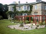 | |||
| Stables, Milne Graden | 55°41′34″N 2°11′47″W | Category B | 4073 | | |||
| 75 High Street, The Besom Inn | 55°39′08″N 2°15′03″W | Category C(S) | 51122 | | |||
| 4 High Street | 55°38′59″N 2°15′20″W | Category C(S) | 23075 | | |||
| High Street,Henderson Park, Gazebo | 55°39′06″N 2°14′58″W | Category B | 23100 | | |||
| Kelso Road, The Lees, Stables | 55°38′52″N 2°15′19″W | Category B | 23106 | | |||
| Kelso Road, Lees Farm, Stable Block | 55°38′59″N 2°15′26″W | Category C(S) | 23109 | | |||
| 15 Leet Street | 55°38′59″N 2°15′13″W | Category C(S) | 23112 | | |||
| 24, 25 Market Square | 55°39′00″N 2°15′05″W | Category C(S) | 23117 | | |||
| 27, 28 Market Square | 55°39′00″N 2°15′06″W | Category C(S) | 23118 | | |||
| Tweed Terrace, Monument To Charles Marjoriebanks Mp | 55°39′12″N 2°14′50″W | Category B | 23121 | 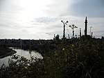 | |||
| 1 Willowbank, Arden House | 55°39′02″N 2°14′59″W | Category C(S) | 23123 | | |||
| Duns Road, Ivy Lodge | 55°39′13″N 2°15′18″W | Category B | 23045 | | |||
| 9 High Street | 55°39′00″N 2°15′20″W | Category C(S) | 23053 | | |||
| 19 High Street | 55°39′02″N 2°15′17″W | Category B | 23057 | | |||
| High Street Church Centre | 55°39′04″N 2°15′15″W | Category B | 23062 | | |||
| 29 High Street Keith House | 55°39′04″N 2°15′13″W | Category B | 23063 | | |||
| 39 High Street | 55°39′05″N 2°15′10″W | Category C(S) | 23066 | | |||
| Coldstream Bridge | 55°39′16″N 2°14′31″W | Category A | 4075 | |
Key
The scheme for classifying buildings in Scotland is:
- Category A: "buildings of national or international importance, either architectural or historic; or fine, little-altered examples of some particular period, style or building type."[1]
- Category B: "buildings of regional or more than local importance; or major examples of some particular period, style or building type, which may have been altered."[1]
- Category C: "buildings of local importance; lesser examples of any period, style, or building type, as originally constructed or moderately altered; and simple traditional buildings which group well with other listed buildings."[1]
In March 2016 there were 47,288 listed buildings in Scotland. Of these, 8% were Category A, and 50% were Category B, with the remaining 42% being Category C.[2]
Notes
- Sometimes known as OSGB36, the grid reference (where provided) is based on the British national grid reference system used by the Ordnance Survey.
• "Guide to National Grid". Ordnance Survey. Retrieved 12 December 2007.
• "Get-a-map". Ordnance Survey. Retrieved 17 December 2007. - Historic Environment Scotland assign a unique alphanumeric identifier to each designated site in Scotland, for listed buildings this always begins with "LB", for example "LB12345".
gollark: I don't really have a favourite.
gollark: ÆÆÆÆÆÆÆÆÆÆÆÆÆÆÆÆÆÆÆÆÆÆÆÆÆÆÆÆÆÆa
gollark: I'm actually LyricLy (realer) (olivia) (x4).
gollark: ... I don't even know at this point.
gollark: That's basically all languages, and also no.
References
- All entries, addresses and coordinates are based on data from Historic Scotland. This data falls under the Open Government Licence
- "What is Listing?". Historic Environment Scotland. Retrieved 29 May 2018.
- Scotland's Historic Environment Audit 2016 (PDF). Historic Environment Scotland and the Built Environment Forum Scotland. pp. 15–16. Retrieved 29 May 2018.
This article is issued from Wikipedia. The text is licensed under Creative Commons - Attribution - Sharealike. Additional terms may apply for the media files.