L'Isle-Bouzon
L'Isle-Bouzon (Occitan: L’Isla Boson) is a commune in the Gers department in southwestern France.
L'Isle-Bouzon | |
|---|---|
The old chateau in L'Isle-Bouzon | |
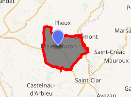
Location of L'Isle-Bouzon 
| |
 L'Isle-Bouzon  L'Isle-Bouzon | |
| Coordinates: 43°55′42″N 0°43′45″E | |
| Country | France |
| Region | Occitanie |
| Department | Gers |
| Arrondissement | Condom |
| Canton | Lectoure-Lomagne |
| Intercommunality | Coeur de Lomagne |
| Government | |
| • Mayor (2008–2014) | Yves Bosc |
| Area 1 | 15.95 km2 (6.16 sq mi) |
| Population (2017-01-01)[1] | 245 |
| • Density | 15/km2 (40/sq mi) |
| Time zone | UTC+01:00 (CET) |
| • Summer (DST) | UTC+02:00 (CEST) |
| INSEE/Postal code | 32158 /32380 |
| Elevation | 85–206 m (279–676 ft) (avg. 168 m or 551 ft) |
| 1 French Land Register data, which excludes lakes, ponds, glaciers > 1 km2 (0.386 sq mi or 247 acres) and river estuaries. | |
Geography
The village lies above the right bank of the Auroue, which flows north through the western part of the commune. The river Arrats forms all of the commune's eastern border.

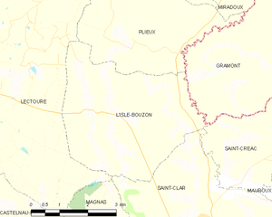
L'Isle-Bouzon and its surrounding communes
Population
| Year | Pop. | ±% |
|---|---|---|
| 1962 | 338 | — |
| 1968 | 297 | −12.1% |
| 1975 | 282 | −5.1% |
| 1982 | 240 | −14.9% |
| 1990 | 230 | −4.2% |
| 1999 | 249 | +8.3% |
| 2008 | 238 | −4.4% |
gollark: Probably exclamation mark.
gollark: **F**xenowyrms.
gollark: I kind of prefer ashes to boreals.
gollark: There are lots of things I really like, so that's not saying much.
gollark: I, too, really like (male) ridgewings.
See also
References
- "Populations légales 2017". INSEE. Retrieved 6 January 2020.
| Wikimedia Commons has media related to L'Isle-Bouzon. |
This article is issued from Wikipedia. The text is licensed under Creative Commons - Attribution - Sharealike. Additional terms may apply for the media files.