Forestdale, Queensland
Forestdale is a suburb of Logan City, Queensland, Australia.[2] In the 2016 census, Forestdale had a population of 2,531 people.[1]
| Forestdale Logan City, Queensland | |||||||||||||||
|---|---|---|---|---|---|---|---|---|---|---|---|---|---|---|---|
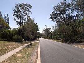 Forestdale Drive, 2014 | |||||||||||||||
 Forestdale | |||||||||||||||
| Coordinates | 27.6638°S 153.0016°E | ||||||||||||||
| Population | 2,531 (2016 census)[1] | ||||||||||||||
| • Density | 415/km2 (1,075/sq mi) | ||||||||||||||
| Postcode(s) | 4118 | ||||||||||||||
| Area | 6.1 km2 (2.4 sq mi) | ||||||||||||||
| Time zone | AEST (UTC+10:00) | ||||||||||||||
| Location |
| ||||||||||||||
| LGA(s) | Logan City | ||||||||||||||
| State electorate(s) | Algester | ||||||||||||||
| Federal Division(s) | Wright | ||||||||||||||
| |||||||||||||||
Geography
Forestdale is bounded to the west by the Brisbane-to-Sydney railway line and by Johnson Road to the north.[3]
Oxley Creek flows through the suburb from the south-west (Greenbank) to the north (Heathwood/Larapinta).[3]
Forestdale is named as such due to the lack of tree clearance compared to surrounding suburbs, although the risk of bushfire is greater than its neighbouring suburbs. "Forest" is from the modern day English word meaning a dense growth of trees and "dale" is originated from Middle English meaning a man who lived in the valley.[4] The suffix is a reference to Robin Hood, an archer according to medieval folk tales. Many of the streets in the suburb are named after characters from Robin Hood stories.[5]
Apart from substantial areas of reserve land, some market gardening, retail and minor pockets of farmland destined for development, Forestdale is residential in nature. Most houses are large and sit on extensive blocks of land.
History
Forestdale is a subdivision of and previously part of Browns Plains.
In the 2011 census the population of Forestdale was 2,520 people.[6]
In the 2016 census, Forestdale had a population of 2,531 people.[1]
Education
There are no schools in Forestdale. The nearest primary schools are in neighbouring Boronia Heights and nearby Regents Park and Browns Plains. The nearest secondary schools are Forest Lake State High School (in Forest Lake), Stretton State College (in Stretton), Browns Plains State High School (in Browns Plains) and Park Ridge State High School (in Park Ridge).[3]
Greenwood Lakes
The Greenwood Lakes wetland with high conservation values is found in Forestdale. Visitors to the park may undertake bushwalking, walk the dog, bird watching and use the picnic tables, boardwalk and viewing platform provided.[7] A large lakes and terraced banks along Oxley Creek were created by commercial sand extraction operations in the area.[7]
Demographics
In the 2011 census the population of Forestdale was 2,520, 48.6% female and 51.4% male.[6] The median age of the Forestdale population was 39 years, 2 years above the national median of 37. 71.4% of people living in Forestdale were born in Australia. The other top responses for country of birth were England 6.3%, New Zealand 3.5%, Taiwan 1.9%, Vietnam 1.4%, South Africa 1.2%. 81.7% of people spoke only English at home; the next most common languages were 2.7% Mandarin, 2.3% Vietnamese, 1.4% Spanish, 1% Cantonese, 1% Greek.[6]
References
- Australian Bureau of Statistics (27 June 2017). "Forestdale (SSC)". 2016 Census QuickStats. Retrieved 20 October 2018.

- "Forestdale - suburb in City of Logan (entry 45265)". Queensland Place Names. Queensland Government. Retrieved 26 January 2020.
- "Queensland Globe". State of Queensland. Retrieved 14 March 2020.
- Surname Meanings and Origins. Retrieved 7 September 2014.
- "Forestdale History". Archived from the original on 16 February 2008. Retrieved 7 September 2014.
- Australian Bureau of Statistics (31 October 2012). "Forestdale (State Suburb)". 2011 Census QuickStats. Retrieved 11 March 2014.
- "Greenwood Lakes". Logan City Council. Retrieved 14 September 2014.
External links
| Wikimedia Commons has media related to Forestdale, Queensland. |
- "Forestdale". Queensland Places. Centre for the Government of Queensland, University of Queensland.
- Forestdale on the Web