National Register of Historic Places listings in Little Rock, Arkansas
This is a list of the National Register of Historic Places listings in Little Rock, Arkansas.
This is intended to be a complete list of the properties and districts on the National Register of Historic Places in Little Rock, Arkansas, United States. The locations of National Register properties and districts for which the latitude and longitude coordinates are included below, may be seen in an online map.[1]
There are 338 properties and districts listed on the National Register in Pulaski County, including 5 National Historic Landmarks, and 20 properties that were once listed but have been removed. The city of Little Rock includes 257 of these properties and districts, including four of the National Historic Landmarks and 16 of the delisted properties; they are listed here, while the remainder are listed separately.
- This National Park Service list is complete through NPS recent listings posted August 14, 2020.[2]
Current listings
| [3] | Name on the Register[4] | Image | Date listed[5] | Location | Description |
|---|---|---|---|---|---|
| 1 | Abrams House |  Abrams House |
February 18, 1999 (#99000221) |
300 S. Pulaski St. 34°44′52″N 92°17′06″W |
|
| 2 | Albert Pike Memorial Temple |  Albert Pike Memorial Temple |
November 13, 1986 (#86003118) |
700-724 Scott St. 34°44′30″N 92°16′14″W |
|
| 3 | Alexander House | March 24, 2020 (#100004904) |
24 East Palisades Dr. 34°46′51″N 92°20′04″W |
||
| 4 | H.M. Anderson House |  H.M. Anderson House |
May 2, 2001 (#01000441) |
3415 W. Markham 34°45′03″N 92°18′41″W |
|
| 5 | Arkansas Power & Light Building | 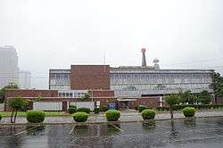 Arkansas Power & Light Building |
September 14, 1992 (#92001156) |
Junction of 9th St. and Louisiana St. 34°44′24″N 92°16′26″W |
|
| 6 | Arkansas State Capitol | 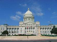 Arkansas State Capitol |
June 28, 1974 (#74000494) |
5th and Woodlane Sts. 34°44′48″N 92°17′20″W |
|
| 7 | Arkansas Teachers Association Headquarters Building and Professional Services Building | February 1, 2018 (#100002002) |
1304 and 1306 Wright Ave. 34°43′55″N 92°17′19″W |
||
| 8 | Arkansas Territorial Restoration Historic District | 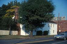 Arkansas Territorial Restoration Historic District |
May 31, 2019 (#100003998) |
W. side of Cumberland between 2nd & 3rd Sts. 34°44′47″N 92°16′06″W |
Now the Historic Arkansas Museum |
| 9 | Associate Reformed Presbyterian Church | 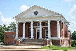 Associate Reformed Presbyterian Church |
December 22, 1982 (#82000874) |
3323 W. 12th St. 34°44′24″N 92°18′40″W |
|
| 10 | Baer House | 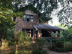 Baer House |
December 22, 1982 (#82000876) |
1010 Rock St. 34°44′17″N 92°16′06″W |
|
| 11 | Barlow Apartments | 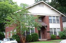 Barlow Apartments |
April 7, 1995 (#95000376) |
2115 Scott St. 34°43′44″N 92°16′19″W |
|
| 12 | Daisy Bates House | 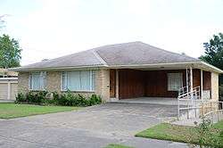 Daisy Bates House |
January 3, 2001 (#01000072) |
1207 W. 28th St. 34°43′18″N 92°17′18″W |
|
| 13 | Beal-Burrow Dry Goods Building | 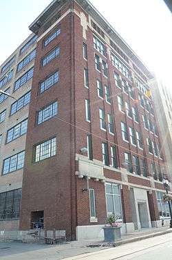 Beal-Burrow Dry Goods Building |
June 26, 1995 (#87001546) |
107 E. Markham 34°44′52″N 92°16′10″W |
|
| 14 | Bechle Apartment Building | 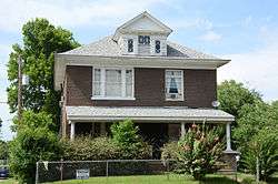 Bechle Apartment Building |
October 2, 1978 (#78003201) |
1000 E. 9th St. 34°44′23″N 92°15′34″W |
|
| 15 | Beyerlein House | 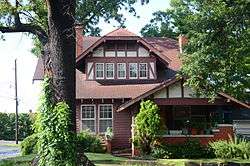 Beyerlein House |
December 22, 1982 (#82000878) |
412 W. 14th St. 34°44′10″N 92°16′36″W |
|
| 16 | Gus Blass Department Store | 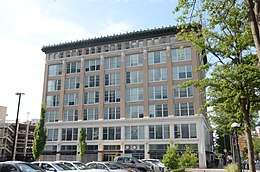 Gus Blass Department Store |
November 13, 1986 (#86003122) |
318-324 Main St. 34°44′43″N 92°16′16″W |
|
| 17 | Noland Blass Jr. House | January 24, 2019 (#100003333) |
217 Normandy Rd. 34°46′03″N 92°20′40″W |
||
| 18 | Block 35 Cobblestone Alley |  Block 35 Cobblestone Alley |
January 22, 2009 (#08001343) |
West of the northern end of Rock St.[6] 34°44′50″N 92°16′02″W |
|
| 19 | Block Realty Building | Block Realty Building |
November 30, 2018 (#100002950) |
723 W Markham St. 34°44′57″N 92°16′42″W |
|
| 20 | Block Realty-Baker House |  Block Realty-Baker House |
September 24, 2008 (#08000935) |
1900 Beechwood St. 34°46′09″N 92°19′28″W |
|
| 21 | Bishop Hiram A. Boaz House |  Bishop Hiram A. Boaz House |
March 7, 1994 (#94000142) |
22 Armistead Rd. 34°46′00″N 92°19′22″W |
|
| 22 | Boone House |  Boone House |
December 22, 1982 (#82000879) |
4014 Lookout 34°45′48″N 92°19′06″W |
|
| 23 | Boyle Park |  Boyle Park |
September 22, 1995 (#95001119) |
Roughly bounded by 38th St., Dorchester Dr., Covewood Cir., Glenmere Dr., Kanis Rd., and W. 12th St. 34°43′35″N 92°21′21″W |
|
| 24 | BPOE Elks Club | 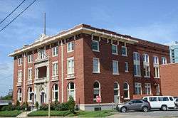 BPOE Elks Club |
December 22, 1982 (#82000880) |
4th and Scott Sts. 34°44′44″N 92°16′09″W |
|
| 25 | Bragg Guesthouse | 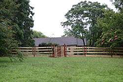 Bragg Guesthouse |
April 4, 2001 (#00001320) |
1615 Cumberland 34°44′03″N 92°16′14″W |
|
| 26 | Adrian Brewer Studio | 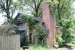 Adrian Brewer Studio |
February 10, 2000 (#00000069) |
510 Cedar St. 34°45′25″N 92°19′01″W |
|
| 27 | Buhler House | 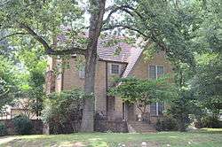 Buhler House |
April 25, 1988 (#88000433) |
1820 Fair Park Boulevard 34°44′38″N 92°20′05″W |
|
| 28 | Bush House | 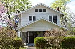 Bush House |
December 22, 1982 (#82000877) |
1516 Ringo St. 34°44′08″N 92°17′05″W |
|
| 29 | Bush-Dubisson House | 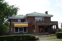 Bush-Dubisson House |
May 28, 1999 (#99000549) |
1500 S. Ringo St. 34°44′08″N 92°17′01″W |
|
| 30 | Capital Hotel | .JPG) Capital Hotel |
July 30, 1974 (#74000495) |
117 W. Markham St. 34°44′53″N 92°16′16″W |
|
| 31 | Capitol-Main Historic District | 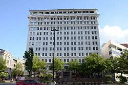 Capitol-Main Historic District |
April 2, 2012 (#11001050) |
500 block of Main St., 100-200 blocks of W. Capitol Ave., 500 block of Center St., and 100-200 blocks of W. 6th St. 34°44′38″N 92°16′21″W |
|
| 32 | Capitol View Neighborhood Historic District | 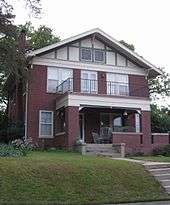 Capitol View Neighborhood Historic District |
March 13, 2001 (#00000813) |
Roughly bounded by Riverview Dr., Schiller St., W. 7th St., and Woodrow St. 34°44′56″N 92°17′55″W |
|
| 33 | Central High School Neighborhood Historic District | 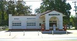 Central High School Neighborhood Historic District |
August 16, 1996 (#96000892) |
Roughly bounded by MLK Dr., Thayer Ave., W. 12th St., and Roosevelt Rd.; also 1850 S. Park St.; also roughly bounded by W. 17th St., Dr. Martin Luther King, Jr., Dr., Wright Ave., and S. Summit and S. Battery Sts. 34°43′56″N 92°17′43″W |
Second and third sets of boundaries represent boundary increases of January 17, 1997 and June 4, 2012 |
| 34 | Central Presbyterian Church |  Central Presbyterian Church |
December 22, 1982 (#82000881) |
1921 Arch St. 34°43′47″N 92°16′45″W |
|
| 35 | Chisum House |  Chisum House |
December 4, 1975 (#75000403) |
1320 Cumberland 34°44′07″N 92°16′13″W |
|
| 36 | Choctaw Route Station |  Choctaw Route Station |
May 6, 1975 (#75000404) |
E. 3rd at the former Rock Island railroad line 34°44′44″N 92°15′32″W |
|
| 37 | John Henry Clayborn House |  John Henry Clayborn House |
May 24, 2006 (#06000420) |
1800 Marshall 34°44′07″N 92°17′32″W |
|
| 38 | Climber Motor Car Factory, Unit A |  Climber Motor Car Factory, Unit A |
June 1, 2005 (#05000500) |
1823 E. 17th St. 34°43′56″N 92°14′56″W |
|
| 39 | Compton-Wood House |  Compton-Wood House |
May 7, 1980 (#80000781) |
800 High St. 34°44′36″N 92°17′21″W |
|
| 40 | Confederate Soldiers Monument | .jpg) Confederate Soldiers Monument |
April 26, 1996 (#96000453) |
Along 4th St. on the eastern side of the State Capitol grounds 34°44′50″N 92°17′16″W |
|
| 41 | Cornish House |  Cornish House |
December 22, 1982 (#82000882) |
1800 Arch St. 34°43′52″N 92°16′47″W |
|
| 42 | Croxson House | 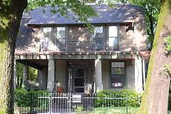 Croxson House |
December 22, 1982 (#82000883) |
1901 Gaines St. 34°43′49″N 92°16′50″W |
|
| 43 | Cumberland Towers | 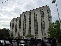 Cumberland Towers |
March 7, 2017 (#100000706) |
311 E. 8th St. 34°44′27″N 92°16′09″W |
|
| 44 | Curran Hall | .png) Curran Hall |
January 1, 1976 (#76000453) |
615 E. Capitol St. 34°44′34″N 92°15′53″W |
|
| 45 | Darragh Building | September 7, 2017 (#100000557) |
1403 E. 6th Ave. 34°44′30″N 92°15′18″W |
||
| 46 | Darragh House | 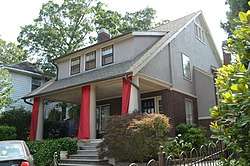 Darragh House |
December 22, 1982 (#82000884) |
2412 Broadway 34°43′29″N 92°16′44″W |
|
| 47 | Julian Bunn Davidson House | 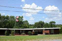 Julian Bunn Davidson House |
March 10, 2014 (#13001105) |
410 S. Battery St. 34°44′50″N 92°17′38″W |
|
| 48 | Deane House | 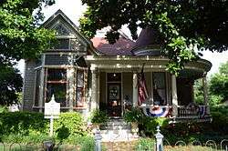 Deane House |
September 5, 1975 (#75000405) |
1701 Arch St. 34°43′59″N 92°16′44″W |
|
| 49 | Democrat Printing & Lithograph Co. Building | 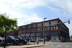 Democrat Printing & Lithograph Co. Building |
December 17, 1998 (#87001547) |
114-122 E. 2nd St. 34°44′50″N 92°16′10″W |
|
| 50 | David O. Dodd Memorial | 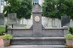 David O. Dodd Memorial |
April 26, 1996 (#96000454) |
300 W. Markham St. 34°44′56″N 92°16′19″W |
|
| 51 | Donaghey Building | 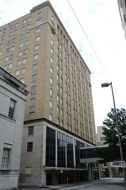 Donaghey Building |
June 27, 2012 (#12000355) |
103 E. 7th St., 703 S. Main St. 34°44′31″N 92°16′16″W |
|
| 52 | Downs Historic District | January 21, 2020 (#100004903) |
4206, 4208, 4210, 4212, 4214, 4216 & 4218 Fairview Rd.; 4201 South Lookout Rd; and 4207, 4209, 4211 & 4213 Wait St. 34°45′40″N 92°19′11″W |
||
| 53 | Dunaway House | 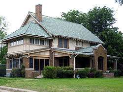 Dunaway House |
December 22, 1982 (#82000885) |
2022 Battery 34°43′46″N 92°17′39″W |
|
| 54 | Dunbar Junior and Senior High School and Junior College | 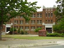 Dunbar Junior and Senior High School and Junior College |
August 6, 1980 (#80000782) |
1100 Wright Ave. 34°43′57″N 92°17′10″W |
|
| 55 | Paul Laurence Dunbar School Neighborhood Historic District | 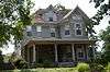 Paul Laurence Dunbar School Neighborhood Historic District |
September 27, 2013 (#13000789) |
Roughly bounded by Wright Ave., S. Chester, S. Ringo & W. 24th Sts. 34°43′44″N 92°17′07″W |
Historically Black Properties in Little Rock's Dunbar School Neighborhood MPS |
| 56 | East Markham Street Historic District | 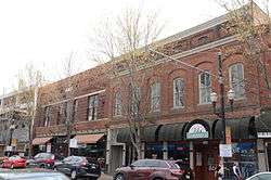 East Markham Street Historic District |
May 5, 1999 (#99000522) |
301-303, 305-307, 313, and 323 East Markham St. 34°44′50″N 92°16′03″W |
|
| 57 | Empire Life Insurance Company of America Building | May 30, 2019 (#100004002) |
2801 W. Roosevelt Rd. 34°43′31″N 92°18′21″W |
||
| 58 | England House | 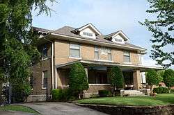 England House |
December 22, 1982 (#82000886) |
2121 Arch St. 34°43′41″N 92°16′46″W |
|
| 59 | Esso Standard Oil Service Station | 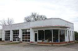 Esso Standard Oil Service Station |
January 8, 2016 (#15000287) |
1600 W. 3rd St. 34°44′55″N 92°17′21″W |
|
| 60 | Exchange Bank Building | 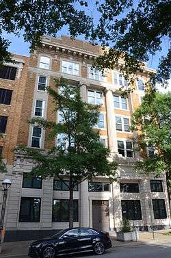 Exchange Bank Building |
October 23, 1986 (#86002896) |
423 Main St. 34°44′45″N 92°16′15″W |
|
| 61 | Farrell House | 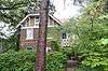 Farrell House |
December 22, 1982 (#82000889) |
2121 Louisiana 34°43′40″N 92°16′29″W |
|
| 62 | Farrell House | 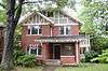 Farrell House |
December 22, 1982 (#82000888) |
2115 Louisiana 34°43′41″N 92°16′28″W |
|
| 63 | Farrell House |  Farrell House |
December 22, 1982 (#82000887) |
2111 Louisiana 34°43′42″N 92°16′29″W |
|
| 64 | Farrell House |  Farrell House |
October 11, 1984 (#84000103) |
2109 Louisiana 34°43′41″N 92°16′28″W |
|
| 65 | Federal Building |  Federal Building |
May 5, 2015 (#15000206) |
700 W. Capitol Ave. 34°44′43″N 92°16′44″W |
|
| 66 | Federal Reserve Bank Building | 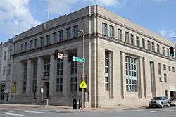 Federal Reserve Bank Building |
October 23, 1986 (#86002895) |
123 W. 3rd St. 34°44′45″N 92°16′15″W |
|
| 67 | First Baptist Church | 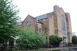 First Baptist Church |
August 9, 1994 (#94000823) |
Southwestern corner of the junction of 12th and Louisiana Sts. 34°44′14″N 92°16′26″W |
|
| 68 | First Church of Christ, Scientist | 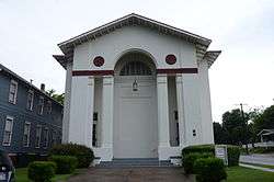 First Church of Christ, Scientist |
October 4, 1984 (#84000008) |
20th and Louisiana Sts. 34°43′46″N 92°16′30″W |
|
| 69 | First Hotze House | 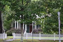 First Hotze House |
September 20, 2006 (#06000828) |
1620 S. Main St. 34°44′04″N 92°16′26″W |
|
| 70 | First Missionary Baptist Church | 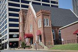 First Missionary Baptist Church |
September 29, 1983 (#83001164) |
701 S. Gaines St. 34°44′35″N 92°16′41″W |
|
| 71 | First Presbyterian Church |  First Presbyterian Church |
November 13, 1986 (#86003124) |
123 E. 8th St. 34°44′26″N 92°16′15″W |
|
| 72 | First United Methodist Church |  First United Methodist Church |
October 9, 1986 (#86002845) |
723 Center St. 34°44′30″N 92°16′25″W |
|
| 73 | Fletcher House |  Fletcher House |
December 22, 1982 (#82000890) |
909 Cumberland St. 34°44′21″N 92°16′08″W |
|
| 74 | Florence Crittenton Home |  Florence Crittenton Home |
December 22, 1982 (#82000891) |
3600 W. 11th St. 34°44′30″N 92°18′53″W |
|
| 75 | Fones House | 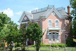 Fones House |
August 19, 1975 (#75000406) |
902 W. 2nd St. 34°44′55″N 92°16′48″W |
|
| 76 | Fordyce House |  Fordyce House |
August 6, 1975 (#75000407) |
2115 S. Broadway 34°43′40″N 92°16′41″W |
|
| 77 | Absalom Fowler House |  Absalom Fowler House |
June 4, 1973 (#73000387) |
502 E. 7th St. 34°44′30″N 92°16′41″W |
|
| 78 | Joseph M. Frank House |  Joseph M. Frank House |
October 3, 1985 (#85002716) |
912 W. 4th 34°45′02″N 92°16′41″W |
|
| 79 | Frauenthal House |  Frauenthal House |
December 22, 1982 (#82000895) |
2008 Arch St. 34°43′45″N 92°16′48″W |
|
| 80 | French-England House |  French-England House |
December 22, 1982 (#82000896) |
1700 Broadway 34°43′58″N 92°16′42″W |
|
| 81 | Fulk Building |  Fulk Building |
November 13, 1986 (#86003121) |
300 Main St. 34°44′45″N 92°16′16″W |
|
| 82 | Fulk-Arkansas Democrat Building | May 18, 2018 (#100002456) |
613-615 Main St. 34°44′34″N 92°16′17″W |
||
| 83 | Solomon Gans House |  Solomon Gans House |
March 29, 1984 (#84000905) |
1010 W. 3rd St. 34°44′52″N 92°16′54″W |
|
| 84 | Garland Elementary School | October 16, 2018 (#100003015) |
3615 W 25th St. 34°43′43″N 92°18′52″W |
||
| 85 | Augustus Garland House | 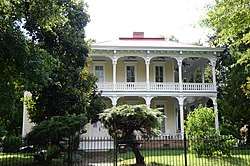 Augustus Garland House |
June 10, 1975 (#75000408) |
1404 Scott St. 34°44′05″N 92°16′19″W |
|
| 86 | Gay Oil Company Building | Gay Oil Company Building |
June 5, 2017 (#100001011) |
300 S. Broadway St. 34°44′48″N 92°16′32″W |
|
| 87 | Gazette Building | 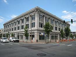 Gazette Building |
October 22, 1976 (#76002239) |
112 W. 3rd St. 34°44′47″N 92°16′18″W |
|
| 88 | Governor's Mansion Historic District | 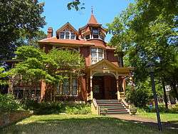 Governor's Mansion Historic District |
September 13, 1978 (#78000620) |
Bounded by the mansion grounds and 13th, Center, Gaines, and 18th Sts.; also roughly bounded by Louisiana St., 23rd St., Roosevelt Rd., Chester and State Sts., and 13th and 12th Sts.; also roughly along Louisiana Ave. from W. 23rd St. and 24th St. 34°44′02″N 92°16′39″W |
Second and third sets of boundaries represent boundary increases of May 19, 1988 and February 15, 2002 |
| 89 | Thomas Gray House | September 18, 2018 (#100002955) |
25 River Valley Rd. 34°47′26″N 92°22′56″W |
||
| 90 | Green House |  Green House |
May 28, 1999 (#99000544) |
1224 W. 21st St. 34°43′45″N 92°17′16″W |
|
| 91 | Hall House |  Hall House |
December 22, 1982 (#82000897) |
32 Edgehill 34°46′04″N 92°19′04″W |
|
| 92 | Halliburton Townhouses |  Halliburton Townhouses |
December 12, 1976 (#76000455) |
1601 and 1605 Center St. 34°44′01″N 92°16′31″W |
|
| 93 | Hanger Hill Historic District |  Hanger Hill Historic District |
January 30, 2008 (#07001466) |
1500 block of Welch St. 34°43′57″N 92°15′33″W |
|
| 94 | Frederick Hanger House |  Frederick Hanger House |
March 15, 1974 (#74000496) |
1010 Scott St. 34°44′18″N 92°16′30″W |
|
| 95 | Hardy House |  Hardy House |
December 22, 1982 (#82000898) |
2400 Broadway 34°43′31″N 92°16′44″W |
|
| 96 | Harris House |  Harris House |
June 3, 1998 (#98000644) |
6507 Fourche Dam Pike 34°43′16″N 92°11′52″W |
|
| 97 | Healey and Roth Mortuary Building |  Healey and Roth Mortuary Building |
December 22, 1982 (#82000899) |
815 Main 34°44′26″N 92°16′17″W |
|
| 98 | Hemingway House |  Hemingway House |
December 22, 1982 (#82000900) |
1720 Arch St. 34°43′57″N 92°16′46″W |
|
| 99 | Henderson House | 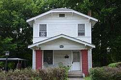 Henderson House |
May 28, 1999 (#99000548) |
1510 S. Ringo St. 34°44′08″N 92°17′02″W |
|
| 100 | Herschell-Spillman Carousel | 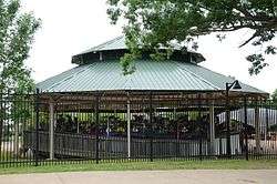 Herschell-Spillman Carousel |
December 1, 1989 (#89002065) |
War Memorial Park midway 34°44′54″N 92°19′48″W |
|
| 101 | Hillcrest Historic District | 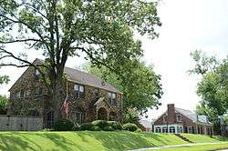 Hillcrest Historic District |
December 18, 1990 (#90001920) |
Bounded by Woodrow, Jackson, and Markham Sts. and N. Lookout Rd.; also roughly bounded by Evergreen, Harrison, Lee, and Jackson Sts. 34°45′23″N 92°19′03″W |
Second set of boundaries represents a boundary increase of October 8, 1992 |
| 102 | Holcomb Court Apartments | 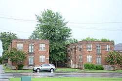 Holcomb Court Apartments |
April 7, 1995 (#95000377) |
2201 Main St. 34°43′39″N 92°16′24″W |
|
| 103 | Isaac Homard House |  Isaac Homard House |
March 27, 2017 (#100000777) |
1217 W. 3rd St. 34°44′53″N 92°17′04″W |
|
| 104 | Hornibrook House |  Hornibrook House |
July 30, 1974 (#74000497) |
2120 S. Louisiana St. 34°43′40″N 92°16′30″W |
|
| 105 | Hotel Freiderica |  Hotel Freiderica |
September 27, 2003 (#03000951) |
625 W. Capitol Ave. 34°44′41″N 92°16′40″W |
|
| 106 | Hotze House |  Hotze House |
August 11, 1975 (#75000409) |
1619 Louisiana St. 34°43′58″N 92°16′27″W |
|
| 107 | Johnson House |  Johnson House |
December 22, 1982 (#82000902) |
514 E. 8th St. 34°44′26″N 92°15′58″W |
|
| 108 | Johnson House |  Johnson House |
December 22, 1982 (#82000903) |
516 E. 8th St. 34°44′26″N 92°15′57″W |
|
| 109 | Johnson House |  Johnson House |
December 22, 1982 (#82000904) |
518 E. 8th St. 34°44′26″N 92°15′56″W |
|
| 110 | Johnswood |  Johnswood |
May 20, 1994 (#94000495) |
10314 Cantrell Rd. 34°47′17″N 92°23′16″W |
|
| 111 | Scipio A. Jones House | 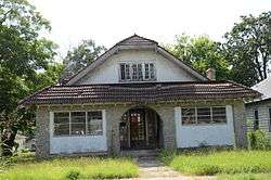 Scipio A. Jones House |
May 28, 1999 (#99000545) |
1872 S. Cross St. 34°43′52″N 92°17′13″W |
|
| 112 | Kahn-Jennings House | 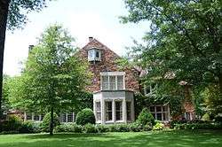 Kahn-Jennings House |
September 8, 1992 (#92001223) |
5300 Sherwood St. 34°45′54″N 92°19′56″W |
|
| 113 | Keith House | 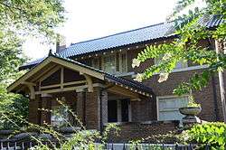 Keith House |
December 22, 1982 (#82000905) |
2200 Broadway 34°43′38″N 92°16′43″W |
|
| 114 | Gustave B. Kleinschmidt House | June 7, 2016 (#16000319) |
621 E. 16th St. 34°43′57″N 92°15′59″W |
||
| 115 | Werner Knoop House | 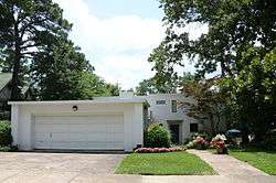 Werner Knoop House |
August 3, 1990 (#90001147) |
6 Ozark Point 34°45′20″N 92°18′18″W |
|
| 116 | LaFayette Hotel | 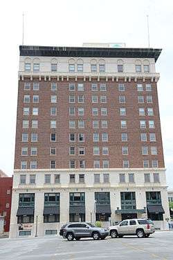 LaFayette Hotel |
September 30, 1982 (#82002128) |
525 S. Louisiana St. 34°44′36″N 92°16′20″W |
|
| 117 | Lake Nixon | June 5, 2017 (#100001013) |
18500 Cooper Orbit Rd. 34°43′05″N 92°26′02″W |
||
| 118 | Lamb-McSwain House |  Lamb-McSwain House |
June 4, 1998 (#98000621) |
2124 Rice St. 34°43′45″N 92°18′03″W |
|
| 119 | Robert E. Lee School |  Robert E. Lee School |
June 2, 2009 (#09000370) |
3805 W. 12th St. 34°44′24″N 92°18′58″W |
|
| 120 | Leiper-Scott House |  Leiper-Scott House |
May 1, 1980 (#80000783) |
312 S. Pulaski St. 34°44′51″N 92°17′06″W |
|
| 121 | Lincoln Avenue Viaduct | 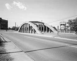 Lincoln Avenue Viaduct |
April 9, 1990 (#90000731) |
Highway 10, over a Missouri Pacific railroad line 34°45′09″N 92°16′59″W |
|
| 122 | Lincoln Building | 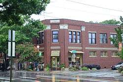 Lincoln Building |
August 5, 1994 (#94000826) |
1423-1425 S. Main St. 34°44′04″N 92°16′21″W |
|
| 123 | Little Rock Boys Club | 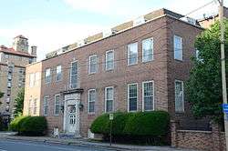 Little Rock Boys Club |
December 22, 1982 (#82000906) |
8th and Scott Sts. 34°44′26″N 92°16′12″W |
|
| 124 | Little Rock Central Fire Station | 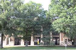 Little Rock Central Fire Station |
October 18, 1979 (#79000451) |
520 W. Markham St. 34°44′57″N 92°16′32″W |
|
| 125 | Little Rock High School | 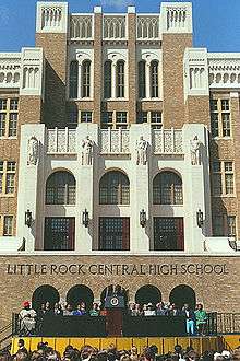 Little Rock High School |
August 19, 1977 (#77000268) |
14th and Park Sts. 34°44′12″N 92°17′55″W |
|
| 126 | Little Rock Central High School National Historic Site | 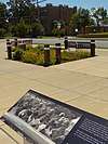 Little Rock Central High School National Historic Site |
November 6, 1998 (#01000274) |
2125 Daisy L. Gatson Dr. 34°44′12″N 92°17′55″W |
|
| 127 | Little Rock City Hall |  Little Rock City Hall |
October 18, 1979 (#79000452) |
500 W. Markham St. 34°44′57″N 92°16′31″W |
|
| 128 | Little Rock Confederate Memorial | 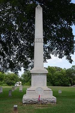 Little Rock Confederate Memorial |
May 3, 1996 (#96000499) |
Little Rock National Cemetery at the junction of 21st and Barber Sts. 34°43′39″N 92°15′40″W |
|
| 129 | Little Rock National Cemetery | 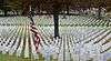 Little Rock National Cemetery |
December 20, 1996 (#96001496) |
2523 Confederate Boulevard 34°43′30″N 92°15′33″W |
|
| 130 | Little Rock US Post Office and Courthouse |  Little Rock US Post Office and Courthouse |
December 23, 1999 (#99001540) |
600 W. Capitol Ave. 34°44′43″N 92°15′59″W |
|
| 131 | Little Rock Y.M.C.A. |  Little Rock Y.M.C.A. |
July 22, 1979 (#79000456) |
524 Broadway St. 34°44′39″N 92°16′33″W |
|
| 132 | The Little Rock | 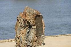 The Little Rock |
October 6, 1970 (#70000124) |
On the southern bank of the Arkansas River at the foot of Rock St. 34°41′11″N 92°23′38″W |
|
| 133 | Luxor Apartments |  Luxor Apartments |
April 7, 1995 (#95000375) |
1923 Main St. 34°43′47″N 92°16′24″W |
|
| 134 | MacArthur Park Historic District |  MacArthur Park Historic District |
July 25, 1977 (#77000269) |
Roughly bounded by Ferry, McGowan, McAlmont, 16th, Bragg, 15th, Scott, 9th, Cumberland, and 5th Sts. 34°44′16″N 92°15′59″W |
|
| 135 | Magnolia Service Station | September 27, 2019 (#100004434) |
3023 W. 7th St. 34°44′43″N 92°18′27″W |
||
| 136 | Main Building, Arkansas Baptist College |  Main Building, Arkansas Baptist College |
April 30, 1976 (#76000457) |
1600 High St. 34°44′06″N 92°17′24″W |
|
| 137 | Main Street Commercial District |  Main Street Commercial District |
June 25, 2010 (#10000396) |
The 300 block of Main St. bounded by East 3rd St. on the north and East 4th St. on the south 34°44′44″N 92°16′15″W |
|
| 138 | George R. Mann Building | 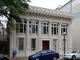 George R. Mann Building |
December 29, 1983 (#83003547) |
115 E. 5th St. 34°44′37″N 92°16′12″W |
|
| 139 | Angelo Marre House | 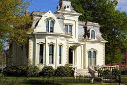 Angelo Marre House |
June 15, 1970 (#70000128) |
1321 Scott St. 34°44′02″N 92°16′04″W |
|
| 140 | Marshall House | 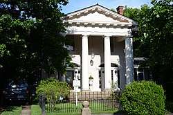 Marshall House |
December 22, 1982 (#82000907) |
2009 Arch St. 34°43′45″N 92°16′46″W |
|
| 141 | Marshall Square Historic District | 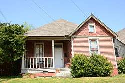 Marshall Square Historic District |
August 10, 1979 (#79000453) |
Bounded by 17th, McAlmont, 18th, and Vance Sts. 34°43′52″N 92°15′50″W |
|
| 142 | Martin Cemetery Historic Section | December 13, 2017 (#100001014) |
10900 I-30 Frontage Rd. 34°39′52″N 92°23′52″W |
||
| 143 | Mary H. Lustron Matthews House |  Mary H. Lustron Matthews House |
May 23, 2014 (#14000249) |
5021 Maryland Ave. 34°44′38″N 92°19′50″W |
|
| 144 | Matthews-Storey House |  Matthews-Storey House |
September 28, 2015 (#15000632) |
8115 Ascension Rd. 34°42′27″N 92°22′01″W |
|
| 145 | Maxwell F. Mayer House |  Maxwell F. Mayer House |
December 9, 1994 (#94001464) |
2016 Battery St. 34°43′47″N 92°17′39″W |
|
| 146 | McDonald-Wait-Newton House |  McDonald-Wait-Newton House |
July 14, 1978 (#78000622) |
1406 Cantrell Rd. 34°45′12″N 92°17′06″W |
|
| 147 | Thomas R. McGuire House |  Thomas R. McGuire House |
December 19, 1991 (#91001858) |
114 Rice St. 34°45′00″N 92°17′59″W |
|
| 148 | McLean House |  McLean House |
December 22, 1982 (#82000908) |
470 Ridgeway 34°45′14″N 92°18′43″W |
|
| 149 | Mehaffey House |  Mehaffey House |
December 22, 1982 (#82000909) |
2101 Louisiana 34°43′42″N 92°16′30″W |
|
| 150 | Memorial to Company A, Capitol Guards | 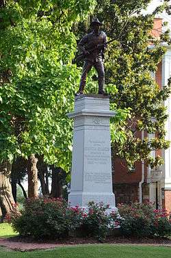 Memorial to Company A, Capitol Guards |
April 26, 1996 (#96000451) |
MacArthur Park, roughly bounded by 9th and 17th Sts. between Rock St. and I-30 34°44′18″N 92°15′54″W |
|
| 151 | Miller House | 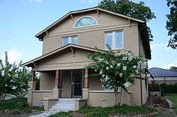 Miller House |
May 28, 1999 (#99000547) |
1853 S. Ringo St. 34°43′54″N 92°17′07″W |
|
| 152 | Mims-Breedlove-Priest-Weatherton House |  Mims-Breedlove-Priest-Weatherton House |
November 23, 1998 (#98001432) |
2108 Beechwood Ave. 34°46′21″N 92°19′28″W |
|
| 153 | Minnesota Monument | 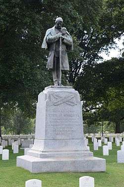 Minnesota Monument |
May 3, 1996 (#96000498) |
2523 Confederate Boulevard 34°43′28″N 92°15′25″W |
|
| 154 | Mitchell House |  Mitchell House |
December 22, 1982 (#82000910) |
1415 Spring St. 34°44′06″N 92°16′34″W |
|
| 155 | James Mitchell School |  James Mitchell School |
May 20, 2009 (#09000322) |
2410 S. Battery St. 34°43′33″N 92°17′41″W |
|
| 156 | Monument to Confederate Women | .JPG) Monument to Confederate Women |
April 26, 1996 (#96000452) |
State capitol grounds at the junction of W. 7th and Marshall Sts. 34°44′45″N 92°17′20″W |
|
| 157 | Moore Building |  Moore Building |
October 23, 1986 (#86002894) |
519-523 Center St. 34°44′37″N 92°16′27″W |
|
| 158 | Moore House |  Moore House |
December 22, 1982 (#82000911) |
20 Armistead 34°46′00″N 92°19′23″W |
|
| 159 | Mopac Station |  Mopac Station |
June 17, 1977 (#77000270) |
Markham and Victory St. 34°45′01″N 92°17′09″W |
|
| 160 | Mosaic Templars State Temple |  Mosaic Templars State Temple |
May 18, 2018 (#100002457) |
906 S Broadway St. 34°44′27″N 92°16′36″W |
|
| 161 | Mount Holly Cemetery | 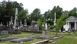 Mount Holly Cemetery |
March 5, 1970 (#70000125) |
12th St. and Broadway 34°44′17″N 92°16′42″W |
|
| 162 | Mount Holly Mausoleum | 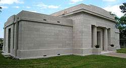 Mount Holly Mausoleum |
December 22, 1982 (#82000912) |
12th St. and Broadway 34°44′17″N 92°16′42″W |
|
| 163 | Mount Zion Baptist Church | 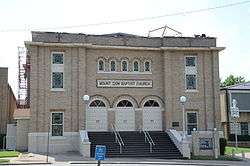 Mount Zion Baptist Church |
March 27, 1987 (#86003230) |
900 Cross St. 34°44′30″N 92°17′07″W |
|
| 164 | Nash House |  Nash House |
December 22, 1982 (#82000913) |
409 E. 6th St. 34°44′32″N 92°16′02″W |
|
| 165 | Nash House |  Nash House |
December 22, 1982 (#82000914) |
601 Rock St. 34°44′32″N 92°16′02″W |
|
| 166 | National Old Line Insurance Company Building | May 29, 2019 (#100003985) |
501 Woodlane St. 34°44′45″N 92°17′16″W |
||
| 167 | Oakland-Fraternal Cemetery |  Oakland-Fraternal Cemetery |
April 20, 2010 (#09001258) |
2101 Barber St. 34°43′43″N 92°15′40″W |
|
| 168 | Old Post Office Building and Customhouse |  Old Post Office Building and Customhouse |
May 7, 1973 (#73000388) |
2nd and Spring Sts. 34°44′52″N 92°16′24″W |
|
| 169 | Old State House | .jpg) Old State House |
December 3, 1969 (#69000037) |
300 W. Markham St. 34°44′56″N 92°16′19″W |
|
| 170 | Parnell Hall |  Parnell Hall |
January 24, 2008 (#07001431) |
2400 W. Markham 34°45′13″N 92°17′55″W |
|
| 171 | Fred W. Parris Towers | March 7, 2017 (#100000707) |
1800 S. Broadway St. 34°43′53″N 92°16′43″W |
||
| 172 | Pearson-Robinson House |  Pearson-Robinson House |
July 24, 1978 (#78000623) |
1900 Marshall St. 34°43′54″N 92°17′30″W |
|
| 173 | Peoples Building & Loan Building |  Peoples Building & Loan Building |
September 2, 1982 (#82002129) |
213-217 W. 2nd St. 34°45′08″N 92°16′42″W |
|
| 174 | Pfeifer Brothers Department Store |  Pfeifer Brothers Department Store |
May 18, 2000 (#00000464) |
522-524 S. Main St. 34°44′34″N 92°16′16″W |
|
| 175 | Philander Smith College Historic District |  Philander Smith College Historic District |
September 13, 1999 (#99000229) |
Roughly bounded by 13th, 11th, Izard, and State Sts. 34°44′24″N 92°16′55″W |
|
| 176 | Albert Pike Hotel |  Albert Pike Hotel |
November 21, 1978 (#78000625) |
7th and Scott Sts. 34°44′30″N 92°16′11″W |
|
| 177 | Pike-Fletcher-Terry House |  Pike-Fletcher-Terry House |
August 21, 1972 (#72000208) |
411 E. 7th St. 34°44′28″N 92°15′53″W |
|
| 178 | Lamar Porter Athletic Field |  Lamar Porter Athletic Field |
December 6, 1990 (#90001827) |
Junction of Johnson and 7th Sts. 34°44′45″N 92°18′29″W |
|
| 179 | Jesse Powell Towers | March 7, 2017 (#100000708) |
1010 Wolfe St. 34°44′28″N 92°17′34″W |
||
| 180 | Prospect Terrace Apartments | 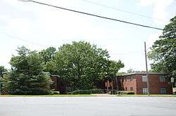 Prospect Terrace Apartments |
September 12, 2002 (#02001043) |
3603 Kavanaugh Boulevard 34°45′43″N 92°19′53″W |
|
| 181 | Pulaski County Courthouse | 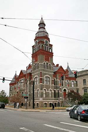 Pulaski County Courthouse |
October 18, 1979 (#79000454) |
405 W. Markham St. 34°44′57″N 92°16′32″W |
|
| 182 | Ragland House | 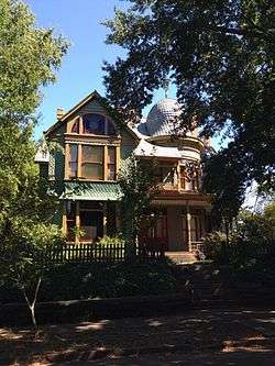 Ragland House |
June 17, 1977 (#77000271) |
1617 Center St. 34°43′59″N 92°16′31″W |
|
| 183 | Railroad Call Historic District |  Railroad Call Historic District |
July 9, 1997 (#97000749) |
108, 112, and 114 S. Pulaski St. 34°44′59″N 92°17′48″W |
|
| 184 | Reichardt House |  Reichardt House |
May 2, 1975 (#75000410) |
1201 Welch St. 34°44′09″N 92°15′34″W |
|
| 185 | Reid House |  Reid House |
December 22, 1982 (#82000916) |
1425 Kavanaugh St. 34°45′17″N 92°18′30″W |
|
| 186 | Remmel Apartments |  Remmel Apartments |
December 22, 1982 (#82000919) |
1704-1706 Spring St. 34°43′57″N 92°16′38″W |
|
| 187 | Remmel Apartments |  Remmel Apartments |
December 22, 1982 (#82000918) |
1708-1710 Spring St. 34°43′56″N 92°16′37″W |
|
| 188 | Remmel Apartments |  Remmel Apartments |
December 22, 1982 (#82000917) |
409-411 W. 17th St. 34°43′58″N 92°16′40″W |
|
| 189 | Remmel Flats |  Remmel Flats |
December 22, 1982 (#82000920) |
1700-1702 Spring St. 34°43′58″N 92°16′37″W |
|
| 190 | Retan House |  Retan House |
December 22, 1982 (#82000921) |
2510 Broadway 34°43′26″N 92°16′44″W |
|
| 191 | Albert Retan House |  Albert Retan House |
December 3, 1980 (#80000784) |
506 N. Elm St. 34°45′18″N 92°19′07″W |
|
| 192 | Joseph Taylor Robinson House |  Joseph Taylor Robinson House |
August 28, 1975 (#75000411) |
2122 Broadway 34°43′40″N 92°16′44″W |
Home of Arkansas governor and U.S. Senator Joseph Taylor Robinson during 1930-1937, the period of his greatest influence |
| 193 | Joseph Taylor Robinson Memorial Auditorium |  Joseph Taylor Robinson Memorial Auditorium |
February 21, 2007 (#07000056) |
414 W. Markham 34°44′57″N 92°16′28″W |
|
| 194 | Rogers House |  Rogers House |
December 22, 1982 (#82000922) |
400 W. 18th St. 34°43′56″N 92°16′40″W |
|
| 195 | Rose Building |  Rose Building |
November 13, 1986 (#86003119) |
307 Main St. 34°44′43″N 92°16′13″W |
|
| 196 | U.M. Rose School | U.M. Rose School |
December 8, 1988 (#88002820) |
Izard and W. 13th St. 34°44′16″N 92°16′54″W |
|
| 197 | Roselawn Memorial Park Gatehouse | 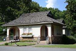 Roselawn Memorial Park Gatehouse |
December 22, 1982 (#82000923) |
2801 Asher 34°43′51″N 92°18′16″W |
|
| 198 | Ross Building | January 24, 2019 (#100003334) |
700 S. Schiller St. 34°44′41″N 92°17′46″W |
||
| 199 | J.P. Runyan House | 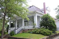 J.P. Runyan House |
August 18, 1992 (#92001067) |
1514 S. Schiller 34°44′09″N 92°17′48″W |
|
| 200 | Safferstone House | 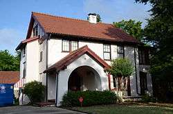 Safferstone House |
December 22, 1982 (#82000925) |
2205 Arch St. 34°43′38″N 92°16′46″W |
|
| 201 | Saint Andrews Catholic Cathedral | 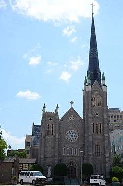 Saint Andrews Catholic Cathedral |
November 13, 1986 (#86003117) |
617 Louisiana St. 34°44′33″N 92°16′19″W |
|
| 202 | St. Edwards Church | 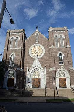 St. Edwards Church |
December 22, 1982 (#82000929) |
823 Sherman 34°44′23″N 92°15′54″W |
|
| 203 | St. Peter's Rock Baptist Church | 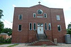 St. Peter's Rock Baptist Church |
January 20, 2005 (#04001492) |
1401 W. 18th St. 34°44′06″N 92°17′19″W |
|
| 204 | Sanders House | 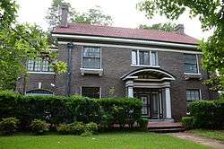 Sanders House |
December 22, 1982 (#82000924) |
2100 Gaines St. 34°43′42″N 92°16′52″W |
|
| 205 | Schaer House | 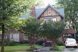 Schaer House |
December 22, 1982 (#82000926) |
1862 Arch St. 34°43′51″N 92°16′47″W |
|
| 206 | Shiloh Missionary Baptist Church | March 24, 2020 (#100004893) |
1200 Hanger St. 34°44′11″N 92°15′26″W |
||
| 207 | Dr. Morgan Smith House |  Dr. Morgan Smith House |
May 20, 2009 (#09000323) |
5110 Stagecoach Rd. 34°42′05″N 92°23′04″W |
|
| 208 | Snyder House |  Snyder House |
December 22, 1982 (#82000928) |
4004 S. Lookout 34°45′49″N 92°19′05″W |
|
| 209 | South Main Street Apartments Historic District |  South Main Street Apartments Historic District |
April 7, 1995 (#95000378) |
2209-2213 Main St. 34°43′37″N 92°16′24″W |
|
| 210 | South Main Street Commercial Historic District |  South Main Street Commercial Historic District |
August 31, 2007 (#07000435) |
S. Main St. from 12th St. to 17th St. 34°44′05″N 92°16′23″W |
|
| 211 | South Main Street Residential Historic District |  South Main Street Residential Historic District |
July 12, 2007 (#07000436) |
S. Main St. from 19th St. to 24th St.; also 2006-2008, and 2014 S. Scott, and 114, 116, and 118 E. 21st Sts. 34°43′41″N 92°16′26″W |
Second set of boundaries represents a boundary increase of October 17, 2012 |
| 212 | South Scott Street Historic District |  South Scott Street Historic District |
November 12, 1999 (#99001297) |
Roughly bounded by E. 24th, S. Scott, E. 25th, and South Main Sts. 34°43′55″N 92°16′22″W |
|
| 213 | Southern Trust Building |  Southern Trust Building |
September 26, 2013 (#13000790) |
221 W. 2nd St. 34°44′50″N 92°16′20″W |
|
| 214 | Stebbins and Roberts Office Building and Factory |  Stebbins and Roberts Office Building and Factory |
October 4, 2016 (#16000682) |
1300 E. 6th St. 34°44′31″N 92°15′21″W |
|
| 215 | Stewart House |  Stewart House |
December 22, 1982 (#82000930) |
1406 Summit St. 34°44′13″N 92°17′43″W |
|
| 216 | Stifft Station Historic District |  Stifft Station Historic District |
October 18, 2006 (#06000941) |
Bounded by W. Markham, W. 7th, Woodrow, and Martin Sts. 34°45′00″N 92°18′29″W |
|
| 217 | Dan Stowers Office Building |  Dan Stowers Office Building |
September 28, 2015 (#15000633) |
1516 W. 3rd St. 34°44′55″N 92°17′18″W |
|
| 218 | Taborian Hall |  Taborian Hall |
April 29, 1982 (#82002130) |
9th and State Sts. 34°44′30″N 92°16′48″W |
|
| 219 | The Tavern | 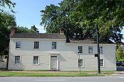 The Tavern |
March 5, 1970 (#70000126) |
214 E. 3rd St. 34°44′47″N 92°15′56″W |
|
| 220 | Taylor Building | 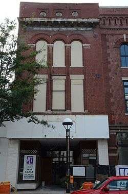 Taylor Building |
November 13, 1986 (#86003123) |
304 Main St. 34°44′45″N 92°16′16″W |
|
| 221 | Samuel P. Taylor Service Station |  Samuel P. Taylor Service Station |
November 29, 2000 (#00001364) |
1123 W. 3rd St. 34°44′51″N 92°17′01″W |
|
| 222 | Ten Mile House | 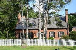 Ten Mile House |
June 22, 1970 (#70000129) |
6915 Stagecoach Road (Highway 5), Mabelvale 34°41′12″N 92°23′52″W |
|
| 223 | Terminal Hotel |  Terminal Hotel |
November 17, 1978 (#78003200) |
Victory and Markham Sts. 34°45′00″N 92°17′08″W |
|
| 224 | Terminal Warehouse Building |  Terminal Warehouse Building |
April 29, 1982 (#82002131) |
500 E. Markham St. 34°44′51″N 92°15′53″W |
|
| 225 | William L. Terry House |  William L. Terry House |
January 1, 1976 (#76000459) |
1422 Scott St. 34°44′05″N 92°16′23″W |
|
| 226 | Ada Thompson Memorial Home |  Ada Thompson Memorial Home |
August 3, 1977 (#77000272) |
2021 S. Main 34°43′44″N 92°16′24″W |
|
| 227 | Thornton House |  Thornton House |
May 28, 1999 (#99000543) |
1420 W. 15th St. 34°44′12″N 92°17′20″W |
|
| 228 | Thurston House |  Thurston House |
December 22, 1982 (#82000931) |
923 Cumberland St. 34°44′20″N 92°16′08″W |
|
| 229 | Dr. Eugene Towbin House | January 24, 2019 (#100003336) |
16 Broadview Dr. 34°45′57″N 92°20′56″W |
||
| 230 | Tower Building | .JPG) Tower Building |
September 23, 2011 (#11000692) |
323 Center St. 34°44′44″N 92°16′24″W |
|
| 231 | Trapnall Hall |  Trapnall Hall |
April 13, 1973 (#73000389) |
423 E. Capitol Ave. 34°44′35″N 92°15′59″W |
|
| 232 | Trinity Episcopal Cathedral |  Trinity Episcopal Cathedral |
May 13, 1976 (#76000460) |
310 W. 17th St. 34°43′59″N 92°16′35″W |
|
| 233 | Trinity Hospital |  Trinity Hospital |
November 18, 1998 (#98001481) |
Junction of Main and 20th Sts. 34°43′46″N 92°16′26″W |
|
| 234 | Tuf Nut Historic Commercial District |  Tuf Nut Historic Commercial District |
March 27, 2003 (#99000856) |
300-312 S. Rock St. and 423 E. 3rd St 34°44′42″N 92°15′58″W |
|
| 235 | Turner House |  Turner House |
December 22, 1982 (#82000932) |
1701 Center St. 34°43′56″N 92°16′31″W |
|
| 236 | Turner-Ledbetter House |  Turner-Ledbetter House |
June 18, 1987 (#87000978) |
1700 S. Louisiana St. 34°43′57″N 92°16′29″W |
|
| 237 | U.S. Arsenal Building | 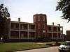 U.S. Arsenal Building |
July 28, 1970 (#70000127) |
MacArthur Park, 9th, and Commerce Sts. 34°44′18″N 92°15′45″W |
|
| 238 | Union Life Building | 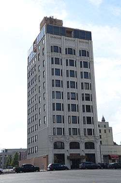 Union Life Building |
September 25, 1981 (#81000141) |
212 Center St. 34°44′49″N 92°16′23″W |
|
| 239 | Van Frank Cottages | 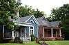 Van Frank Cottages |
October 21, 1985 (#85003476) |
515-519 E. 15th St. and 1510 Park Ln. 34°44′00″N 92°16′02″W |
|
| 240 | Vanetten House | 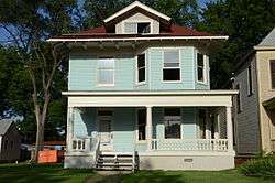 Vanetten House |
December 22, 1982 (#82000933) |
1012 Cumberland 34°44′18″N 92°16′11″W |
|
| 241 | Vaughan House | 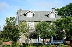 Vaughan House |
December 22, 1982 (#82000934) |
2201 Broadway 34°43′36″N 92°16′41″W |
|
| 242 | Vaughn House | 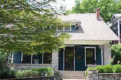 Vaughn House |
February 18, 1999 (#99000226) |
104 Rosetta 34°44′59″N 92°18′31″W |
|
| 243 | Vinson House | 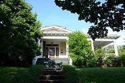 Vinson House |
May 6, 1976 (#76000461) |
2123 Broadway 34°43′39″N 92°16′42″W |
|
| 244 | Wallace Building | 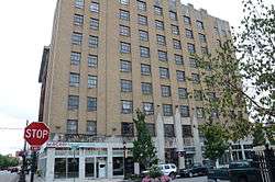 Wallace Building |
February 18, 1999 (#99000223) |
101-111 Main St. 34°44′52″N 92°16′12″W |
|
| 245 | Zeb Ward Building | 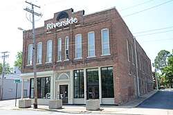 Zeb Ward Building |
April 19, 1978 (#78000626) |
1001-1003 W. Markham St. 34°44′57″N 92°16′52″W |
|
| 246 | Ward-Hays House | 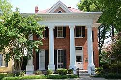 Ward-Hays House |
August 11, 1975 (#75000412) |
1008 W. 2nd St. 34°44′56″N 92°16′54″W |
|
| 247 | Corydon Wassell House | 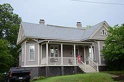 Corydon Wassell House |
June 2, 2000 (#00000611) |
2005 S. Scott St. 34°43′45″N 92°16′20″W |
|
| 248 | Charles Clary Waters House | 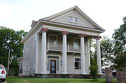 Charles Clary Waters House |
August 10, 1979 (#79000455) |
2004 W. 22nd St. 34°43′42″N 92°17′37″W |
|
| 249 | West 7th Street Historic District |  West 7th Street Historic District |
January 21, 2009 (#08001341) |
Portions of the 800-1100 blocks of W. 7th St. 34°44′37″N 92°16′56″W |
|
| 250 | White-Baucum House |  White-Baucum House |
February 29, 1980 (#80000785) |
201 S. Izard St. 34°44′53″N 92°16′46″W |
|
| 251 | Williamson House |  Williamson House |
November 15, 1984 (#84000238) |
325 Fairfax St. 34°45′11″N 92°18′28″W |
|
| 252 | Winchester Auto Store | January 24, 2019 (#100003337) |
323 W. 8th St. 34°44′30″N 92°16′30″W |
||
| 253 | Winfield Methodist Church |  Winfield Methodist Church |
December 22, 1982 (#82000935) |
1601 Louisiana 34°43′59″N 92°16′26″W |
|
| 254 | Womack House | 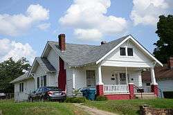 Womack House |
May 28, 1999 (#99000546) |
1867 S. Ringo St. 34°43′52″N 92°17′07″W |
|
| 255 | William Woodruff House | 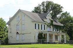 William Woodruff House |
March 21, 1989 (#89000173) |
1017 E. 8th St. 34°44′24″N 92°15′32″W |
|
| 256 | Worthen Bank Building | 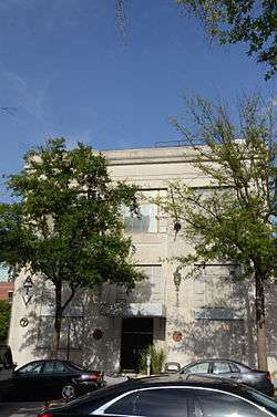 Worthen Bank Building |
November 13, 1986 (#86003125) |
401 Main St. 34°44′41″N 92°16′13″W |
|
| 257 | YMCA-Democrat Building | 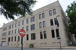 YMCA-Democrat Building |
June 11, 1992 (#87001544) |
E. Capitol and Scott Sts. 34°44′37″N 92°16′12″W |
Former listings
| [3] | Name on the Register | Image | Date listed | Date removed | Location | Summary |
|---|---|---|---|---|---|---|
| 1 | Al-Amin Temple | December 22, 1982 (#82000873) | June 3, 1986 | 2100 Main St. |
||
| 2 | Back House | December 22, 1982 (#82000875) | March 31, 2000 | 1523 Cumberland St. |
||
| 3 | Bechle House | February 8, 1979 (#79000449) | December 28, 2002 | 1004 E. 9th Street |
||
| 4 | Richard Bragg House | July 22, 1979 (#79000450) | August 2, 1999 | 305 E. 16th St. |
||
| 5 | Bruner House | April 11, 1977 (#77000267) | September 18, 2013 | 1415 Cantrell Rd. 34°45′10″N 92°17′05″W |
Demolished March 17, 2013[7] | |
| 6 | Center Theater | May 22, 2003 (#03000422) | January 25, 2010 | 407 S. Main St. 34°44′41″N 92°16′14″W |
Demolished in 2009 | |
| 7 | Forrey-Smith Apartments (Ringo Street) | December 22, 1982 (#82000892) | January 14, 2002 | 409 S. Ringo Street |
||
| 8 | Forrey-Smith Apartments | December 22, 1982 (#82000894) | June 3, 1986 | 1017 W. 4th Street |
||
| 9 | Forrey-Smith Apartments | December 22, 1982 (#82000893) | January 14, 2002 | 1019 W. 4th Street |
||
| 10 | Alexander George House | May 28, 1976 (#76000454) | September 17, 1999 | 1007 E. 2nd St. |
||
| 11 | Hopkins-Grace House | July 1, 1999 (#99000764) | January 24, 2011 | 1310 Summit 34°44′22″N 92°17′41″W |
||
| 12 | Ish House | January 3, 1978 (#78000621) | May 15, 2003 | 1600 Scott Street |
||
| 13 | Arthur J. Jones House | January 1, 1976 (#76000456) | January 26, 2006 | 814 Scott St. 34°44′25″N 92°16′14″W |
||
| 14 | Mosaic Templars of America Headquarters Building | April 19, 1990 (#90000634) | September 14, 2005 | 900 Broadway |
Vernacular commercial structure designed by Frank W. Blaisdell. Applied for National Historic Landmark designation. Burned down during restoration March 2, 2005[8] | |
| 15 | Old Statehouse Square Historic District | August 11, 1976 (#76000458) | Unknown | Roughly bounded by Arkansas River, Arch, Main, and 2nd Sts. |
||
| 16 | Harry Pettefer House | October 19, 1978 (#78000624) | May 15, 2003 | 105 E. 24th Street |
||
| 17 | Second Street Bridge | 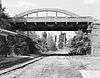 Second Street Bridge |
April 9, 1990 (#90000528) | August 11, 1999 | Second St., over the Missouri-Pacific Railroad |
|
| 18 | Skillern House | December 22, 1982 (#82000927) | May 28, 2010 | 2522 Arch St. 34°43′25″N 92°16′48″W |
See also
| Wikimedia Commons has media related to National Register of Historic Places in Little Rock, Arkansas. |
References
- The latitude and longitude information provided in this table was derived originally from the National Register Information System, which has been found to be fairly accurate for about 99% of listings. Some locations in this table may have been corrected to current GPS standards.
- "National Register of Historic Places: Weekly List Actions". National Park Service, United States Department of the Interior. Retrieved on August 14, 2020.
- Numbers represent an ordering by significant words. Various colorings, defined here, differentiate National Historic Landmarks and historic districts from other NRHP buildings, structures, sites or objects.
- "National Register Information System". National Register of Historic Places. National Park Service. March 13, 2009.
- The eight-digit number below each date is the number assigned to each location in the National Register Information System database, which can be viewed by clicking the number.
- Location derived from description on the Arkansas Historic Preservation Program web site.
| Topics | |
|---|---|
| Lists by state |
|
| Lists by insular areas | |
| Lists by associated state | |
| Other areas | |
| Related | |
| |