National Register of Historic Places listings in Clark County, Arkansas
This is a list of the National Register of Historic Places listings in Clark County, Arkansas.
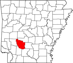
Location of Clark County in Arkansas
This is intended to be a complete list of the properties on the National Register of Historic Places in Clark County, Arkansas, United States. The locations of National Register properties for which the latitude and longitude coordinates are included below, may be seen in a map.[1]
There are 41 properties listed on the National Register in the county, including one site, Elkin's Ferry, which is part of the Camden Expedition Sites, a National Historic Landmark District associated with events of the Civil War. Another property was once listed but has been removed.
- This National Park Service list is complete through NPS recent listings posted August 14, 2020.[2]
Current listings
| [3] | Name on the Register[4] | Image | Date listed[5] | Location | City or town | Description |
|---|---|---|---|---|---|---|
| 1 | Arkadelphia Boy Scout Hut | 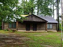 Arkadelphia Boy Scout Hut |
January 28, 2002 (#01001526) |
8th St. 34°07′45″N 93°03′16″W |
Arkadelphia | |
| 2 | Arkadelphia Commercial Historic District | 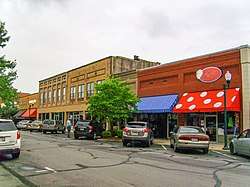 Arkadelphia Commercial Historic District |
July 20, 2011 (#11000464) |
Roughly Main St. between 5th & 7th Sts., & Clinton St between 6th & 9th Sts. 34°07′12″N 93°03′13″W |
Arkadelphia | 1870-1961 commercial core of Clark County |
| 3 | Arkadelphia Confederate Monument | _004.jpg) Arkadelphia Confederate Monument |
May 3, 1996 (#96000507) |
Courthouse lawn, near the southwestern corner of the junction of Court and Clay Sts. 34°07′12″N 93°03′03″W |
Arkadelphia | |
| 4 | Arkansas 7/51 Bridge |  Arkansas 7/51 Bridge |
February 1, 2006 (#05001591) |
Highways 7 and 51 34°07′23″N 93°02′47″W |
Arkadelphia | 1933 Parker Through Truss spanning the Ouachita River |
| 5 | James E. M. Barkman House | 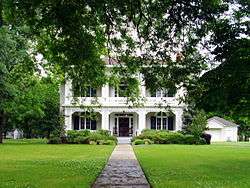 James E. M. Barkman House |
July 30, 1974 (#74000467) |
406 N. 10th St. 34°07′31″N 93°03′22″W |
Arkadelphia | ca. 1860 house in Greek and Gothic Revival styles |
| 6 | Bayou Sel | September 10, 1974 (#74000468) |
Address Restricted |
Arkadelphia | ||
| 7 | Nannie Gresham Biscoe House | 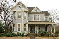 Nannie Gresham Biscoe House |
January 21, 2004 (#03001450) |
227 Cherry St. 34°07′22″N 93°02′57″W |
Arkadelphia | |
| 8 | Dr. Boaz House | 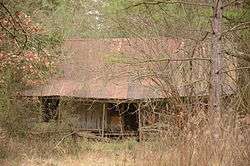 Dr. Boaz House |
January 28, 1992 (#91002014) |
Highway 26 34°04′23″N 93°22′19″W |
Clear Spring | |
| 9 | Bozeman House | 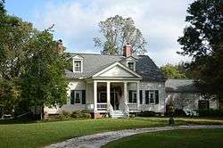 Bozeman House |
November 14, 1978 (#78000576) |
West of Arkadelphia on Highway 26 34°05′44″N 93°09′03″W |
Arkadelphia | |
| 10 | Clark County Courthouse | _001.jpg) Clark County Courthouse |
December 1, 1978 (#78000577) |
4th and Crittenden Sts. 34°07′06″N 93°03′03″W |
Arkadelphia | |
| 11 | Clark County Library | 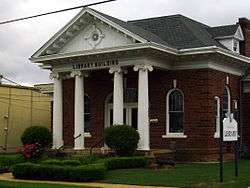 Clark County Library |
November 5, 1974 (#74000469) |
609 Caddo St. 34°07′14″N 93°03′15″W |
Arkadelphia | |
| 12 | Clear Springs Tabernacle | Clear Springs Tabernacle |
February 13, 1992 (#92000057) |
Junction of Highway 26 and Bobo Rd. 34°03′23″N 93°23′31″W |
Okolona | |
| 13 | DeGray Creek Bridge | January 21, 2010 (#09001239) |
County Road 50 over DeGray Creek 34°09′37″N 93°11′21″W |
Arkadelphia | Washed away by flooding. | |
| 14 | Domestic Science Building | 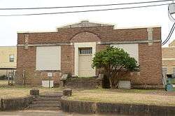 Domestic Science Building |
December 22, 1982 (#82000800) |
11th and Haddock 34°06′19″N 93°03′35″W |
Arkadelphia | |
| 15 | Elkins' Ferry | 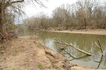 Elkins' Ferry |
April 19, 1994 (#94001182) |
Both banks of the Little Missouri River, about 10 miles north of Prescott 33°56′09″N 93°21′12″W |
Prescott | Site of the Civil War Battle of Elkin's Ferry; one of the Camden Expedition Sites, a National Historic Landmark consisting of sites in several counties; extends into Nevada County |
| 16 | Horace Estes House | 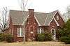 Horace Estes House |
September 21, 1993 (#93000487) |
614 E. Main St. 33°55′00″N 93°08′48″W |
Gurdon | |
| 17 | Flanagin Law Office | 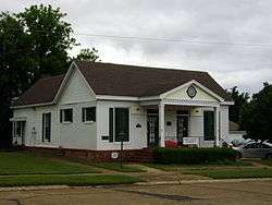 Flanagin Law Office |
December 22, 1977 (#77000245) |
320 Clay St. 34°07′08″N 93°03′03″W |
Arkadelphia | |
| 18 | Gurdon Jail | 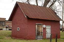 Gurdon Jail |
November 13, 1989 (#89001959) |
W. Joslyn and Front Sts. 33°55′11″N 93°09′14″W |
Gurdon | |
| 19 | Habicht-Cohn-Crow House | 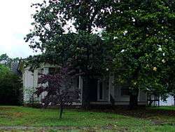 Habicht-Cohn-Crow House |
October 3, 1985 (#85002717) |
8th and Pine 34°07′21″N 93°03′21″W |
Arkadelphia | 1870 Greek Revival house |
| 20 | Capt. Charles C. Henderson House | 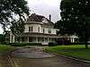 Capt. Charles C. Henderson House |
August 24, 1998 (#98000957) |
Junction of 10th and Henderson Sts. 34°07′12″N 93°03′25″W |
Arkadelphia | |
| 21 | Hoo Hoo Monument | 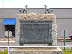 Hoo Hoo Monument |
September 2, 1999 (#94000821) |
1st St. 33°55′13″N 93°09′14″W |
Gurdon | |
| 22 | Hudson-Jones House |  Hudson-Jones House |
September 30, 1982 (#82002096) |
East of Arkadelphia on Highway 2 34°04′11″N 92°56′33″W |
Arkadelphia | |
| 23 | Loy Kirksey House | 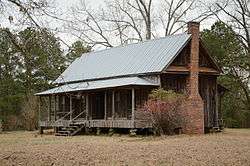 Loy Kirksey House |
February 3, 1992 (#91000586) |
County Road 59 west of De Gray Lake 34°14′02″N 93°17′45″W |
Fendley | |
| 24 | Little Missouri River Bridge | 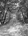 Little Missouri River Bridge |
April 9, 1990 (#90000536) |
formerly County Road 179, over the Little Missouri River 33°54′10″N 93°18′35″W |
Prescott | Bridge appears to be closed to traffic. |
| 25 | Magnolia Manor | 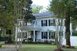 Magnolia Manor |
September 27, 1972 (#72000200) |
0.6 miles southwest of the junction of Interstate 30 and Highway 51 34°06′44″N 93°06′20″W |
Arkadelphia | |
| 26 | McNeely Creek Bridge | 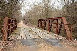 McNeely Creek Bridge |
May 26, 2004 (#04000495) |
County Road 12 33°53′20″N 93°12′34″W |
Beirne | |
| 27 | Missouri-Pacific Railroad Depot-Arkadelphia | 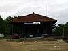 Missouri-Pacific Railroad Depot-Arkadelphia |
June 11, 1992 (#92000599) |
S. 5th St. 34°07′05″N 93°03′09″W |
Arkadelphia | |
| 28 | Missouri-Pacific Railroad Depot-Gurdon | 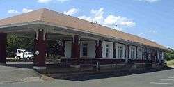 Missouri-Pacific Railroad Depot-Gurdon |
June 11, 1992 (#92000609) |
Northwest of the junction of N. 1st and E. Walnut Sts. 33°55′14″N 93°09′07″W |
Gurdon | |
| 29 | Okolona Colored High School Gymnasium | 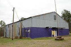 Okolona Colored High School Gymnasium |
September 23, 2011 (#11000686) |
767 Layne St. 33°59′35″N 93°20′23″W |
Okolona | |
| 30 | Old Arkansas 51, Curtis to Gum Springs |  Old Arkansas 51, Curtis to Gum Springs |
January 21, 2004 (#03001457) |
West of U.S. Route 67, starting approximately 0.5 miles south of the junction of U.S. Route 67 and Curtis Cemetery Rd., and ending at its junction with Highway 26 34°01′58″N 93°06′18″W |
Curtis | |
| 31 | Old Bank of Amity |  Old Bank of Amity |
June 5, 1991 (#91000690) |
Northwestern corner of the town square 34°15′55″N 93°27′40″W |
Amity | |
| 32 | Old US 67 Rest Area | 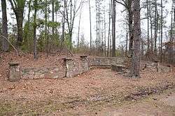 Old US 67 Rest Area |
October 5, 2006 (#06000907) |
Western side of Old U.S. Route 67, approx. 0.5 miles south of Middleton 34°01′12″N 93°06′35″W |
Curtis | |
| 33 | Peake High School | 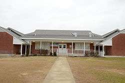 Peake High School |
January 19, 2005 (#04001499) |
1600 Caddo St. 34°07′17″N 93°04′03″W |
Arkadelphia | |
| 34 | Ronoake Baptist Church |  Ronoake Baptist Church |
September 23, 2011 (#11000687) |
North end of Ronoake Baptist Church Rd. 33°56′33″N 93°08′48″W |
Gurdon vicinity | |
| 35 | Rose Hill Cemetery |  Rose Hill Cemetery |
February 1, 1999 (#98000613) |
1200 block of Main St. 34°07′07″N 93°03′41″W |
Arkadelphia | |
| 36 | Rosedale Plantation Barn | 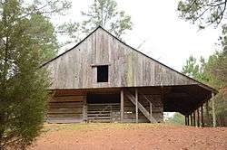 Rosedale Plantation Barn |
January 21, 2004 (#03001451) |
879 Old Military Rd. 34°09′41″N 93°06′07″W |
Arkadelphia | |
| 37 | Ross Site (3CL401) | October 10, 1985 (#85003133) |
Address Restricted |
Whelen Springs | ||
| 38 | June Sandidge House | 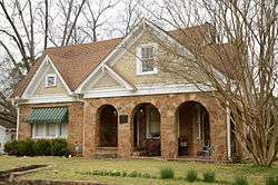 June Sandidge House |
February 25, 1993 (#93000093) |
811 Cherry St. 33°55′21″N 93°08′41″W |
Gurdon | |
| 39 | C. E. Thompson General Store and House | 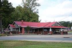 C. E. Thompson General Store and House |
April 4, 2001 (#01000302) |
3100 Hollywood 34°07′03″N 93°05′49″W |
Arkadelphia | |
| 40 | US 67 Bridge over Little Missouri River | 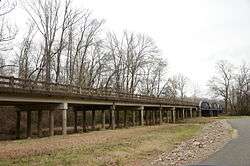 US 67 Bridge over Little Missouri River |
January 24, 2007 (#06001271) |
U.S. Route 67 33°52′48″N 93°18′16″W |
Prescott | Extends into Nevada County. |
| 41 | W. H. Young House | 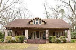 W. H. Young House |
September 20, 2006 (#06000842) |
316 Meador Ln. 34°07′32″N 93°02′21″W |
Arkadelphia |
Former listing
| [3] | Name on the Register | Image | Date listed | Date removed | Location | City or town | Summary |
|---|---|---|---|---|---|---|---|
| 1 | Cobb-Weber House | September 14, 2002 (#02000956) | January 26, 2006 | 307 N. 6th Street |
Arkadelphia | ||
| 2 | Benjamin Mercantile Building | September 5, 1990 (#90001378) | January 14, 2002 | 410 Main Street |
Arkadelphia |
See also
| Wikimedia Commons has media related to National Register of Historic Places in Clark County, Arkansas. |
References
- The latitude and longitude information provided in this table was derived originally from the National Register Information System, which has been found to be fairly accurate for about 99% of listings. Some locations in this table may have been corrected to current GPS standards.
- "National Register of Historic Places: Weekly List Actions". National Park Service, United States Department of the Interior. Retrieved on August 14, 2020.
- Numbers represent an ordering by significant words. Various colorings, defined here, differentiate National Historic Landmarks and historic districts from other NRHP buildings, structures, sites or objects.
- "National Register Information System". National Register of Historic Places. National Park Service. March 13, 2009.
- The eight-digit number below each date is the number assigned to each location in the National Register Information System database, which can be viewed by clicking the number.
| Topics | |
|---|---|
| Lists by state |
|
| Lists by insular areas | |
| Lists by associated state | |
| Other areas | |
| Related | |
| |
Municipalities and communities of Clark County, Arkansas, United States | ||
|---|---|---|
| Cities | Map of Arkansas highlighting Clark County | |
| Towns | ||
| Unincorporated communities | ||
This article is issued from Wikipedia. The text is licensed under Creative Commons - Attribution - Sharealike. Additional terms may apply for the media files.