National Register of Historic Places listings in Craighead County, Arkansas
This is a list of the National Register of Historic Places listings in Craighead County, Arkansas.
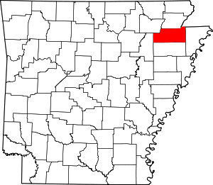
Location of Craighead County in Arkansas
This is intended to be a complete list of the properties and districts on the National Register of Historic Places in Craighead County, Arkansas, United States. The locations of National Register properties and districts for which the latitude and longitude coordinates are included below, may be seen in a map.[1]
There are 20 properties and districts listed on the National Register in the county. One property was delisted and relisted under a different name, and then delisted again.
- This National Park Service list is complete through NPS recent listings posted August 14, 2020.[2]
Current listings
| [3] | Name on the Register[4] | Image | Date listed[5] | Location | City or town | Description |
|---|---|---|---|---|---|---|
| 1 | Bay Mounds | February 14, 1978 (#78000582) |
Address Restricted |
Bay | ||
| 2 | Bell House | 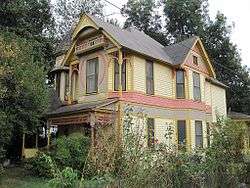 Bell House |
November 7, 1976 (#76000398) |
303 W. Cherry St. 35°50′02″N 90°42′26″W |
Jonesboro | |
| 3 | Berger House | 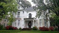 Berger House |
November 7, 1996 (#96001272) |
1120 S. Main St. 35°49′55″N 90°42′17″W |
Jonesboro | |
| 4 | Berger-Graham House | October 10, 1985 (#85003006) |
1327 S. Main St. 35°49′43″N 90°42′19″W |
Jonesboro | ||
| 5 | US Sen. Hattie Caraway Gravesite | 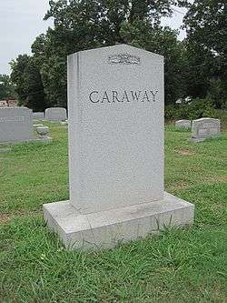 US Sen. Hattie Caraway Gravesite |
September 20, 2007 (#07000976) |
Oaklawn Cemetery, 2349 W. Matthews Avenue Ln. 35°50′15″N 90°44′20″W |
Jonesboro | Gravesite of Hattie Caraway, the first woman elected to a full term in the United States Senate. |
| 6 | Community Center No. 1 | 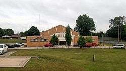 Community Center No. 1 |
January 23, 2008 (#07001422) |
1212 S. Church St. 35°50′00″N 90°42′10″W |
Jonesboro | |
| 7 | Craighead County Courthouse | 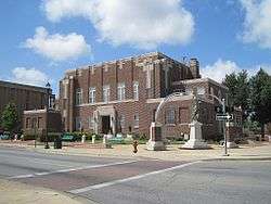 Craighead County Courthouse |
September 11, 1998 (#98000831) |
511 Main St. 35°50′14″N 90°42′18″W |
Jonesboro | |
| 8 | Craighead County Road 513C Bridge | May 18, 1995 (#95000614) |
County Road 513C over an unnamed ditch, approximately 1.5 miles east of Dixie, just east of its junction with County Road 669 35°55′12″N 90°25′23″W |
Dixie | ||
| 9 | First National Bank Building | 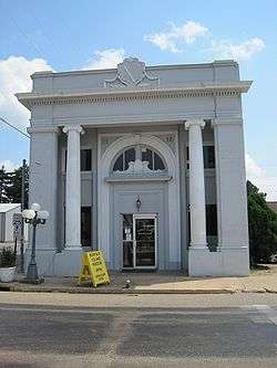 First National Bank Building |
January 24, 2008 (#07001423) |
207 W. Drew Ave. 35°53′31″N 90°20′34″W |
Monette | |
| 10 | Frierson House | 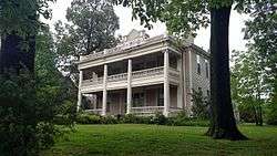 Frierson House |
April 24, 1973 (#73000381) |
1112 S. Main St. 35°49′56″N 90°42′17″W |
Jonesboro | |
| 11 | Home Ice Company | June 5, 2017 (#100001005) |
700 Cate Ave. 35°50′31″N 90°41′54″W |
Jonesboro | ||
| 12 | Jonesboro U.S. Post Office and Courthouse | 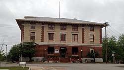 Jonesboro U.S. Post Office and Courthouse |
May 29, 2019 (#100003987) |
524 S. Church St. 35°50′16″N 90°42′15″W |
Jonesboro | |
| 13 | Victor Cicero Kays House | May 23, 2014 (#14000246) |
2506 Aggie Rd. 35°50′33″N 90°40′26″W |
Jonesboro | ||
| 14 | Mercantile Bank Building | 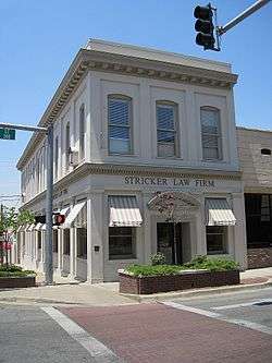 Mercantile Bank Building |
January 20, 2005 (#04001506) |
249 S. Main St. 35°24′34″N 90°46′16″W |
Jonesboro | |
| 15 | Monette Water Tower | 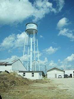 Monette Water Tower |
January 24, 2008 (#07001424) |
Southwestern corner of the junction of Highway 139 and Texie Ave. 35°53′38″N 90°20′35″W |
Monette | |
| 16 | Nash-Reid-Hill House | August 16, 1994 (#94000852) |
418 W. Matthews Ave. 35°50′09″N 90°42′31″W |
Jonesboro | ||
| 17 | Patteson House | January 23, 2020 (#100004898) |
2801 Harrisburg Rd. 35°48′42″N 90°41′55″W |
Jonesboro | ||
| 18 | St. Francis River Bridge | 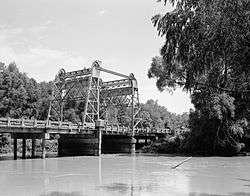 St. Francis River Bridge |
April 9, 1990 (#90000515) |
Highway 18 over the St. Francis River 35°49′14″N 90°25′58″W |
Lake City | Dismantled in 1998; only the vertical lift section remains |
| 19 | West Washington Avenue Historic District | 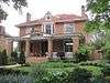 West Washington Avenue Historic District |
October 22, 1982 (#82000805) |
500-626 W. Washington Ave. 35°50′13″N 90°42′39″W |
Jonesboro | |
| 20 | Edward L. Westbrooke Building | 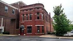 Edward L. Westbrooke Building |
January 8, 2003 (#02001675) |
505 Union St. 35°50′16″N 90°42′21″W |
Jonesboro |
Former listings
| [3] | Name on the Register | Image | Date listed | Date removed | Location | City or town | Summary |
|---|---|---|---|---|---|---|---|
| 1 | C.S. Stuck & Sons Lumber Office Building | May 18, 2018 (#100002450) | September 30, 2019 | 215 Union St. 35°50′29″N 90°42′21″W |
Jonesboro | Originally listed on December 27, 2002; delisted and relisted simultaneously on May 18, 2018 before being delisted again. |
See also
| Wikimedia Commons has media related to National Register of Historic Places in Craighead County, Arkansas. |
References
- The latitude and longitude information provided in this table was derived originally from the National Register Information System, which has been found to be fairly accurate for about 99% of listings. Some locations in this table may have been corrected to current GPS standards.
- "National Register of Historic Places: Weekly List Actions". National Park Service, United States Department of the Interior. Retrieved on August 14, 2020.
- Numbers represent an ordering by significant words. Various colorings, defined here, differentiate National Historic Landmarks and historic districts from other NRHP buildings, structures, sites or objects.
- "National Register Information System". National Register of Historic Places. National Park Service. March 13, 2009.
- The eight-digit number below each date is the number assigned to each location in the National Register Information System database, which can be viewed by clicking the number.
| Topics | |
|---|---|
| Lists by state |
|
| Lists by insular areas | |
| Lists by associated state | |
| Other areas | |
| Related | |
| |
Municipalities and communities of Craighead County, Arkansas, United States | ||
|---|---|---|
| Cities | Map of Arkansas highlighting Craighead County | |
| Towns | ||
| Unincorporated communities |
| |
| Ghost town | ||
This article is issued from Wikipedia. The text is licensed under Creative Commons - Attribution - Sharealike. Additional terms may apply for the media files.