National Register of Historic Places listings in Van Buren County, Arkansas
This is a list of the National Register of Historic Places listings in Van Buren County, Arkansas.
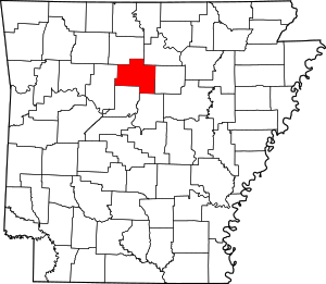
Location of Van Buren County in Arkansas
This is intended to be a complete list of the properties and districts on the National Register of Historic Places in Van Buren County, Arkansas, United States. The locations of National Register properties and districts for which the latitude and longitude coordinates are included below, may be seen in a map.[1]
There are 16 properties and districts listed on the National Register in the county.
- This National Park Service list is complete through NPS recent listings posted August 14, 2020.[2]
Current listings
| [3] | Name on the Register[4] | Image | Date listed[5] | Location | City or town | Description |
|---|---|---|---|---|---|---|
| 1 | Melvin Chrisco House | 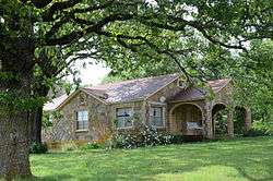 Melvin Chrisco House |
September 28, 2005 (#05001082) |
237 Alvin Brown Rd. 35°22′13″N 92°25′22″W |
Damascus | |
| 2 | Clinton Commercial Historic District |  Clinton Commercial Historic District |
May 15, 2006 (#06000410) |
Roughly bounded by Town Branch Creek and by U.S. Highway 65B 35°35′43″N 92°27′31″W |
Clinton | |
| 3 | Collums-Baker House |  Collums-Baker House |
November 24, 1992 (#92001282) |
Eastern side of U.S. Highway 65, approximately ½ mile south of the community 35°26′38″N 92°23′21″W |
Bee Branch | |
| 4 | Damascus CCC Camp, Co. No. 3781 Historic District | 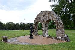 Damascus CCC Camp, Co. No. 3781 Historic District |
December 31, 2002 (#02001631) |
Camp Hill Rd. 35°22′19″N 92°23′32″W |
Damascus | |
| 5 | Damascus Gymnasium | 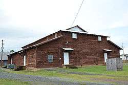 Damascus Gymnasium |
September 4, 1992 (#92001122) |
Highway 285 35°22′03″N 92°24′36″W |
Damascus | |
| 6 | Edgemont Shelter | May 4, 1982 (#82002146) |
Address Restricted |
Shirley | ||
| 7 | Joclin-Bradley-Bowling House | 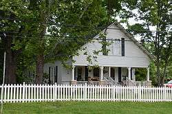 Joclin-Bradley-Bowling House |
February 1, 2007 (#06001316) |
160 Highway 95, W. 35°35′49″N 92°27′46″W |
Clinton | |
| 8 | Carl and Esther Lee House | 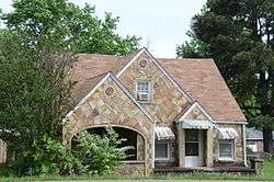 Carl and Esther Lee House |
October 19, 2005 (#05001170) |
17493 U.S. Highway 65 South 35°22′02″N 92°24′29″W |
Damascus | |
| 9 | Lynn Creek Shelter | March 21, 1978 (#78000634) |
Address Restricted |
Fairfield Bay | ||
| 10 | Middle Fork of the Little Red River Bridge | 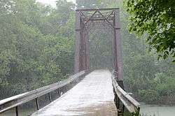 Middle Fork of the Little Red River Bridge |
January 21, 2010 (#09001260) |
County Road 125 over the Middle Fork of the Little Red River 35°39′34″N 92°19′20″W |
Shirley | |
| 11 | Walter Patterson Filling Station | 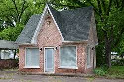 Walter Patterson Filling Station |
February 9, 2001 (#01000074) |
U.S. Highway 65 between Griggs and Court Sts. 35°35′29″N 92°27′26″W |
Clinton | |
| 12 | Walter Patterson House |  Walter Patterson House |
June 5, 2007 (#07000504) |
1800 U.S. Highway 65 North 35°36′42″N 92°27′26″W |
Clinton | |
| 13 | Art Scanlan House |  Art Scanlan House |
November 18, 1999 (#99001355) |
Route 1, west of U.S. Highway 65 35°26′52″N 92°23′38″W |
Bee Branch | |
| 14 | Titan II ICBM Launch Complex 374-7 Site | February 18, 2000 (#98001434) |
West of U.S. Highway 65, 1.7 miles north of its junction with Highway 124 35°24′51″N 92°23′47″W |
Southside | ||
| 15 | Van Buren County Courthouse | 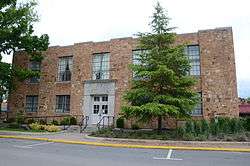 Van Buren County Courthouse |
May 13, 1991 (#91000584) |
Junction of Griggs and Main Sts. 35°35′33″N 92°27′28″W |
Clinton | |
| 16 | Van Buren County Road 2E Bridge |  Van Buren County Road 2E Bridge |
May 5, 1995 (#95000570) |
County Road 2E over a tributary of Driver's Creek 35°30′41″N 92°41′53″W |
Scotland |
Former listings
| [3] | Name on the Register | Image | Date listed | Date removed | Location | City or town | Summary |
|---|---|---|---|---|---|---|---|
| 1 | Stobaugh House | July 6, 1976 (#76000471) | March 31, 2000 | AR 9, 0.5 mi. SW of Choctaw |
Choctaw vicinity |
See also
| Wikimedia Commons has media related to National Register of Historic Places in Van Buren County, Arkansas. |
References
- The latitude and longitude information provided in this table was derived originally from the National Register Information System, which has been found to be fairly accurate for about 99% of listings. Some locations in this table may have been corrected to current GPS standards.
- "National Register of Historic Places: Weekly List Actions". National Park Service, United States Department of the Interior. Retrieved on August 14, 2020.
- Numbers represent an ordering by significant words. Various colorings, defined here, differentiate National Historic Landmarks and historic districts from other NRHP buildings, structures, sites or objects.
- "National Register Information System". National Register of Historic Places. National Park Service. March 13, 2009.
- The eight-digit number below each date is the number assigned to each location in the National Register Information System database, which can be viewed by clicking the number.
| Topics | |
|---|---|
| Lists by state |
|
| Lists by insular areas | |
| Lists by associated state | |
| Other areas | |
| Related | |
| |
Municipalities and communities of Van Buren County, Arkansas, United States | ||
|---|---|---|
| Cities | Map of Arkansas highlighting Van Buren County | |
| Towns | ||
| CDP | ||
| Townships |
| |
| Unincorporated communities | ||
| Ghost town | ||
| Footnotes | ‡This populated place also has portions in an adjacent county or counties | |
This article is issued from Wikipedia. The text is licensed under Creative Commons - Attribution - Sharealike. Additional terms may apply for the media files.