National Register of Historic Places listings in Conway County, Arkansas
This is a list of the National Register of Historic Places listings in Conway County, Arkansas.
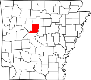
Location of Conway County in Arkansas
This is intended to be a complete list of the properties and districts on the National Register of Historic Places in Conway County, Arkansas, United States. The locations of National Register properties and districts for which the latitude and longitude coordinates are included below, may be seen in a map.[1]
There are 56 properties and districts listed on the National Register in the county. Four other sites once listed on the Register have been removed.
- This National Park Service list is complete through NPS recent listings posted August 14, 2020.[2]
Current listings
| [3] | Name on the Register[4] | Image | Date listed[5] | Location | City or town | Description |
|---|---|---|---|---|---|---|
| 1 | Arkansas Christian College Administration Building | 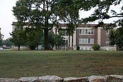 Arkansas Christian College Administration Building |
January 22, 2014 (#13001101) |
100 W. Harding St. 35°09′51″N 92°44′36″W |
Morrilton | |
| 2 | Aycock House | 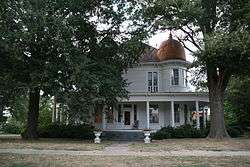 Aycock House |
May 13, 1976 (#76000397) |
410 W. Church St. 35°09′06″N 92°45′01″W |
Morrilton | |
| 3 | Bold Pilgrim Cemetery | September 18, 2018 (#100002947) |
End of Bold Pilgrim Rd., W of AR 9 35°14′20″N 92°41′23″W |
Morrilton vicinity | ||
| 4 | Cafeteria Building-Cleveland School |  Cafeteria Building-Cleveland School |
September 10, 1992 (#92001194) |
County Road 511 35°23′27″N 92°42′41″W |
Cleveland | |
| 5 | Cedar Creek Bridge | 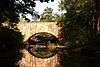 Cedar Creek Bridge |
April 9, 1990 (#90000520) |
Off Highway 154, over Cedar Creek at Roosevelt Lake 35°07′43″N 92°55′30″W |
Petit Jean State Park | |
| 6 | Coca-Cola Building | 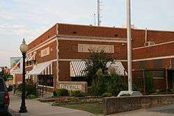 Coca-Cola Building |
December 22, 1982 (#82000803) |
211 N. Moose 35°09′15″N 92°44′35″W |
Morrilton | |
| 7 | Community Mausoleum, Elmwood Cemetery | September 27, 2019 (#100004436) |
1148 W. Church St. 35°09′15″N 92°45′43″W |
Morrilton | ||
| 8 | Conway County Courthouse | 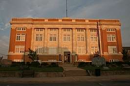 Conway County Courthouse |
November 13, 1989 (#89001960) |
Moose St. at Church St. 35°09′05″N 92°44′37″W |
Morrilton | |
| 9 | Conway County Library |  Conway County Library |
April 15, 1978 (#78000581) |
101 W. Church St. 35°09′04″N 92°44′45″W |
Morrilton | |
| 10 | Cox House |  Cox House |
October 22, 1974 (#74000471) |
Bridge St. 35°08′30″N 92°44′06″W |
Morrilton | |
| 11 | Earl Building |  Earl Building |
January 22, 2009 (#08001336) |
201 N. St. Joseph St. 35°09′12″N 92°44′28″W |
Morrilton | |
| 12 | Elmwood Cemetery Historic Section | December 22, 1982 (#100004438) |
W. of AR 113 and W. Church St. intersection 35°09′10″N 92°45′31″W |
Morrilton | ||
| 13 | First National Bank of Morrilton | 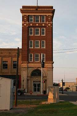 First National Bank of Morrilton |
December 22, 1982 (#82000804) |
Main at Moose St. 35°09′10″N 92°44′38″W |
Morrilton | |
| 14 | Grotto, Petit Jean No. 8 | 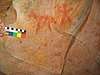 Grotto, Petit Jean No. 8 |
May 4, 1982 (#82002100) |
Address Restricted |
Oppelo | |
| 15 | Hardison Shelter, Petit Jean No. 3 |  Hardison Shelter, Petit Jean No. 3 |
May 4, 1982 (#82002101) |
Address Restricted |
Oppelo | |
| 16 | Indian Cave, Petit Jean No. 1 |  Indian Cave, Petit Jean No. 1 |
May 4, 1982 (#82002102) |
Address Restricted |
Oppelo | |
| 17 | Little Rock to Cantonment Gibson Road-Old Wire Road Segment |  Little Rock to Cantonment Gibson Road-Old Wire Road Segment |
March 27, 2008 (#07001465) |
Old Wire Rd., southwest of Blackwell 35°12′47″N 92°50′45″W |
Blackwell | A Trail of Tears site[6] |
| 18 | Mallettown United Methodist Church | 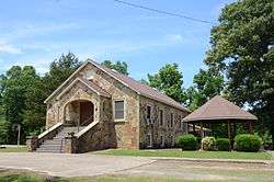 Mallettown United Methodist Church |
February 15, 2005 (#05000041) |
274 Mallett Town Rd. 35°17′02″N 92°29′23″W |
Mallet Town | |
| 19 | Menifee High School Gymnasium | 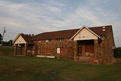 Menifee High School Gymnasium |
June 6, 2002 (#02000601) |
Junction of N. Park St. and E. Mustang St. 35°08′50″N 92°32′48″W |
Menifee | |
| 20 | Moose Addition Neighborhood Historic District | 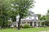 Moose Addition Neighborhood Historic District |
September 13, 2013 (#13000349) |
Roughly bounded by W. Valley, S. Moose, Green, Brown & S. Division Sts.; also Roughly bounded by S. St. Joseph, E. Green, S. Chestnut, E. Valley, S. Morrill & E. Church Sts. 35°08′59″N 92°44′49″W |
Morrilton | Second set of addresses represents a boundary increase May 26, 2015. |
| 21 | Moose House | 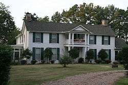 Moose House |
October 22, 1974 (#74000472) |
711 Green St. 35°08′56″N 92°44′15″W |
Morrilton | |
| 22 | Morrilton Commercial Historic District | 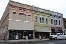 Morrilton Commercial Historic District |
March 7, 2003 (#03000085) |
Roughly bounded by E. Railroad, Broadway, N. Division, and N. Moose Sts. 35°09′13″N 92°44′39″W |
Morrilton | |
| 23 | Morrilton Post Office | 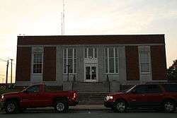 Morrilton Post Office |
August 14, 1998 (#98000921) |
117 N. Division St. 35°09′14″N 92°44′42″W |
Morrilton | |
| 24 | Morrilton Railroad Station | 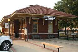 Morrilton Railroad Station |
September 13, 1977 (#77000249) |
Railroad Ave. between Division and Moose Sts. 35°08′55″N 92°44′40″W |
Morrilton | |
| 25 | Museum of Automobiles | May 31, 2019 (#100003990) |
8 Jones Ln. 35°07′46″N 92°53′28″W |
Winrock vicinity | ||
| 26 | Old US 64, Menifee Segment |  Old US 64, Menifee Segment |
March 2, 2006 (#06000071) |
Canal Rd., approximately 0.5 miles southeast of U.S. Route 64 35°08′52″N 92°33′16″W |
Menifee | |
| 27 | Petit Jean No. 4 | 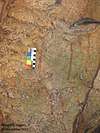 Petit Jean No. 4 |
May 4, 1982 (#82002105) |
Address Restricted |
Oppelo | |
| 28 | Petit Jean No. 5 | 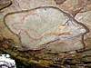 Petit Jean No. 5 |
May 4, 1982 (#82002106) |
Address Restricted |
Oppelo | |
| 29 | Petit Jean No. 6 |  Petit Jean No. 6 |
May 4, 1982 (#82002107) |
Address Restricted |
Oppelo | |
| 30 | Petit Jean No. 7 |  Petit Jean No. 7 |
May 4, 1982 (#82002108) |
Address Restricted |
Oppelo | |
| 31 | Petit Jean No. 9 |  Petit Jean No. 9 |
May 4, 1982 (#82002109) |
Address Restricted |
Oppelo | |
| 32 | Petit Jean No. 10 | 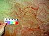 Petit Jean No. 10 |
May 4, 1982 (#82002103) |
Address Restricted |
Oppelo | |
| 33 | Petit Jean No. 11 | 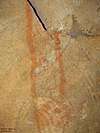 Petit Jean No. 11 |
May 4, 1982 (#82002104) |
Address Restricted |
Oppelo | |
| 34 | Petit Jean State Park-Administration Office | 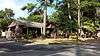 Petit Jean State Park-Administration Office |
May 28, 1992 (#92000520) |
Highway 154 east of Bench Mark 914 in Petit Jean State Park 35°07′39″N 92°55′09″W |
Winrock | |
| 35 | Petit Jean State Park-Blue Hole Road District |  Petit Jean State Park-Blue Hole Road District |
May 28, 1992 (#92000513) |
Blue Hole Rd. in Petit Jean State Park 35°07′17″N 92°57′16″W |
Winrock | |
| 36 | Petit Jean State Park-Cabin No. 1 | 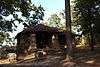 Petit Jean State Park-Cabin No. 1 |
May 28, 1992 (#92000523) |
Campground access road in Petit Jean State Park 35°07′05″N 92°56′13″W |
Winrock | |
| 37 | Petit Jean State Park-Cabin No. 6 |  Petit Jean State Park-Cabin No. 6 |
May 28, 1992 (#92000524) |
Campground access road in Petit Jean State Park 35°07′07″N 92°56′15″W |
Winrock | |
| 38 | Petit Jean State Park-Cabin No. 9 | 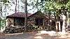 Petit Jean State Park-Cabin No. 9 |
May 28, 1992 (#92000525) |
Campground access road in Petit Jean State Park 35°07′08″N 92°56′20″W |
Winrock | |
| 39 | Petit Jean State Park-Cabin No. 16 | 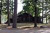 Petit Jean State Park-Cabin No. 16 |
May 28, 1992 (#92000522) |
Campground access road in Petit Jean State Park 35°07′07″N 92°56′21″W |
Winrock | |
| 40 | Petit Jean State Park-Cedar Falls Trail Historic District | 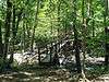 Petit Jean State Park-Cedar Falls Trail Historic District |
May 28, 1992 (#92000514) |
Adjacent to the main access road in Petit Jean State Park 35°07′01″N 92°56′30″W |
Winrock | |
| 41 | Petit Jean State Park-Concrete Log Bridge | 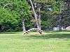 Petit Jean State Park-Concrete Log Bridge |
May 28, 1992 (#92000519) |
Highway 154 south of Bench Mark 914 in Petit Jean State Park 35°07′34″N 92°55′29″W |
Winrock | |
| 42 | Petit Jean State Park-Culvert No. 1 | 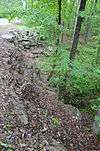 Petit Jean State Park-Culvert No. 1 |
May 28, 1992 (#92000518) |
Highway 154 in Petit Jean State Park 35°07′05″N 92°55′58″W |
Winrock | |
| 43 | Petit Jean State Park-Lake Bailey-Roosevelt Lake Historic District |  Petit Jean State Park-Lake Bailey-Roosevelt Lake Historic District |
May 28, 1992 (#92000515) |
East and north of Highway 154 in Petit Jean State Park 35°07′45″N 92°54′54″W |
Winrock | |
| 44 | Petit Jean State Park-Mather Lodge |  Petit Jean State Park-Mather Lodge |
May 28, 1992 (#92000521) |
Main access road in Petit Jean State Park 35°07′02″N 92°56′18″W |
Petit Jean State Park | |
| 45 | Petit Jean State Park-Office Headquarters | 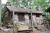 Petit Jean State Park-Office Headquarters |
May 28, 1992 (#92000516) |
Highway 154, approximately 500 feet south of Bench Mark 914 in Petit Jean State Park 35°07′35″N 92°55′34″W |
Winrock | |
| 46 | Petit Jean State Park-Water Treatment Building | 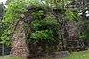 Petit Jean State Park-Water Treatment Building |
May 28, 1992 (#92000517) |
On a dirt access road south of its junction with Highway 154, approximately 800 feet east of Bench Mark 914 in Petit Jean State Park 35°07′31″N 92°55′20″W |
Winrock | |
| 47 | Plumerville School Building | September 10, 1992 (#92001193) |
Arnold St. 35°09′30″N 92°38′03″W |
Plumerville | ||
| 48 | Plummer's Station |  Plummer's Station |
August 11, 1975 (#75000378) |
South of Plumerville on Gap Creek 35°09′21″N 92°38′33″W |
Plumerville | |
| 49 | Point Remove Creek Bridge | September 27, 2019 (#100004442) |
Old Arkansas Highway 113 over Point Remove Creek 35°09′47″N 92°48′14″W |
Morrilton | ||
| 50 | Rockhouse Cave, Petit Jean No. 2 | 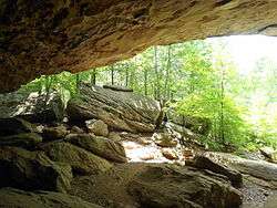 Rockhouse Cave, Petit Jean No. 2 |
May 4, 1982 (#82002110) |
Address Restricted |
Oppelo | |
| 51 | Saint Anthony's Hospital | 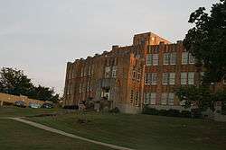 Saint Anthony's Hospital |
March 28, 1986 (#86000581) |
202 E. Green St. 35°08′51″N 92°44′37″W |
Morrilton | |
| 52 | Seven Hollows-Petit Jean Mountain Site #1 | September 20, 2006 (#06000833) |
Southeast of the junction of Highways 154 and 155 in Petit Jean State Park[7] 35°06′37″N 92°56′53″W |
Winrock | ||
| 53 | Trinity Lutheran Church | 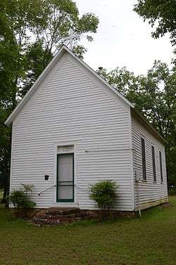 Trinity Lutheran Church |
December 13, 1976 (#76000396) |
7.2 miles south of Atkins off Highway 154 35°07′58″N 92°55′31″W |
Atkins | |
| 54 | Union Chapel School and Shop Building | 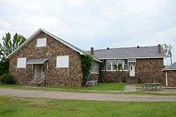 Union Chapel School and Shop Building |
January 26, 2016 (#15000993) |
298 Union Chapel Rd. & 28 Acker Ln. 35°13′55″N 92°33′21″W |
Springfield vicinity | |
| 55 | West Church Street Historic District | 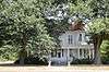 West Church Street Historic District |
May 25, 2015 (#15000259) |
Roughly bounded by S. Morrill, Valley, S. Cherokee & W. Church Sts. 35°09′04″N 92°44′54″W |
Morrilton | |
| 56 | W. L. Wood House | 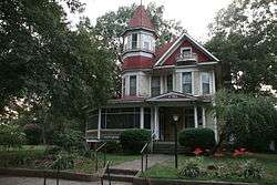 W. L. Wood House |
June 6, 2002 (#02000604) |
709 N. Morrill St. 35°09′40″N 92°44′46″W |
Morrilton |
Former listings
| [3] | Name on the Register | Image | Date listed | Date removed | Location | City or town | Summary |
|---|---|---|---|---|---|---|---|
| 1 | Sims Hotel | August 28, 1975 (#75000379) | March 31, 2000 | Center of Plumerville 35°09′29″N 92°38′33″W |
Plumerville | ||
| 2 | Cove Creek Bridge | May 24, 2004 (#04000499) | January 24, 2017 | Highway 124 35°19′23″N 92°29′08″W |
Martinville | ||
| 3 | Morrilton Colored School | 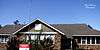 Morrilton Colored School |
May 23, 2014 (#14000245) | September 29, 2015 | 906 W. Rock St. 35°09′32″N 92°45′14″W |
Morrilton | Destroyed in a fire in 2015.[8] |
| 4 | Morrilton Male and Female College | 1979 (#79000436) | September 17, 1999 | E. Church St. |
Morrilton | ||
| 5 | Solgohachia Bridge | Solgohachia Bridge |
May 26, 2004 (#04000498) | January 27, 2012 | County Road 67 35°16′17″N 92°42′48″W |
Solgohachia |
See also
| Wikimedia Commons has media related to National Register of Historic Places in Conway County, Arkansas. |
References
- The latitude and longitude information provided in this table was derived originally from the National Register Information System, which has been found to be fairly accurate for about 99% of listings. Some locations in this table may have been corrected to current GPS standards.
- "National Register of Historic Places: Weekly List Actions". National Park Service, United States Department of the Interior. Retrieved on August 14, 2020.
- Numbers represent an ordering by significant words. Various colorings, defined here, differentiate National Historic Landmarks and historic districts from other NRHP buildings, structures, sites or objects.
- "National Register Information System". National Register of Historic Places. National Park Service. March 13, 2009.
- The eight-digit number below each date is the number assigned to each location in the National Register Information System database, which can be viewed by clicking the number.
- "Trail Of Tears National Historic Trail: National Register Research". National Park Service. Retrieved January 22, 2013.
- Location derived from NRIS-provided coordinates; the NRIS provides the coordinates but lists the site as "Address Restricted".
- "Fire destroys historic school". KATV. April 10, 2015. Retrieved April 20, 2016.
| Topics | |
|---|---|
| Lists by state |
|
| Lists by insular areas | |
| Lists by associated state | |
| Other areas | |
| Related | |
| |
Municipalities and communities of Conway County, Arkansas, United States | ||
|---|---|---|
| Cities | Map of Arkansas highlighting Conway County | |
| Town | ||
| CDP | ||
| Unincorporated communities | ||
This article is issued from Wikipedia. The text is licensed under Creative Commons - Attribution - Sharealike. Additional terms may apply for the media files.