National Register of Historic Places listings in Calhoun County, Arkansas
This is a list of the National Register of Historic Places listings in Calhoun County, Arkansas.
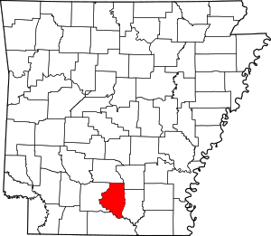
Location of Calhoun County in Arkansas
This is intended to be a complete list of the properties on the National Register of Historic Places in Calhoun County, Arkansas, United States. The locations of National Register properties for which the latitude and longitude coordinates are included below, may be seen in a map.[1]
There are 11 properties listed on the National Register in the county.
- This National Park Service list is complete through NPS recent listings posted August 14, 2020.[2]
Current listings
| [3] | Name on the Register[4] | Image | Date listed[5] | Location | City or town | Description |
|---|---|---|---|---|---|---|
| 1 | Boone's Mounds | .jpg) Boone's Mounds |
April 14, 1980 (#80000774) |
Address Restricted |
Calion | |
| 2 | Calhoun County Courthouse |  Calhoun County Courthouse |
December 12, 1976 (#76000390) |
Courthouse Sq. 33°32′15″N 92°28′19″W |
Hampton | |
| 3 | Dunn House | 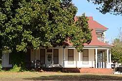 Dunn House |
May 4, 1976 (#76000391) |
West of Hampton on U.S. Route 278 33°32′10″N 92°31′10″W |
Hampton | |
| 4 | Hampton Cemetery | 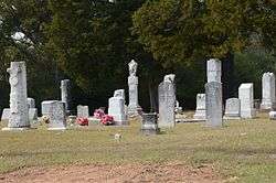 Hampton Cemetery |
May 27, 2009 (#09000340) |
South of the junction of U.S. Route 278, W. and 1st St. 33°32′18″N 92°28′23″W |
Hampton | |
| 5 | Hampton Masonic Lodge Building | 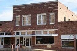 Hampton Masonic Lodge Building |
May 20, 2008 (#08000433) |
115 S. 2nd St. 33°31′51″N 92°28′22″W |
Hampton | |
| 6 | Hampton Waterworks | 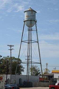 Hampton Waterworks |
October 5, 2006 (#06000909) |
Hunt St., west of Lee St. 33°32′21″N 92°28′14″W |
Hampton | |
| 7 | Keller Site | October 29, 1979 (#79000434) |
Address Restricted |
Calion | ||
| 8 | Ouachita River Lock and Dam No. 8 | 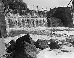 Ouachita River Lock and Dam No. 8 |
December 19, 1983 (#83003458) |
Southeast of Calion 33°18′03″N 92°27′41″W |
Calion | |
| 9 | Shumaker Naval Ammunition Depot (NAD) 500-Man Barracks | May 21, 2018 (#100002448) |
S side of Highway 274 between Spellman Rd and AR 203 33°37′39″N 92°43′00″W |
East Camden | ||
| 10 | Shumaker Naval Ammunition Depot (NAD) Administration Building | May 21, 2018 (#100002449) |
6415 Spellman Rd 33°37′56″N 92°43′04″W |
East Camden | ||
| 11 | State Highway 274 Bridge | May 18, 1995 (#95000610) |
Highway 274 over Little Cypress Creek 33°37′48″N 92°42′32″W |
Thornton |
Former listings
| [3] | Name on the Register | Image | Date listed | Date removed | Location | City or town | Summary |
|---|---|---|---|---|---|---|---|
| 1 | Tinsman School | .JPG) Tinsman School |
January 24, 2007 (#06001265) | September 18, 2013 | Southwestern corner of the junction of Highway 274 and County Road 38 33°37′54″N 92°21′24″W |
Tinsman |
See also
| Wikimedia Commons has media related to National Register of Historic Places in Calhoun County, Arkansas. |
References
- The latitude and longitude information provided in this table was derived originally from the National Register Information System, which has been found to be fairly accurate for about 99% of listings. Some locations in this table may have been corrected to current GPS standards.
- "National Register of Historic Places: Weekly List Actions". National Park Service, United States Department of the Interior. Retrieved on August 14, 2020.
- Numbers represent an ordering by significant words. Various colorings, defined here, differentiate National Historic Landmarks and historic districts from other NRHP buildings, structures, sites or objects.
- "National Register Information System". National Register of Historic Places. National Park Service. March 13, 2009.
- The eight-digit number below each date is the number assigned to each location in the National Register Information System database, which can be viewed by clicking the number.
| Topics | |
|---|---|
| Lists by state |
|
| Lists by insular areas | |
| Lists by associated state | |
| Other areas | |
| Related | |
| |
Municipalities and communities of Calhoun County, Arkansas, United States | ||
|---|---|---|
| Cities | Map of Arkansas highlighting Calhoun County | |
| Towns | ||
This article is issued from Wikipedia. The text is licensed under Creative Commons - Attribution - Sharealike. Additional terms may apply for the media files.