Girringun National Park
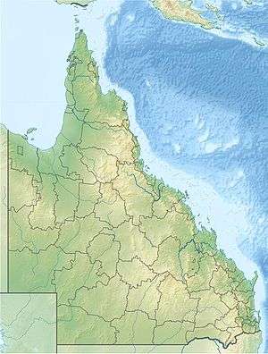
Girringun National Park is a national park in Queensland, Australia, approximately 50 kilometres (31 mi) southwest of Ingham, 110 kilometres (68 mi) north of Townsville and 1,290 kilometres (800 mi) northwest of Brisbane. The park is one of the Wet Tropics World Heritage Area series of national parks, and is a gazetted World Heritage site.
| Girringun National Park Queensland | |
|---|---|
IUCN category II (national park) | |
 | |
 Girringun National Park | |
| Nearest town or city | Ingham |
| Coordinates | 18°05′00″S 145°35′36″E |
| Established | 1994 |
| Area | 1,538 km2 (593.8 sq mi) |
| Managing authorities | Queensland Parks and Wildlife Service |
| Website | Girringun National Park |
| See also | Protected areas of Queensland |
History
The park was originally named the Lumholtz National Park, after scientist Carl Sofus Lumholtz, when it was created in 1994. The Blencoe Falls Section was gazetted as part of Lumholtz National Park in 2000. The name was subsequently changed to Girringun in 2003. On National Parks Day 2010 (28 March) the Government of Queensland announced the addition of 2,810 hectares (6,900 acres) to the park.[1]
Environment
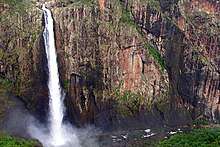
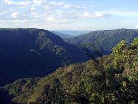
This large national park consists mainly of wet sclerophyll forests, but small pockets of rainforest also exist along the eastern slopes and hilltops. The Seaview, George and Cardwell ranges dominate the landscape, which is strewn with granite debris from a volcanic eruption 100,000 years ago. Perhaps the most well known geological feature in this park is the Wallaman Falls. At 268 metres (879 ft) it is the largest single-drop falls in Australia. The park forms part of the Wooroonooran Important Bird Area, identified as such by BirdLife International because it supports populations of a range of bird species endemic to Queensland's Wet Tropics.[2]
Access and infrastructure
Vehicle access into the forest include the Dalrymple Gap Track, or the Wallaman Falls track. However, for most of the park there is only very rudimentary or absent vehicle access. Most of the park is accessible for hikers, but due to its remoteness and rugged terrain only experienced bushwalkers should undertake extensive hikes.
References
- Jones, Kate (28 March 2010). Bligh Government Expands National Parks By 60,000 Hectares To Protect Rare Plants And Animals. Ministerial Media Statement. Department of the Premier and Cabinet. Retrieved on 4 June 2012.
- BirdLife International. (2011). Important Bird Areas factsheet: Wooroonooran. Downloaded from "Archived copy". Archived from the original on 30 June 2007. Retrieved 2013-12-31.CS1 maint: archived copy as title (link) on 2011-12-02.