Shire of Burke
The Shire of Burke is a local government area in North West Queensland, Australia. The shire lies on the south coast of the Gulf of Carpentaria and abuts the border with the Northern Territory. It covers an area of 39,864 square kilometres (15,391.6 sq mi), and has existed as a local government entity since 1885. The major town and administrative centre of the shire is Burketown. The shire and town and the Burke River passing through all are named in honour of ill-fated explorer Robert O'Hara Burke.[2]
| Shire of Burke Queensland | |||||||||||||||
|---|---|---|---|---|---|---|---|---|---|---|---|---|---|---|---|
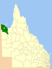 Location within Queensland | |||||||||||||||
| Population | 352 (2018)[1] | ||||||||||||||
| • Density | 0.008870/km2 (0.02297/sq mi) | ||||||||||||||
| Established | 1885 | ||||||||||||||
| Area | 39,684 km2 (15,322.1 sq mi)[1] | ||||||||||||||
| Mayor | Ernie Camp | ||||||||||||||
| Council seat | Burketown | ||||||||||||||
| Region | North West Queensland | ||||||||||||||
| State electorate(s) | Traeger | ||||||||||||||
| Federal Division(s) | Kennedy | ||||||||||||||
| Website | Shire of Burke | ||||||||||||||
| |||||||||||||||
From the months of August to November, a rare meteorological phenomenon known as "Morning Glory" – long, tubular clouds, some up to 1000 km in length – are often observed in the skies above Burke Shire.[3]
The shire contains Boodjamulla National Park (formerly called Lawn Hill National Park) and the World Heritage Site Riversleigh fossil fields. The Aboriginal Shire of Doomadgee lies inside Burke Shire to the west of Burketown. It also includes Gregory Downs.
History
Yukulta (also known as Ganggalida) is an Australian Aboriginal language. The Yukulta language region is the Gulf Country including the local government areas of the Aboriginal Shire of Doomadgee and Shire of Mornington.[4]
Yulluna (also known as Yalarnga, Yalarrnga, Jalanga, Jalannga, Wonganja, Gunggalida, Jokula) is an Australian Aboriginal language. The Yulluna language region includes the local government boundaries of the Shire of Cloncurry and other areas near the Gulf of Carpentaria.[5]
Garrwa (also known as Garawa) is a language of the Gulf region, taking in the localities of Borroloola and Westmoreland. The Garrwa language region takes in the landscape of the Roper Gulf Regional Council and the Doomadgee Shire Council.[6]
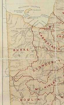
The Doonmunya Division was created on 11 November 1879 as one of 74 divisions around Queensland under the Divisional Boards Act 1879 with a population of 396.[7] However, the divisional board appeared to be completely inactive, perhaps because the division was so large (being the area surrounding the southern part of the Gulf of Carpentaria) and was very sparsely settled.[8] Nonetheless some of the citizens were unhappy about this.[9] Consequently, on 11 January 1883, the Doonmunya Division was abolished and a new Carpentaria Division was created to replace it.[10][11][12]
However, once the Carpentaria Divisional Board became operational, the residents of the Burketown area became concerned that their rates were likely to be spent on the Normanton area rather than their own and began to agitate for their own division west of the Leichhardt River.[13] On 30 January 1885, the Burke Division was created from lands formerly within the Carpentaria Division with some adjustments to the Cloncurry Division.[14][15][16]
On 31 March 1903, Burke Division became the Shire of Burke.[17]
Towns and localities
The Shire of Burke includes the following settlements:
Amenities
The Burke Shire Council operate public library in Burketown.[18]
Chairmen and mayors
Population
The populations below exclude the Aboriginal community of Doomadgee, which hovered between 800-1000 residents for most of the period under consideration.
| Year | Population |
|---|---|
| 1933 | 355 |
| 1947 | 250 |
| 1954 | 248 |
| 1961 | 361 |
| 1966 | 291 |
| 1971 | 384 |
| 1976 | 413 |
| 1981 | 466 |
| 1986 | 511 |
| 1991 | 513 |
| 1996 | 660 |
| 2001 | 1,010 |
| 2006 | 1,145 |
| 2011 | 514 |
| 2016 | 328 |
References
- "3218.0 – Regional Population Growth, Australia, 2017-18: Population Estimates by Local Government Area (ASGS 2018), 2017 to 2018". Australian Bureau of Statistics. Australian Bureau of Statistics. 27 March 2019. Retrieved 25 October 2019. Estimated resident population, 30 June 2018.
- "Burketown (entry 5355)". Queensland Place Names. Queensland Government. Retrieved 13 September 2015.
- ABC Australia, August 2003, Soaring the Glory Accessed 12 December 2006.
-

-
-
- "Proclamation [Doonmunya Division]". Queensland Government Gazette. 11 November 1879. p. 25:1007.
- "Local Government Practically Applied". The Queenslander. Brisbane: National Library of Australia. 15 January 1881. p. 71. Retrieved 4 October 2013.
- "NORMANTON". The Brisbane Courier. National Library of Australia. 12 January 1883. p. 6. Retrieved 4 October 2013.
- "Proclamation [Doonmunya Division abolished]". Queensland Government Gazette. 13 January 1883. p. 32:98.
- "Proclamation [Carpentaria Division constituted]". Queensland Government Gazette. 13 January 1883. p. 32:98.
- "Agency ID 556, Carpentaria Divisional Board". Queensland State Archives. Retrieved 12 September 2013.
- "BURKETOWN". The Brisbane Courier. National Library of Australia. 26 September 1884. p. 6. Retrieved 5 October 2013.
- "Proclamation [Burke Division constituted]". Queensland Government Gazette. 31 January 1885. p. 36:328-329.
- "Proclamation [Carpentaria Division amended]". Queensland Government Gazette. 31 January 1885. p. 36:328.
- "Proclamation [Cloncurry Division amended]". Queensland Government Gazette. 31 January 1885. p. 36:327-328.
- "Agency ID 546, Burke Shire Council". Queensland State Archives. Retrieved 5 October 2013.
- "Burke Shire Council". Public Libraries Connect. State Library of Queensland. 20 September 2016. Archived from the original on 5 February 2018. Retrieved 5 February 2018.
- Pugh, Theophilus Parsons (1927). Pugh's Almanac for 1927. Retrieved 13 June 2014.
- "2008 Burke Shire - Mayoral Election - Election Summary". 31 August 2010. Electoral Commission of Queensland. Retrieved 16 March 2017.
- "2012 Burke Shire - Mayoral Election - Election Summary". Electoral Commission of Queensland. 28 May 2012. Retrieved 16 March 2017.
- "Mayor and Councillor Profiles". Burke Shire COuncil. Burke Shire Council. Archived from the original on 4 August 2012. Retrieved 14 June 2014.
- "2016 Burke Shire Council - Mayoral Election - Election Summary". Electoral Commission of Queensland. 19 April 2016. Retrieved 16 March 2017.
- "2020 Local Government Elections: Saturday, 28 March 2020". Electoral Commission of Queensland. 2020. Retrieved 16 June 2020.
External links
- "Burke Shire". Queensland Places. Centre for the Government of Queensland, University of Queensland.