Atherton, Queensland
Atherton is a rural town and locality in the Tablelands Region, Queensland, Australia.[2][3] In the 2016 census, Atherton had a population of 7,331 people.[1]
| Atherton Queensland | |||||||||||||||
|---|---|---|---|---|---|---|---|---|---|---|---|---|---|---|---|
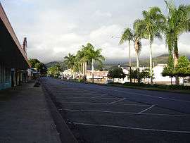 The main street of Atherton | |||||||||||||||
 Atherton | |||||||||||||||
| Coordinates | 17.2658°S 145.4780°E | ||||||||||||||
| Population | 7,331 (2016 census)[1] | ||||||||||||||
| • Density | 77.91/km2 (201.78/sq mi) | ||||||||||||||
| Postcode(s) | 4883 | ||||||||||||||
| Elevation | 752 m (2,467 ft) | ||||||||||||||
| Area | 94.1 km2 (36.3 sq mi) | ||||||||||||||
| Time zone | AEST (UTC+10:00) | ||||||||||||||
| LGA(s) | Tablelands Region | ||||||||||||||
| State electorate(s) | Hill | ||||||||||||||
| Federal Division(s) | Kennedy | ||||||||||||||
| |||||||||||||||
| |||||||||||||||
Geography
Atherton is on the Atherton Tableland in Far North Queensland.
Atherton is joined by the Gillies Highway to Yungaburra, the Kennedy Highway north to Mareeba and south to Ravenshoe and Mount Garnet, the Malanda Road to Malanda and the Herberton Road to Herberton.
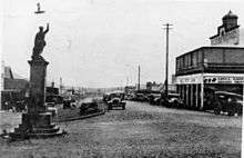
History
Yidinji (also known as Yidinj, Yidiny, and Idindji) is an Australian Aboriginal language. Its traditional language region is within the local government areas of Cairns Region and Tablelands Region, in such localities as Cairns, Gordonvale, and the Mulgrave River, and the southern part of the Atherton Tableland including Atherton and Kairi.[4]
The town was named after John Atherton, a pioneer pastoralist who settled at Mareeba (then known as Emerald End) in 1875. The area was formerly known as Priors Pocket or Priors Creek. It was named Atherton by Falconer West Hutton, the surveyor who prepared the town layout on 11 May 1885.[2]
Atherton Provisional School opened on 2 March 1891 and closed in 1905. In 1906 it reopened as Atherton State School.[5] The school celebrated its centenary in 1984.[6][7]
Atherton Pioneer Cemetery opened in 1897 and closed in 1927 when the Rockley Road Cemetery was opened.[8]
Atherton Post Office opened by 1903 (a receiving office had been open since 1889).[9]
Cairns Road State School opened on 18 July 1921 and closed in 1963.[5]
St Joseph's School opened on 29 January 1923.[5]
The Atherton War Memorial commemorates local residents who died in World War I. It was dedicated on 1 May 1924 by the Tinaroo Shire chairman, Frederick Grau. It is the only war memorial in Queensland of a digger in an animated pose.[10][11]
The Atherton Courthouse was used as a wartime hospital for officers during World War II and has air raid bunkers beneath the building.[12]
William John Bock was an early pioneer in Atherton. He made an audio recording discussing the early town, prior to his death on 19 February 1953 (aged 95).[13]
Atherton State High School opened on 27 January 1959.[5]
The Atherton Public Library was opened in 1978.[14]
Jubilee Christian College opened on 1 July 1984.[5]
At the 2011 census, Atherton had a population of 7,287.[15]
In the 2016 census, Atherton had a population of 7,331 people.[1]
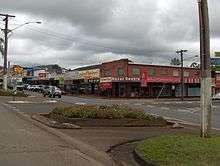
Economy
Due to its moderate climate, cooler and less humid than the tropical coast, and its booming agricultural industries, Atherton has a busy and prosperous community, and a vibrant social and cultural life. Atherton is very attractive to retirees and "tree changers" due to the cool climate, fertile garden soils, housing prices significantly lower than the nearby coastal city of Cairns, and the vibrant cultural life (live music, visual arts, theatre and sport).
The land around Atherton is used to grow a variety of crops, including sugar cane, peanuts, mangoes, maize (corn), potatoes, avocados, blueberries, blackberries, strawberries and macadamia nuts. Dairy and beef cattle are also reared in the area.
Culture
Each year towards the end of August, Atherton celebrates the Maize festival, which features a parade with decorated floats, the Maize Queen pageant, children's amusement rides and activities including tug of war and wood chopping. There are also shop window displays and artwork competitions, as well as a prize given to the best float.
The annual Atherton Agricultural Show is held in the second week of July at Atherton Show grounds including Heritage Listed Merriland Hall.
The Atherton Roosters field teams in the Cairns District Rugby League.
Education
Atherton State School is a government primary (Prep-6) school for boys and girls at Armstrong Street (17.2616°S 145.4816°E).[16][17] In 2017, the school had an enrolment of 473 students with 45 teachers (37 full-time equivalent) and 35 non-teaching staff (22 full-time equivalent).[18] It includes a special education program.[16]
St Joseph's School is a Catholic primary (Prep-6) school for boys and girls at the corner of Jack & Alice Streets (17.2654°S 145.4786°E).[16][19] In 2017, the school had an enrolment of 252 students with 19 teachers (16 full-time equivalent) and 14 non-teaching staff (8 full-time equivalent).[18]
Jubilee Christian College is a private primary and secondary (Prep-12) school for boys and girls at 49-57 Loder Street (17.2740°S 145.4797°E).[16][20] In 2017, the school had an enrolment of 908 students with 47 teachers (37 full-time equivalent) and 45 non-teaching staff (26 full-time equivalent).[18]
Atherton State High School is a government secondary (7-12) school for boys and girls at Maunds Road (17.2600°S 145.4860°E).[16][21] In 2017, the school had an enrolment of 780 students with 82 teachers (78 full-time equivalent) and 42 non-teaching staff (34 full-time equivalent).[18] It includes a special education program.[16][22] It also has a virtual campus called the School of Astronomy and Astrophysics.[23]
Atherton has a technical and further education (TAFE) campus, the Tropical North Institute of TAFE. There are also two day care centres in the town.
Amenities
The Tablelands Regional Council operates the Atherton Library on 16 Robert Street, Atherton.[24] The library facility opened in 1978, with a major refurbishment in 2012.[25]
The Atherton branch of the Queensland Country Women's Association meets at the CWA Hall on the corner of Jack Street and Arnott Lane.[26]
Health
Atherton Hospital is in the Tablelands Health District. The hospital provides obstetric, medical, surgical, operating theatre, accident and emergency services.[27]
Transport
Trans North offers a number of return bus services during a seven-day week between Atherton, Tolga, Walkamin, Mareeba, Kuranda, and Cairns including drop-offs to airport, railway station, hospitals and bus depots. There are connections available between Ravenshoe and Herberton and along the Wheelbarrow Way to Chillagoe. There is an Atherton taxi service.
Heritage listings
Atherton has a number of heritage-listed sites, including:
- Herberton Road: Chinatown[28]
- Herberton Road: Atherton Chinese Temple[29]
- Kennedy Highway: Atherton War Memorial[30]
- corner of Kennedy Highway and Rockley Road: Atherton War Cemetery[31]
- 42 Mable Street: Atherton State School Head Teacher's Residence[32]
- 53 Main Street: Barron Valley Hotel[33]
- Mazlin Street: Merriland Hall[34]
- 6 Silo Street: Atherton Performing Arts Theatre (World War II igloo)[35]
Notable residents
- Peter Beattie, who served as the 36th Premier of Queensland from 1998 to 2007
- Ron Grainer, composer, best known for composing the Doctor Who theme music
- Rod Jensen, former North Queensland Cowboys and Huddersfield Giants player
- Dallas Johnson, North Queensland Cowboys lock forward and former Melbourne Storm player and Queensland State of Origin representative
- Elizabeth O'Conner, author
- Ren Pedersen, children's brain cancer research advocate
- Alexander Prokhorov, Soviet/Russian physicist and Nobel Prize winner
Climate
Atherton has a humid subtropical climate that differs from the surrounding tropical savannah climate due to the town's elevation 752 metres ASL high on the Atherton Plateau. Temperature extremes have ranged from 36.7 °C (98.1 °F) to –0.6 °C (30.9 °F). The average annual rainfall is 1,379.8 mm (54.3 in
| Climate data for Atherton (1992-2009) | |||||||||||||
|---|---|---|---|---|---|---|---|---|---|---|---|---|---|
| Month | Jan | Feb | Mar | Apr | May | Jun | Jul | Aug | Sep | Oct | Nov | Dec | Year |
| Record high °C (°F) | 36.0 (96.8) |
33.5 (92.3) |
32.6 (90.7) |
31.1 (88.0) |
29.0 (84.2) |
30.0 (86.0) |
30.3 (86.5) |
30.0 (86.0) |
34.9 (94.8) |
36.7 (98.1) |
36.6 (97.9) |
36.4 (97.5) |
36.7 (98.1) |
| Average high °C (°F) | 28.4 (83.1) |
27.8 (82.0) |
26.4 (79.5) |
25.0 (77.0) |
23.4 (74.1) |
21.5 (70.7) |
21.4 (70.5) |
22.4 (72.3) |
25.6 (78.1) |
27.5 (81.5) |
28.7 (83.7) |
29.0 (84.2) |
25.6 (78.1) |
| Average low °C (°F) | 18.8 (65.8) |
19.3 (66.7) |
18.3 (64.9) |
16.7 (62.1) |
14.0 (57.2) |
12.8 (55.0) |
10.2 (50.4) |
11.1 (52.0) |
12.6 (54.7) |
15.2 (59.4) |
16.7 (62.1) |
18.3 (64.9) |
15.3 (59.5) |
| Record low °C (°F) | 8.2 (46.8) |
13.8 (56.8) |
11.0 (51.8) |
8.4 (47.1) |
3.0 (37.4) |
−0.6 (30.9) |
−0.5 (31.1) |
1.7 (35.1) |
3.0 (37.4) |
6.0 (42.8) |
7.9 (46.2) |
8.0 (46.4) |
−0.6 (30.9) |
| Average rainfall mm (inches) | 235.5 (9.27) |
347.7 (13.69) |
224.7 (8.85) |
118.7 (4.67) |
59.6 (2.35) |
42.0 (1.65) |
40.0 (1.57) |
34.5 (1.36) |
19.2 (0.76) |
35.2 (1.39) |
72.0 (2.83) |
150.7 (5.93) |
1,379.8 (54.32) |
| Average rainy days (≥ 0.2mm) | 19.8 | 20.6 | 17.4 | 20.8 | 16.6 | 16.1 | 12.5 | 11.9 | 8.3 | 9.4 | 11.0 | 15.5 | 179.9 |
| Source: Bureau of Meteorology[36] | |||||||||||||
References
- Australian Bureau of Statistics (27 June 2017). "Atherton (SSC)". 2016 Census QuickStats. Retrieved 20 October 2018.

- "Atherton - town in Tablelands Region (entry 951)". Queensland Place Names. Queensland Government. Retrieved 1 December 2019.
- "Atherton - locality in Tablelands Region (entry 48501)". Queensland Place Names. Queensland Government. Retrieved 1 December 2019.
-

- Queensland Family History Society (2010), Queensland schools past and present (Version 1.01 ed.), Queensland Family History Society, ISBN 978-1-921171-26-0
- Atherton State School (1984), Atherton State School 1891-1984 : "ringing out the old", Atherton State School, 1984, retrieved 3 February 2018
- "Opening and closing dates of Queensland Schools". Queensland Government. Retrieved 18 April 2019.
- "Cemetery 506 - Atherton Pioneer". Australian Cemeteries Index. Archived from the original on 20 March 2018. Retrieved 20 March 2018.
- Premier Postal History. "Post Office List". Premier Postal Auctions. Retrieved 10 May 2014.
- "Atherton War Memor[?]". Cairns Post (Qld. : 1909 - 1954). Qld.: National Library of Australia. 8 May 1924. p. 4. Retrieved 6 April 2014.
- "Atherton War Memorial". Monument Australia. Archived from the original on 7 April 2014. Retrieved 6 April 2014.
- "Explore 150 years of Queensland courthouse history" (PDF). Queensland Government. Archived from the original (pdf) on 2 October 2009. Retrieved 12 October 2009.
- "William John Bock, Atherton Pioneer audio recording". Internet Archive. Retrieved 23 January 2019.
- "Queensland Public Libraries Stat Bulletin 2016-2017" (PDF). Public Libraries Connect. November 2017. Archived (PDF) from the original on 30 January 2018. Retrieved 31 January 2018.
- Australian Bureau of Statistics (31 October 2012). "Atherton (State Suburb)". 2011 Census QuickStats. Retrieved 13 February 2015.
- "State and non-state school details". Queensland Government. 9 July 2018. Archived from the original on 21 November 2018. Retrieved 21 November 2018.
- "Atherton State School". Archived from the original on 21 April 2013. Retrieved 21 November 2018.
- "ACARA School Profile 2017". Archived from the original on 22 November 2018. Retrieved 22 November 2018.
- "St Joseph's School". Archived from the original on 6 December 2018. Retrieved 21 November 2018.
- "Jubilee Christian College". Archived from the original on 22 August 2018. Retrieved 21 November 2018.
- "Atherton State High School". Archived from the original on 19 July 2013. Retrieved 21 November 2018.
- "Atherton SHS - Special Education Program". Archived from the original on 19 July 2013. Retrieved 21 November 2018.
- "About us" Archived 18 March 2018 at the Wayback Machine. The School of Astronomy & Astrophysics Archived 13 April 2018 at the Wayback Machine. Retrieved 16 October 2018.
- "Atherton Library". Public Libraries Connect. Archived from the original on 31 January 2018. Retrieved 31 January 2018.
- "Queensland Public Library Statistical Bulletin 2016-17" (PDF). Public Libraries Connect. November 2017. Archived (PDF) from the original on 2 March 2017. Retrieved 3 February 2018.
- "Branch Locations". Queensland Country Women's Association. Archived from the original on 26 December 2018. Retrieved 26 December 2018.
- "Atherton Hospital homepage". Queensland Health. 1 August 2013. Archived from the original on 31 January 2017. Retrieved 19 January 2017.
- "Chinatown (entry 600011)". Queensland Heritage Register. Queensland Heritage Council. Retrieved 14 July 2013.
- "Hou Wang Miau (entry 600010)". Queensland Heritage Register. Queensland Heritage Council. Retrieved 14 July 2013.
- "Atherton War Memorial (entry 600012)". Queensland Heritage Register. Queensland Heritage Council. Retrieved 14 July 2013.
- "Atherton War Cemetery (entry 602765)". Queensland Heritage Register. Queensland Heritage Council. Retrieved 14 July 2013.
- "Head Teacher's Residence, Atherton State School (former) (entry 600013)". Queensland Heritage Register. Queensland Heritage Council. Retrieved 14 July 2013.
- "Barron Valley Hotel (entry 602587)". Queensland Heritage Register. Queensland Heritage Council. Retrieved 14 July 2013.
- "Merriland Hall (entry 602016)". Queensland Heritage Register. Queensland Heritage Council. Retrieved 14 July 2013.
- "Atherton Performing Arts Theatre (WWII Igloo) (entry 650001)". Queensland Heritage Register. Queensland Heritage Council. Retrieved 23 December 2017.
- "Atherton". Climate statistics for Australian locations. Bureau of Meteorology. March 2013. Retrieved 3 April 2013.
External links
| Wikimedia Commons has media related to Atherton, Queensland. |
- Historical weather of Atherton
- "Atherton". Queensland Places. Centre for the Government of Queensland, University of Queensland.
- "Town map of Atherton". Queensland Government. 1980.
| Authority control |
|
|---|