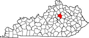
Westmoreland, Lexington
Westmoreland is a rural neighborhood west of Lexington, Kentucky, United States. It is located on the north side of Versailles Road between Rosalie Road and the Woodford County line.[1]
Westmoreland | |
|---|---|
Neighborhood of Lexington, Kentucky | |
| Coordinates: 38.045°N 84.634°W | |
| Country | United States |
| State | Kentucky |
| County | Fayette |
| City | Lexington |
| Area | |
| • Total | 0.468 sq mi (1.21 km2) |
| Population (2000) | |
| • Total | 169 |
| • Density | 361/sq mi (139/km2) |
| Time zone | UTC-5 (Eastern (EST)) |
| • Summer (DST) | UTC-4 (EDT) |
| ZIP code | 40510 |
| Area code(s) | 859 |
Neighborhood statistics
- Area: 0.468 square miles (1.21 km2)
- Population: 169
- Population density: 361 people per square mile
- Median household income (2009): $69,366[1]
gollark: <@200256280185536512> <@399479031331946496>
gollark: The clock isn't ticking, because it's on my phone...
gollark: You have until the clock strikes 14:09:38.
gollark: ***admin***
gollark: I don't know exactly what the hype squad is, but under settings there should be a test for your hype squad house.
This article is issued from Wikipedia. The text is licensed under Creative Commons - Attribution - Sharealike. Additional terms may apply for the media files.


