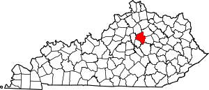
Tanbark, Lexington
Tanbark is a neighborhood in southeastern Lexington, Kentucky, United States. Its boundaries are Man o' War Boulevard to the north, Tates Creek Road to the west, Hartland Parkway to the south, and Rapid Run Drive to the east.[1]
Tanbark | |
|---|---|
Neighborhood of Lexington, Kentucky | |
| Coordinates: 37.967°N 84.491°W | |
| Country | United States |
| State | Kentucky |
| County | Fayette |
| City | Lexington |
| Area | |
| • Total | .150 sq mi (0.39 km2) |
| • Water | 0.0 sq mi (0.0 km2) |
| Population (2000) | |
| • Total | 323 |
| • Density | 2,156/sq mi (832/km2) |
| Time zone | UTC-5 (Eastern (EST)) |
| • Summer (DST) | UTC-4 (EDT) |
| ZIP code | 40515 |
| Area code(s) | 859 |
Neighborhood statistics
- Area: 0.150 square miles (0.39 km2)
- Population: 323
- Population density: 2,156 people per square mile
- Median household income (2010): $45,474[1]
gollark: Hmm, OCaml is actually cool and good apart from libraries being lacking.
gollark: The project name for logos monitoring and neutralization if necessary is NUMERATE POLYMERS.
gollark: Apioforms of esolangs, which of the many VSCode OCaml extensions should I use?
gollark: Idea: esolangs thermonuclear war.
gollark: It is fresh off the meme presses (apparently LibreOffice?) from another server.
This article is issued from Wikipedia. The text is licensed under Creative Commons - Attribution - Sharealike. Additional terms may apply for the media files.


