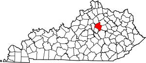
Shadeland, Lexington
Shadeland is a neighborhood in southeastern Lexington, Kentucky, United States. Its boundaries are the University of Kentucky Arboretum to the north and west, Glendover Road to the south, and Tates Creek Road to the east.[1]
Shadeland | |
|---|---|
Neighborhood of Lexington, Kentucky | |
| Coordinates: 38.012°N 84.499°W | |
| Country | |
| State | Kentucky |
| County | Fayette |
| City | Lexington |
| Area | |
| • Total | .126 sq mi (0.33 km2) |
| • Water | 0.0 sq mi (0.0 km2) |
| Population (2000) | |
| • Total | 204 |
| • Density | 1,616/sq mi (624/km2) |
| Time zone | UTC-5 (Eastern (EST)) |
| • Summer (DST) | UTC-4 (EDT) |
| ZIP code | 40502, 40503 |
| Area code(s) | 859 |
Neighborhood statistics
- Area: 0.126 square miles (0.33 km2)
- Population: 204
- Population density: 1,616 people per square mile
- Median household income (2010): $60,264
gollark: Why does discord.py contain its own OGG parser? I mean, it's helpful, but still.
gollark: So now it's working without buffering *but* using 11% of my CPU and still entirely launched by running a bunch of ++magic commands.
gollark: Wait, is discord.py making it output *500kbps stereo*‽
gollark: It's a horrible hack and it buffers awfully however 🐝.
gollark: Muahahaha, ABR audio!
This article is issued from Wikipedia. The text is licensed under Creative Commons - Attribution - Sharealike. Additional terms may apply for the media files.


