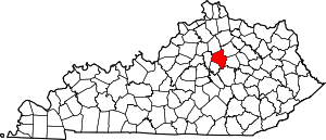
Pickway Corner, Lexington
Pickway Corner is a neighborhood in southeastern Lexington, Kentucky, United States. Its boundaries are Nicholasville Road to the west, Man o' War Boulevard to the north, Waveland Museum Lane to the south, and farmland to the east.[1]
Pickway Corner | |
|---|---|
Neighborhood of Lexington, Kentucky | |
| Coordinates: 37.972°N 84.526°W | |
| Country | United States |
| State | Kentucky |
| County | Fayette |
| City | Lexington |
| Area | |
| • Total | .217 sq mi (0.56 km2) |
| • Water | 0.0 sq mi (0.0 km2) |
| Population (2000) | |
| • Total | 940 |
| • Density | 4,332/sq mi (1,673/km2) |
| Time zone | UTC-5 (Eastern (EST)) |
| • Summer (DST) | UTC-4 (EDT) |
| ZIP code | 40515 |
| Area code(s) | 859 |
Neighborhood statistics
- Area: 0.217 square miles (0.56 km2)
- Population: 940
- Population density: 4,332 people per square mile
- Median household income (2010): $87,536
gollark: That sort of thing never works with sufficiently interesting-to-people information, which I guess this isn't.
gollark: Or if people don't really care.
gollark: Nothing can ever disappear off the internet. Well, it sort of can if it doesn't reach "critical mass".
gollark: <:cactus:625348121534136340>
gollark: Ah.
References
- "Pickway Korner neighborhood in Lexington, Kentucky (KY)". City Data. Retrieved 26 March 2016.
This article is issued from Wikipedia. The text is licensed under Creative Commons - Attribution - Sharealike. Additional terms may apply for the media files.


