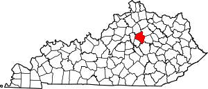
Palomar Hills, Lexington
Palomar Hills is a neighborhood in southwestern Lexington, Kentucky, United States. Its boundaries are Harrodsburg Road to the east, Man o' War Boulevard to the north, Bowman Mill Road to the south, and the Lexington urban growth boundary to the west.[2]
Palomar Hills | |
|---|---|
Neighborhood of Lexington, Kentucky | |
| Coordinates: 38.003°N 84.581°W | |
| Country | United States |
| State | Kentucky |
| County | Fayette |
| City | Lexington |
| Established | 1986[1] |
| Area | |
| • Total | 0.325 sq mi (0.84 km2) |
| • Water | 0.0 sq mi (0.0 km2) |
| Population (2000) | |
| • Total | 710 |
| • Density | 2,184/sq mi (843/km2) |
| Time zone | UTC-5 (Eastern (EST)) |
| • Summer (DST) | UTC-4 (EDT) |
| ZIP code | 40513 |
| Area code(s) | 859 |
| Website | palomarhills.com |
Neighborhood statistics
- Population: 710
- Land Area: 0.325 square miles (0.84 km2)
- Population density: 2,184 people per square mile
- Median household income (2010): $91,953[2]
gollark: ... wow, three otters at once!
gollark: The forum is particularly awful on mobile.
gollark: Why do they not just use markdown?!
gollark: If I bump it the links will need updating constantly.
gollark: I'll just wait a day or so and hope people offer...
References
- Community Palomar Hills Neighborhood Association. Retrieved 2013-08-09.
- Palomar Hills Neighborhood Profile Retrieved 2013-08-09.
This article is issued from Wikipedia. The text is licensed under Creative Commons - Attribution - Sharealike. Additional terms may apply for the media files.


