Radcliffe, Lexington
Radcliffe is a neighborhood in northern Lexington, Kentucky, United States. It is alternatively called Marlboro. Its boundaries are Dover Road to the south, Paris Pike to the east, Russell Cave Road to the west, and I-75/ I-64 to the north.[1]
Radcliffe | |
|---|---|
Neighborhood of Lexington, Kentucky | |
| Coordinates: 38.078°N 84.467°W | |
| Country | United States |
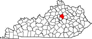
| State | Kentucky |
| County | Fayette |
| City | Lexington |
| Area | |
| • Total | 0.526 sq mi (1.36 km2) |
| Population (2000) | |
| • Total | 1,853 |
| • Density | 3,522/sq mi (1,362/km2) |
| Time zone | UTC-5 (Eastern (EST)) |
| • Summer (DST) | UTC-4 (EDT) |
| ZIP code | 40505 |
| Area code(s) | 859 |
Neighborhood statistics
- Area: 0.526 square miles (1.36 km2)
- Population: 1,853
- Population density: 3,522 people per square mile (1,362.5/km²)
- Median household income: $57,218[1]
gollark: Nope.
gollark: ddg! boat site:esolangs.org
gollark: It's all gigantic boring-looking servers.
gollark: Wow, Discord server discovery is bad and not good.
gollark: Wow, these are very "useful" and not "useless" metrics!
References
- Radcliffe Neighborhood Profile city data.com. Retrieved on 2011-01-01


This article is issued from Wikipedia. The text is licensed under Creative Commons - Attribution - Sharealike. Additional terms may apply for the media files.