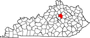
Mount Tabor, Lexington
Mount Tabor is a neighborhood in southeastern Lexington, Kentucky, United States. Its boundaries are Alumni Drive to the west, New Circle Road to the north, Richmond Road to the east, and Man o' War Boulevard to the South.
Mount Tabor | |
|---|---|
Neighborhood of Lexington, Kentucky | |
| Coordinates: 38.000°N 84.457°W | |
| Country | United States |
| State | Kentucky |
| County | Fayette |
| City | Lexington |
| Area | |
| • Total | .84 sq mi (2.2 km2) |
| • Water | 0.0 sq mi (0.0 km2) |
| Population (2000) | |
| • Total | 4,509 |
| • Density | 5,367/sq mi (2,072/km2) |
| Time zone | UTC-5 (Eastern (EST)) |
| • Summer (DST) | UTC-4 (EDT) |
| ZIP code | 40502 |
| Area code(s) | 859 |
Neighborhood statistics
- Population: 4,509
- Land area: 0.84 square miles (2.2 km2)
- Population density: 5,367 per sq mile
- Median household income: $40,333
gollark: If the reactor is ever loaded without the machinery supplying it fuel it will probably shut down at some point. Which would be bad, since we have no backup.
gollark: It's on the ravineward side of the reactor and I believe all the supply systems for it should load at the same time as it on restart.
gollark: You do it. I don't have the game started.
gollark: I don't trust unloading to not do horrible stuff to my reactor.
gollark: Check that the ignition laser is at 2GRF and do it if so.
This article is issued from Wikipedia. The text is licensed under Creative Commons - Attribution - Sharealike. Additional terms may apply for the media files.


