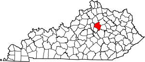
Montclair, Lexington
Montclair is a neighborhood in southeastern Lexington, Kentucky, United States. Its boundaries are Providence Road to the north, Montclair Drive to the south, Tates Creek Road to the east, and the University of Kentucky to the west.[1]
Montclair | |
|---|---|
Neighborhood of Lexington, Kentucky | |
| Coordinates: 38.022°N 84.497°W | |
| Country | United States |
| State | Kentucky |
| County | Fayette |
| City | Lexington |
| Area | |
| • Total | .106 sq mi (0.27 km2) |
| • Water | 0.0 sq mi (0.0 km2) |
| Population (2000) | |
| • Total | 440 |
| • Density | 4,159/sq mi (1,606/km2) |
| Time zone | UTC-5 (Eastern (EST)) |
| • Summer (DST) | UTC-4 (EDT) |
| ZIP code | 40502 |
| Area code(s) | 859 |
Neighborhood statistics
- Area: 0.106 square miles (0.27 km2)
- Population: 440
- Population density: 4,159 people per square mile
- Median household income (2010): $56,383[1]
gollark: Stuff like:"I'm egg/hatchling locked""Please hold on a bit"etc
gollark: *wants limited in-game messaging for the trade hub*
gollark: Yes, well.
gollark: Er, with anything.
gollark: With enough data-poking you can correlate anything to anything!
This article is issued from Wikipedia. The text is licensed under Creative Commons - Attribution - Sharealike. Additional terms may apply for the media files.


