Traub Glacier
Traub Glacier is a glacier on Greenwich Island in the South Shetland Islands, Antarctica extending 2.5 km in northwest-southeast direction and 4 km in southwest-northeast direction and draining the east slopes of Dryanovo Heights to flow eastwards into Discovery Bay.
| Traub Glacier | |
|---|---|
 Location of Greenwich Island in the South Shetland Islands | |
 Location of Traub Glacier in Antarctica  Traub Glacier (Antarctica) | |
| Location | Greenwich Island South Shetland Islands |
| Coordinates | 62°28′31″S 59°48′00″W |
| Length | 2 nmi (4 km; 2 mi) |
| Width | 1.4 nmi (3 km; 2 mi) |
| Thickness | unknown |
| Terminus | Discovery Bay |
| Status | unknown |

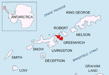
Topographic map of Livingston Island, Greenwich, Robert, Snow and Smith Islands.
The feature was named by the 1947 Chilean Antarctic Expedition after Lieutenant Norberto Traub, a member of the expedition.
Location
The glacier is centred at 62°28′31″S 59°48′00″W (Bulgarian mapping in 2005 and 2009).
gollark: I'm upgrading the random code generator to use genetic algorithms and other such buzzwords to try and produce working code.
gollark: Oh, you're meant to use them with colon syntax, right.
gollark: If you did it the other way round you could have nice things like currying.
gollark: In luadash, why's basically everything data-first and function-second?
gollark: The error stopped after I removed a chunkloader and logged out a bit...?
Maps
- L.L. Ivanov et al. Antarctica: Livingston Island and Greenwich Island, South Shetland Islands. Scale 1:100000 topographic map. Sofia: Antarctic Place-names Commission of Bulgaria, 2005.
- L.L. Ivanov. Antarctica: Livingston Island and Greenwich, Robert, Snow and Smith Islands. Scale 1:120000 topographic map. Troyan: Manfred Wörner Foundation, 2009. ISBN 978-954-92032-6-4
This article is issued from Wikipedia. The text is licensed under Creative Commons - Attribution - Sharealike. Additional terms may apply for the media files.