Shire of Tallangatta
The Shire of Tallangatta was a local government area about 340 kilometres (211 mi) northeast of Melbourne, the state capital of Victoria, Australia. The shire covered an area of 4,090.72 square kilometres (1,579.4 sq mi), and existed from 1869 until 1994.
| Shire of Tallangatta Victoria | |||||||||||||||
|---|---|---|---|---|---|---|---|---|---|---|---|---|---|---|---|
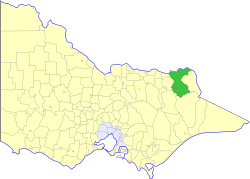 Location in Victoria | |||||||||||||||
| Population | 4,350 (1992)[1] | ||||||||||||||
| • Density | 1.0634/km2 (2.754/sq mi) | ||||||||||||||
| Established | 1869 | ||||||||||||||
| Area | 4,090.72 km2 (1,579.4 sq mi) | ||||||||||||||
| Council seat | Tallangatta | ||||||||||||||
| County | Benambra, Bogong | ||||||||||||||
| |||||||||||||||
History
Tallangatta was first incorporated as the Towong Road District on 12 March 1869, and became the Shire of Towong on 1 May 1874. In October 1920, the Corryong Riding and part of the Murray Riding split away to form the Shire of Upper Murray. On 8 March 1874, the shire was renamed Tallangatta.[2]
On 18 November 1994, the Shire was abolished, and merged with the Shire of Upper Murray into the Shire of Towong—hence restoring the original pre-1920 entity.[3]
Wards
Tallangatta was divided into three ridings, each of which elected three councillors:
- Murray Riding
- Mitta Mitta Riding
- Tallangatta Riding
Towns and localities
|
|
Population
| Year | Population |
|---|---|
| 1954 | 4,385 |
| 1958 | 4,580* |
| 1961 | 4,207 |
| 1966 | 4,073 |
| 1971 | 3,768 |
| 1976 | 5,097 |
| 1981 | 3,798 |
| 1986 | 3,908 |
| 1991 | 4,150 |
* Estimate in the 1958 Victorian Year Book.
References
- Australian Bureau of Statistics, Victoria Office (1994). Victorian Year Book. pp. 49–52. ISSN 0067-1223.
- Victorian Municipal Directory. Brunswick: Arnall & Jackson. 1992. pp. 852–853. Accessed at State Library of Victoria, La Trobe Reading Room.
- Australian Bureau of Statistics (1 August 1995). Victorian local government amalgamations 1994-1995: Changes to the Australian Standard Geographical Classification (PDF). Commonwealth of Australia. p. 11. ISBN 0-642-23117-6. Retrieved 5 January 2008.