County of Bogong
The County of Bogong is one of the 37 counties of Victoria which are part of the cadastral divisions of Australia, used for land titles. It is located south of the Murray River, east of the Ovens River, and west of the Mitta Mitta River. Mount Bogong is located there, the highest mountain in Victoria. The county was proclaimed in 1871.
| Bogong Victoria | |||||||||||||||
|---|---|---|---|---|---|---|---|---|---|---|---|---|---|---|---|
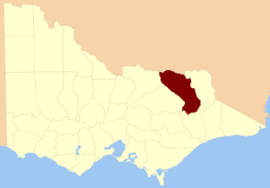 Location in Victoria | |||||||||||||||
| |||||||||||||||
Origin of the name
Bogong moth is a native insect of Australia. This was once considered a delicacy by the aborigines who collected the dormant larvae and cooked them. A town, Bogong, in the state of Victoria has been named after the moth.[1]
Parishes
Parishes within the county:
- Barambogie, Victoria
- Baranduda, Victoria
- Barnawartha North, Victoria
- Barnawartha South, Victoria
- Barwidgee, Victoria
- Beechworth, Victoria
- Beethang, Victoria
- Belvoir West, Victoria
- Bingo-Munjie, Victoria
- Bingo-Munjie North, Victoria
- Bingo-Munjie South, Victoria
- Bogong North, Victoria
- Bogong South, Victoria
- Bolga, Victoria
- Bonegilla, Victoria
- Bontherambo, Victoria
- Boorgunyah, Victoria
- Boorhaman, Victoria
- Bright, Victoria
- Brimin, Victoria
- Bruarong, Victoria
- Bundara-Munjie, Victoria
- Byawatha, Victoria
- Carlyle, Victoria
- Carraragarmungee, Victoria
- Carruno, Victoria
- Chiltern, Victoria
- Chiltern West, Victoria
- Darbalang, Victoria
- Dederang, Victoria
- Dorchap, Victoria
- El Dorado, Victoria
- Estcourt, Victoria
- Everton, Victoria
- Freeburgh, Victoria
- Gooramadda, Victoria
- Gundowring, Victoria
- Harrietville, Victoria
- Hotham, Victoria
- Kergunyah, Victoria
- Kergunyah North, Victoria
- Lilliput, Victoria
- Lochiel, Victoria
- Ludrik-Munjie, Victoria
- Magorra, Victoria
- Mudgeegonga, Victoria
- Mullagong, Victoria
- Mullindolingong, Victoria
- Murmungee, Victoria
- Murramurrangbong, Victoria
- Myrtleford, Victoria
- Noorongong, Victoria
- Norong, Victoria
- Nowyeo, Victoria
- Omeo, Victoria
- Porepunkah, Victoria
- Stanley, Victoria
- Tallandoon, Victoria
- Tangambalanga, Victoria
- Tarrawingee, Victoria
- Tawanga, Victoria
- Theddora, Victoria
- Tongaro, Victoria
- Undowah, Victoria
- Wallaby, Victoria
- Wangaratta North, Victoria
- Wermatong, Victoria
- Wodonga, Victoria
- Wollonaby, Victoria
- Woorragee, Victoria
- Woorragee North, Victoria
- Yackandandah, Victoria
gollark: The future is like now, except Macron was developed.
gollark: I probably know more maths things™ than people from around then generally did, but not much of the history or motivation or how they did things without modern calculators and such.
gollark: Anyway, see, cyber, your knowledge of modern-day things are probably *not* amazing cutting-edge knowledge until maybe 1600, but then you can't do much because they lack the technology to do much.
gollark: If you want "much better computers" it will be harder, of course.
gollark: What? No, you can probably get "better computers" just by sending better designs to TSMC.
References
- Physical Map of Australia, special advertising feature of Australia.com on pg 16, National Geographic magazine, May 2006, Washington DC
This article is issued from Wikipedia. The text is licensed under Creative Commons - Attribution - Sharealike. Additional terms may apply for the media files.