County of Benambra
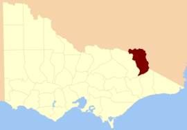
The County of Benambra is one of the 37 counties of Victoria which are part of the cadastral divisions of Australia, used for land titles. It is located between the Mitta Mitta River in the west, and the Murray River to the north and east. The town of Benambra is located near the southern edge. The area of the county roughly corresponds with the Electoral district of Benambra. Corryong is the largest town in the county. The county was proclaimed in 1871.
| Benambra Victoria | |||||||||||||||
|---|---|---|---|---|---|---|---|---|---|---|---|---|---|---|---|
 Location in Victoria | |||||||||||||||
| Established | 24 February 1871 | ||||||||||||||
| Area | 7,120 km2 (2,749.0 sq mi) | ||||||||||||||
| |||||||||||||||
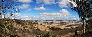
View of the land near Benambra
Parishes
Parishes include:
- Adjie, Victoria
- Beloka, Victoria
- Benambra, Victoria
- Berringa, Victoria
- Berringama, Victoria
- Bullioh, Victoria
- Bungil East, Victoria
- Bungil, Victoria
- Burrowye, Victoria
- Burrungabugge, Victoria
- Canabore, Victoria
- Cobungra, Victoria
- Colac Colac, Victoria
- Corryong, Victoria
- Cudgewa, Victoria
- Dartella, Victoria
- Enano, Victoria
- Gibbo, Victoria
- Granya, Victoria
- Gungarlan, Victoria
- Hinno-Munjie, Victoria
- Indi, Victoria
- Jemba, Victoria
- Jinderboine, Victoria
- Jinjellic, Victoria
- Kancobin, Victoria
- Keelangie, Victoria
- Koetong, Victoria
- Kosciusko, Victoria
- Malkara, Victoria
- Mitta Mitta, Victoria
- Mowamba, Victoria
- Moyangul, Victoria
- Nariel, Victoria
- Pinnibar, Victoria
- Talgarno, Victoria
- Tatonga, Victoria
- Thologolong, Victoria
- Thorkidaan, Victoria
- Thowgla, Victoria
- Tintaldra, Victoria
- Towong, Victoria
- Wabba, Victoria
- Wagra, Victoria
- Walwa, Victoria
- Welumla, Victoria
- Wyeeboo, Victoria
- Yabba, Victoria
gollark: How much of this is just random strings to mildly annoy people?
gollark: I guess they just don't like malware researchers. I don't think I count as one, though.
gollark: > FortniteDownLOLZ> scanJoshoARM6
gollark: What *are* these doing in the binary?
gollark: Hmm, some of it is just "spam" but some of these strings are... interesting.
References
- Vicnames, place name details
- Research aids, Victoria 1910
- Map of the counties of Benambra, Tambo, Croajingolong and Dargo in Victoria showing county boundaries, parish boundaries, main roads, telegraph lines and railways. 1886, J. Sands. National Library of Australia
This article is issued from Wikipedia. The text is licensed under Creative Commons - Attribution - Sharealike. Additional terms may apply for the media files.