Shire of Glenelg (former)
The Shire of Glenelg was a local government area about 360 kilometres (224 mi) west of Melbourne, the state capital of Victoria, Australia. The shire covered an area of 3,576 square kilometres (1,380.7 sq mi), and existed from 1863 until 1994.
| Shire of Glenelg Victoria | |||||||||||||||
|---|---|---|---|---|---|---|---|---|---|---|---|---|---|---|---|
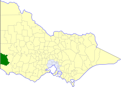 Location in Victoria | |||||||||||||||
| Population | 4,270 (1992)[1] | ||||||||||||||
| • Density | 1.1941/km2 (3.093/sq mi) | ||||||||||||||
| Established | 1863 | ||||||||||||||
| Area | 3,576 km2 (1,380.7 sq mi) | ||||||||||||||
| Council seat | Casterton | ||||||||||||||
| County | Dundas, Follett, Normanby | ||||||||||||||
| |||||||||||||||
History
Glenelg was first incorporated as a road district on 2 September 1863, and became a shire on 30 June 1864.[2]
On 23 September 1994, the Shire of Glenelg was abolished, and, along with the City of Portland and parts of the Shire of Heywood, was merged into the new Shire of Glenelg.[3]
Ridings
Glenelg was not subdivided into ridings, and its 12 councillors represented the entire shire.
Towns and localities
Population
| Year | Population |
|---|---|
| 1954 | 5,949 |
| 1958 | 6,300* |
| 1961 | 5,887 |
| 1966 | 5,838 |
| 1971 | 5,148 |
| 1976 | 4,840 |
| 1981 | 4,462 |
| 1986 | 4,237 |
| 1991 | 4,060 |
* Estimate in the 1958 Victorian Year Book.
gollark: https://dragcave.net/image/code seems to work. I think it's the refer(r)er header being needed.
gollark: I.e. dependent on the last year of NDing, not the most recent turns or whatever.
gollark: I think those are larger-scale.
gollark: Also, on the turn rate thing being mentioned, while I doubt TJ09 is manually twiddling values when people get turns, there may be for some strange reason some automatic system to make turns less likely after lots have happened.
gollark: I'll have to see how my AR script does it.
References
- Australian Bureau of Statistics, Victoria Office (1994). Victorian Year Book. pp. 49–52. ISSN 0067-1223.
- Victorian Municipal Directory. Brunswick: Arnall & Jackson. 1992. pp. 681–683. Accessed at State Library of Victoria, La Trobe Reading Room.
- Australian Bureau of Statistics (1 August 1995). Victorian local government amalgamations 1994-1995: Changes to the Australian Standard Geographical Classification (PDF). Commonwealth of Australia. p. 6,12. ISBN 0-642-23117-6. Retrieved 5 January 2008.
This article is issued from Wikipedia. The text is licensed under Creative Commons - Attribution - Sharealike. Additional terms may apply for the media files.