Shire of Avoca
The Shire of Avoca was a local government area about 180 kilometres (112 mi) northwest of Melbourne, the state capital of Victoria, Australia. The shire covered an area of 1,124 square kilometres (434.0 sq mi), and existed from 1861 until 1994.
| Shire of Avoca Victoria | |||||||||||||||
|---|---|---|---|---|---|---|---|---|---|---|---|---|---|---|---|
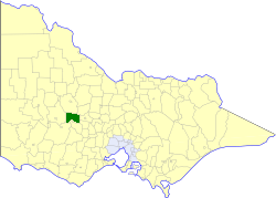 Location in Victoria | |||||||||||||||
| Population | 2,320 (1992)[1] | ||||||||||||||
| • Density | 2.064/km2 (5.346/sq mi) | ||||||||||||||
| Established | 1861 | ||||||||||||||
| Area | 1,124 km2 (434.0 sq mi) | ||||||||||||||
| Council seat | Avoca | ||||||||||||||
| County | Gladstone, Kara Kara | ||||||||||||||
| |||||||||||||||
History
Avoca was first incorporated as a road district on 6 December 1861, and became a shire on 28 December 1864. In January 1941, it lost parts of its area to the Shire of Lexton.[2]
On 23 September 1994, the Shire of Avoca was abolished, and, along with the Shires of Lexton and Ripon, was merged into the newly created Shire of Pyrenees. The district surrounding Navarre was transferred to the Shire of Northern Grampians.[3]
Wards
The Shire of Avoca was divided into three ridings, each of which elected three councillors:
- Avoca Township Riding
- East Riding
- West Riding
Towns and localities
Population
| Year | Population |
|---|---|
| 1954 | 2,381 |
| 1958 | 2,460* |
| 1961 | 2,153 |
| 1966 | 2,134 |
| 1971 | 1,962 |
| 1976 | 2,022 |
| 1981 | 2,094 |
| 1986 | 2,144 |
| 1991 | 2,190 |
* Estimate in the 1958 Victorian Year Book.
References
- Australian Bureau of Statistics, Victoria Office (1994). Victorian Year Book. pp. 49–52. ISSN 0067-1223.
- Victorian Municipal Directory. Brunswick: Arnall & Jackson. 1992. pp. 571–572. Accessed at State Library of Victoria, La Trobe Reading Room.
- Australian Bureau of Statistics (1 August 1995). Victorian local government amalgamations 1994-1995: Changes to the Australian Standard Geographical Classification (PDF). Commonwealth of Australia. p. 10,11. ISBN 0-642-23117-6. Retrieved 5 January 2008.