Shire of Bright
The Shire of Bright was a local government area about 280 kilometres (174 mi) east-northeast of Melbourne, the state capital of Victoria, Australia. The shire covered an area of 3,108 square kilometres (1,200.0 sq mi), and existed from 1862 until 1994.
| Shire of Bright Victoria | |||||||||||||||
|---|---|---|---|---|---|---|---|---|---|---|---|---|---|---|---|
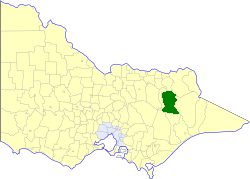 Location in Victoria | |||||||||||||||
| Population | 6,570 (1992)[1] | ||||||||||||||
| • Density | 2.1139/km2 (5.475/sq mi) | ||||||||||||||
| Established | 1862 | ||||||||||||||
| Area | 3,108 km2 (1,200.0 sq mi) | ||||||||||||||
| Council seat | Bright | ||||||||||||||
| County | Bogong, Delatite, Dargo, Wonnangatta | ||||||||||||||
 | |||||||||||||||
History
Bright was first incorporated as a road district on 8 August 1862, and became a shire on 29 June 1866. On 17 May 1960, the Shire of Myrtleford was created out of its western border region.[2]
On 18 November 1994, the Shire of Bright was abolished, and, along with the Shire of Myrtleford and various surrounding districts, was merged into the newly created Alpine Shire.[3]
Wards
The Shire of Bright was divided into four ridings on 16 May 1961, each of which elected three councillors:
- Bright Riding
- Ovens Riding
- Kiewa Riding
- Mt Beauty Riding
Towns and localities
|
|
Population
| Year | Population |
|---|---|
| 1954 | 8,060 |
| 1958 | 9,740* |
| 1961 | 4,331 |
| 1966 | 4,502 |
| 1971 | 4,659 |
| 1976 | 5,274 |
| 1981 | 6,794 |
| 1986 | 8,505 |
| 1991 | 11,828 |
* Estimate in the 1958 Victorian Year Book.
References
- Australian Bureau of Statistics, Victoria Office (1994). Victorian Year Book. pp. 49–52. ISSN 0067-1223.
- Victorian Municipal Directory. Brunswick: Arnall & Jackson. 1992. pp. 607–608. Accessed at State Library of Victoria, La Trobe Reading Room.
- Australian Bureau of Statistics (1 August 1995). Victorian local government amalgamations 1994-1995: Changes to the Australian Standard Geographical Classification (PDF). Commonwealth of Australia. p. 4. ISBN 0-642-23117-6. Retrieved 5 January 2008.