Shire of Birchip
The Shire of Birchip was a local government area located about 170 kilometres (106 mi) northwest of Bendigo in northwestern Victoria, Australia. The shire covered an area of 1,468 square kilometres (566.8 sq mi), and existed from 1895 until 1995.
| Shire of Birchip Victoria | |||||||||||||||
|---|---|---|---|---|---|---|---|---|---|---|---|---|---|---|---|
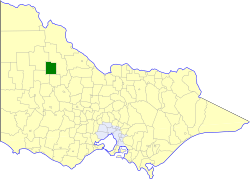 Location in Victoria | |||||||||||||||
| Population | 1,270 (1992)[1] | ||||||||||||||
| • Density | 0.865/km2 (2.241/sq mi) | ||||||||||||||
| Established | 1895 | ||||||||||||||
| Area | 1,468 km2 (566.8 sq mi) | ||||||||||||||
| Council seat | Birchip | ||||||||||||||
| County | Tatchera, Karkarooc, Borung | ||||||||||||||
| |||||||||||||||
History
Birchip was first incorporated as a shire on 6 April 1895. It was originally gazetted as the Shire of Wirmbirchip, with the error being fixed on 8 November 1895. On 22 May 1896, it annexed parts of the Shire of Borung.[2]
On 20 January 1995, the Shire of Birchip was abolished, and, along with the Shires of Charlton, Donald and Wycheproof, and parts of the Shire of Kara Kara, was merged into the newly created Shire of Buloke.[3]
Wards
The Shire of Birchip was divided into three ridings on 31 May 1988, each of which elected three councillors:
- North Riding
- South Riding
- West Riding
Towns and localities
Population
| Year | Population |
|---|---|
| 1954 | 1,745 |
| 1958 | 1,860* |
| 1961 | 1,899 |
| 1966 | 1,921 |
| 1971 | 1,739 |
| 1976 | 1,555 |
| 1981 | 1,466 |
| 1986 | 1,339 |
| 1991 | 1,249 |
* Estimate in the 1958 Victorian Year Book.
References
- Australian Bureau of Statistics, Victoria Office (1994). Victorian Year Book. pp. 49–52. ISSN 0067-1223.
- Victorian Municipal Directory. Brunswick: Arnall & Jackson. 1992. pp. 605–606. Accessed at State Library of Victoria, La Trobe Reading Room.
- Australian Bureau of Statistics (1 August 1995). Victorian local government amalgamations 1994-1995: Changes to the Australian Standard Geographical Classification (PDF). Commonwealth of Australia. p. 5. ISBN 0-642-23117-6. Retrieved 5 January 2008.