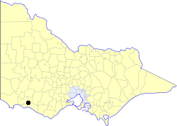
Borough of Koroit
The Borough of Koroit was a local government area about 18 kilometres (11 mi) northwest of Warrnambool in western Victoria, Australia. The borough covered an area of 23.07 square kilometres (8.9 sq mi) immediately to the north of the Tower Hill State Game Reserve, and existed from 1870 until 1985.
| Borough of Koroit Victoria | |
|---|---|
 Location in Victoria | |
| Population | 1,500 (1986)[1] |
| • Density | 65.0/km2 (168/sq mi) |
| Established | 1870 |
| Area | 23.07 km2 (8.9 sq mi) |
| Council seat | Koroit |
| County | Villiers |
It was first incorporated on 7 October 1870. On 1 June 1985 the borough was united with the Shire of Warrnambool as the Koroit Riding.[2]
Population
| Year | Population |
|---|---|
| 1954 | 1,401 |
| 1958 | 1,430* |
| 1961 | 1,466 |
| 1966 | 1,416 |
| 1971 | 1,429 |
| 1976 | 1,408 |
| 1981 | 1,469 |
| 1986 | 1,500* |
* Estimates in 1958 and 1988 Victorian Year Books.
gollark: Memory mapped IO is probably faster for bulk transfers.
gollark: You may just have to trawl through the internet for old driver software.
gollark: Well, if you have driver source code yes, good luck modifying binary drivers.
gollark: Is there an old version of MPSS or something?
gollark: You still need drivers of some kind, I think, as whatever way to access filesystems the card has is probably specific to said card.
References
This article is issued from Wikipedia. The text is licensed under Creative Commons - Attribution - Sharealike. Additional terms may apply for the media files.