Shire of Ballarat
The Shire of Ballarat was a local government area immediately to the northwest and west of the regional city of Ballarat, Victoria, Australia. The shire covered an area of 481.74 square kilometres (186.0 sq mi), and existed from 1856 until 1994.
| Shire of Ballarat Victoria | |||||||||||||||
|---|---|---|---|---|---|---|---|---|---|---|---|---|---|---|---|
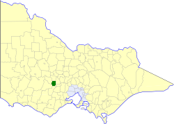 Location in Victoria | |||||||||||||||
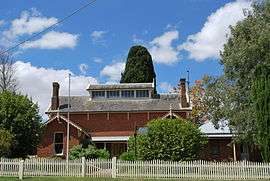 Historic shire office at Learmonth | |||||||||||||||
| Population | 19,530 (1992)[1] | ||||||||||||||
| • Density | 40.541/km2 (105.000/sq mi) | ||||||||||||||
| Established | 1856 | ||||||||||||||
| Area | 481.74 km2 (186.0 sq mi) | ||||||||||||||
| Council seat | Wendouree | ||||||||||||||
| County | Ripon, Talbot, Grenville | ||||||||||||||
_Council_1994.jpg) | |||||||||||||||
| |||||||||||||||
History
Ballarat was first incorporated as a road district on 7 October 1856, and became a shire on 24 November 1863.[2]
On 6 May 1994, the Shire of Ballarat was abolished, and, along with the City of Ballaarat, the Borough of Sebastopol and parts of the Shires of Bungaree, Buninyong, Grenville and Ripon, was merged into the newly created City of Ballarat.[3]
Wards
The Shire of Ballarat was divided into four ridings on 11 November 1952, each of which elected three councillors:
- Alfredton Riding
- Central Riding
- Rural Riding
- Showgrounds Riding
Towns and localities
- Wendouree
- Addington
- Ascot
- Alfredton (shared with the City of Ballaarat)
- Bald Hills
- Ballarat North
- Blowhard
- Burrumbeet
- Cardigan
- Cardigan Village
- Coghills Creek
- Dowling
- Glendaruel
- Invermay Park
- Learmonth
- Miners Rest
- Mitchell Park
- Mount Rowan
- Sulky
- Tourello
- Weatherboard
- Windermere
Population
| Year | Population |
|---|---|
| 1954 | 6,145 |
| 1958 | 7,970* |
| 1961 | 10,102 |
| 1966 | 12,254 |
| 1971 | 14,405 |
| 1976 | 17,037 |
| 1981 | 18,845 |
| 1986 | 19,110 |
| 1991 | 18,802 |
* Estimate in 1958 Victorian Year Book.
References
- Australian Bureau of Statistics, Victoria Office (1994). Victorian Year Book. pp. 49–52. ISSN 0067-1223.
- Victorian Municipal Directory. Brunswick: Arnall & Jackson. 1992. p. 584. Accessed at State Library of Victoria, La Trobe Reading Room.
- Australian Bureau of Statistics (1 August 1995). Victorian local government amalgamations 1994-1995: Changes to the Australian Standard Geographical Classification (PDF). Commonwealth of Australia. ISBN 0-642-23117-6. Retrieved 5 January 2008.