Shire of Rutherglen
The Shire of Rutherglen was a local government area about 275 kilometres (171 mi) north-northeast of Melbourne, the state capital of Victoria, Australia. The shire covered an area of 530.9 square kilometres (205.0 sq mi), and existed from 1862 until 1994.
| Shire of Rutherglen Victoria | |||||||||||||||
|---|---|---|---|---|---|---|---|---|---|---|---|---|---|---|---|
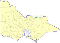 Location in Victoria | |||||||||||||||
| Population | 3,560 (1992)[1] | ||||||||||||||
| • Density | 6.706/km2 (17.367/sq mi) | ||||||||||||||
| Established | 1862 | ||||||||||||||
| Area | 530.9 km2 (205.0 sq mi) | ||||||||||||||
| Council seat | Rutherglen | ||||||||||||||
| County | Bogong | ||||||||||||||
| |||||||||||||||
History
Rutherglen was incorporated as a road district on 12 September 1862 and became a shire on 16 June 1871. Part of its Lilliput Riding was lost to the Shire of Chiltern in February 1917. On 15 December 1920, the Borough of Rutherglen, which had been gazetted on 12 September 1862 with an area of 518 hectares (1,280 acres), was merged into the Shire as its Central Riding.[2]
On 18 November 1994, the Shire was abolished, and merged with most of the Shires of Beechworth, Chiltern and Yackandandah into the Shire of Indigo.[3]
Wards
Rutherglen was divided into three wards, each of which elected three councillors:
- Central Ward
- East Ward
- West Ward
Towns and localities
- Rutherglen
- Wahgunyah (opposite Corowa, New South Wales)
- Browns Plains
- Cornishtown
- Gooramadda
- Great Northern
- Lilliput
- Prentice North
Population
| Year | Population |
|---|---|
| 1954 | 2,897 |
| 1958 | 2,990* |
| 1961 | 2,655 |
| 1966 | 2,552 |
| 1971 | 2,473 |
| 1976 | 2,612 |
| 1981 | 2,774 |
| 1986 | 2,980 |
| 1991 | 3,369 |
* Estimate in the 1958 Victorian Year Book.
References
- Australian Bureau of Statistics, Victoria Office (1994). Victorian Year Book. pp. 49–52. ISSN 0067-1223.
- Victorian Municipal Directory. Brunswick: Arnall & Jackson. 1992. pp. 826–827. Accessed at State Library of Victoria, La Trobe Reading Room.
- Australian Bureau of Statistics (1 August 1995). Victorian local government amalgamations 1994-1995: Changes to the Australian Standard Geographical Classification (PDF). Commonwealth of Australia. p. 8. ISBN 0-642-23117-6. Retrieved 5 January 2008.