Muchedent
Muchedent is a commune in the Seine-Maritime department in the Normandy region in north-western France.
Muchedent | |
|---|---|
 The bison farm | |
Location of Muchedent 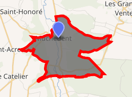
| |
 Muchedent  Muchedent | |
| Coordinates: 49°46′21″N 1°10′59″E | |
| Country | France |
| Region | Normandy |
| Department | Seine-Maritime |
| Arrondissement | Dieppe |
| Canton | Luneray |
| Intercommunality | CC Terroir de Caux |
| Area 1 | 7.05 km2 (2.72 sq mi) |
| Population (2017-01-01)[1] | 131 |
| • Density | 19/km2 (48/sq mi) |
| Time zone | UTC+01:00 (CET) |
| • Summer (DST) | UTC+02:00 (CEST) |
| INSEE/Postal code | 76458 /76590 |
| Elevation | 43–176 m (141–577 ft) (avg. 60 m or 200 ft) |
| 1 French Land Register data, which excludes lakes, ponds, glaciers > 1 km2 (0.386 sq mi or 247 acres) and river estuaries. | |
Geography
A small farming village situated by the banks of the river Varenne in the Pays de Caux, some 13 miles (21 km) south of Dieppe at the junction of the D77, the D154 and the D476 roads.
Population
| 1962 | 1968 | 1975 | 1982 | 1990 | 1999 | 2006 | 2007 | 2008 |
|---|---|---|---|---|---|---|---|---|
| 100 | 112 | 115 | 96 | 117 | 129 | 113 | 118 | 124 |
| Starting in 1962: Population without duplicates | ||||||||
Places of interest
- The bison farm.
- The church of St. Pierre, dating from the eleventh century.
- A nineteenth century château.
gollark: Hmm, maybe I should try rescaling it, that could work.
gollark: ↑
gollark: The goose decoder? No. BoneAmputee did it.
gollark: I think I tried exponentiating it and didn't get any effect.
gollark: Maybe I should have tried having Codex do it.
References
- "Populations légales 2017". INSEE. Retrieved 6 January 2020.
External links
| Wikimedia Commons has media related to Muchedent. |
- Website of the bison farm (in French)
| Authority control |
|
|---|
This article is issued from Wikipedia. The text is licensed under Creative Commons - Attribution - Sharealike. Additional terms may apply for the media files.