Saint-Gilles-de-la-Neuville
Saint-Gilles-de-la-Neuville is a commune in the Seine-Maritime department in the Normandy region in northern France.
Saint-Gilles-de-la-Neuville | |
|---|---|
Location of Saint-Gilles-de-la-Neuville 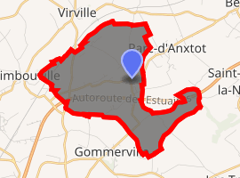
| |
 Saint-Gilles-de-la-Neuville  Saint-Gilles-de-la-Neuville | |
| Coordinates: 49°34′32″N 0°22′36″E | |
| Country | France |
| Region | Normandy |
| Department | Seine-Maritime |
| Arrondissement | Le Havre |
| Canton | Saint-Romain-de-Colbosc |
| Intercommunality | Le Havre Seine Métropole |
| Area 1 | 7.09 km2 (2.74 sq mi) |
| Population (2017-01-01)[1] | 645 |
| • Density | 91/km2 (240/sq mi) |
| Time zone | UTC+01:00 (CET) |
| • Summer (DST) | UTC+02:00 (CEST) |
| INSEE/Postal code | 76586 /76430 |
| Elevation | 78–127 m (256–417 ft) (avg. 109 m or 358 ft) |
| 1 French Land Register data, which excludes lakes, ponds, glaciers > 1 km2 (0.386 sq mi or 247 acres) and river estuaries. | |
Geography
It is a farming village in the Pays de Caux, situated 15 miles (24 km) northeast of Le Havre, at the junction of the D80 and D324 roads. The A29 autoroute passes through the south of the commune.
Population
| 1962 | 1968 | 1975 | 1982 | 1990 | 1999 | 2006 |
|---|---|---|---|---|---|---|
| 359 | 386 | 401 | 445 | 515 | 562 | 632 |
| Starting in 1962: Population without duplicates | ||||||
Places of interest
- A church dating from the twelfth century.
gollark: A clock.
gollark: Using the combined power of all potatOS laser lawnmowers, if I actually made any, which I didn't.
gollark: No, but we can target it with one.
gollark: Which I am sure we can all agree is useful and important.
gollark: Plethora has a `getCelestialAngle()` method for clocks as modules, so I can in theory use this information to automatically shoot the sun with lasers.
References
- "Populations légales 2017". INSEE. Retrieved 6 January 2020.
| Wikimedia Commons has media related to Saint-Gilles-de-la-Neuville. |
| Authority control |
|
|---|
This article is issued from Wikipedia. The text is licensed under Creative Commons - Attribution - Sharealike. Additional terms may apply for the media files.