Virville
Virville is a commune in the Seine-Maritime department in the Normandy region in northern France.
Virville | |
|---|---|
 The church in Virville | |
Location of Virville 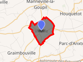
| |
 Virville  Virville | |
| Coordinates: 49°35′33″N 0°21′21″E | |
| Country | France |
| Region | Normandy |
| Department | Seine-Maritime |
| Arrondissement | Le Havre |
| Canton | Saint-Romain-de-Colbosc |
| Intercommunality | CC Campagne de Caux |
| Area 1 | 2.46 km2 (0.95 sq mi) |
| Population (2017-01-01)[1] | 357 |
| • Density | 150/km2 (380/sq mi) |
| Time zone | UTC+01:00 (CET) |
| • Summer (DST) | UTC+02:00 (CEST) |
| INSEE/Postal code | 76747 /76110 |
| Elevation | 93–127 m (305–417 ft) (avg. 120 m or 390 ft) |
| 1 French Land Register data, which excludes lakes, ponds, glaciers > 1 km2 (0.386 sq mi or 247 acres) and river estuaries. | |
Geography
A small farming village in the Pays de Caux, situated some 13 miles (21 km) northeast of Le Havre, at the junction of the D125 and D10 roads. An SNCF TER railway station serves both this and a neighbouring commune.
Population
| Year | 1962 | 1968 | 1975 | 1982 | 1990 | 1999 | 2006 |
|---|---|---|---|---|---|---|---|
| Population | 144 | 147 | 155 | 211 | 254 | 260 | 301 |
| From the year 1962 on: No double counting—residents of multiple communes (e.g. students and military personnel) are counted only once. | |||||||
Places of interest
- The church of St. Aubin, dating from the twelfth century.
gollark: What are you talking about?
gollark: I was hoping it would just cycle over a few days.
gollark: I shall add them to my breeding program, in which I just breed dragons together crazily to produce long lineages.
gollark: People had green ones, which are coloured.
gollark: OR DID IT?
References
- "Populations légales 2017". INSEE. Retrieved 6 January 2020.
External links
| Wikimedia Commons has media related to Virville. |
- Virville on the Quid website (in French)
| Authority control |
|
|---|
This article is issued from Wikipedia. The text is licensed under Creative Commons - Attribution - Sharealike. Additional terms may apply for the media files.