Saint-Ouen-du-Breuil
Saint-Ouen-du-Breuil is a commune in the Seine-Maritime department in the Normandy region in northern France.
Saint-Ouen-du-Breuil | |
|---|---|
.svg.png) Coat of arms | |
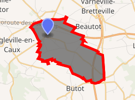
Location of Saint-Ouen-du-Breuil 
| |
 Saint-Ouen-du-Breuil  Saint-Ouen-du-Breuil | |
| Coordinates: 49°38′22″N 1°00′37″E | |
| Country | France |
| Region | Normandy |
| Department | Seine-Maritime |
| Arrondissement | Dieppe |
| Canton | Luneray |
| Intercommunality | CC Terroir de Caux |
| Government | |
| • Mayor (2008–2014) | Jean Marc Capron |
| Area 1 | 6.3 km2 (2.4 sq mi) |
| Population (2017-01-01)[1] | 778 |
| • Density | 120/km2 (320/sq mi) |
| Time zone | UTC+01:00 (CET) |
| • Summer (DST) | UTC+02:00 (CEST) |
| INSEE/Postal code | 76628 /76890 |
| Elevation | 154–182 m (505–597 ft) (avg. 175 m or 574 ft) |
| 1 French Land Register data, which excludes lakes, ponds, glaciers > 1 km2 (0.386 sq mi or 247 acres) and river estuaries. | |
Geography
A farming village situated in the Pays de Caux, some 16 miles (26 km) north of Rouen at the junction of the D22 and the D253 roads. Both the A29 and the A151 autoroutes pass through the commune's territory.
Population
| 1962 | 1968 | 1975 | 1982 | 1990 | 1999 | 2006 |
|---|---|---|---|---|---|---|
| 352 | 362 | 377 | 582 | 645 | 685 | 751 |
| Starting in 1962: Population without duplicates | ||||||
Places of interest
- The church of St. Ouen, dating from the thirteenth century.
gollark: JS actually is faster than python generally.
gollark: Or you write still less-performant high-level code, which is what you actually need most of the t ime.
gollark: Assembly is obviously better for... I don't know, when you actually need to implement interrupt handlers or something, or when you have a small bit of computing which needs to be run as fast as possible, but most practical stuff is *not* that.
gollark: Actually, it might be better to write it as OpenCL if it parallelizes well enough to run on GPUs.
gollark: It would probably still be somewhat slower, but more maintainable and easy to read/write.
References
- "Populations légales 2017". INSEE. Retrieved 6 January 2020.
| Wikimedia Commons has media related to Saint-Ouen-du-Breuil. |
This article is issued from Wikipedia. The text is licensed under Creative Commons - Attribution - Sharealike. Additional terms may apply for the media files.