Montreuil-en-Caux
Montreuil-en-Caux is a commune in the Seine-Maritime department in the Normandy region in northern France.
Montreuil-en-Caux | |
|---|---|
Location of Montreuil-en-Caux 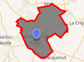
| |
 Montreuil-en-Caux  Montreuil-en-Caux | |
| Coordinates: 49°40′47″N 1°08′58″E | |
| Country | France |
| Region | Normandy |
| Department | Seine-Maritime |
| Arrondissement | Dieppe |
| Canton | Luneray |
| Intercommunality | CC Terroir de Caux |
| Government | |
| • Mayor (2014-2020) | Victor Boucher |
| Area 1 | 9.4 km2 (3.6 sq mi) |
| Population (2017-01-01)[1] | 507 |
| • Density | 54/km2 (140/sq mi) |
| Time zone | UTC+01:00 (CET) |
| • Summer (DST) | UTC+02:00 (CEST) |
| INSEE/Postal code | 76449 /76850 |
| Elevation | 124–174 m (407–571 ft) (avg. 145 m or 476 ft) |
| 1 French Land Register data, which excludes lakes, ponds, glaciers > 1 km2 (0.386 sq mi or 247 acres) and river estuaries. | |
Geography
A farming village situated in the Pays de Caux, some 20 miles (32 km) south of Dieppe at the junction of the D99, D96, D100 and the D929 roads.
Population
| 1962 | 1968 | 1975 | 1982 | 1990 | 1999 | 2006 |
|---|---|---|---|---|---|---|
| 404 | 411 | 349 | 367 | 357 | 380 | 439 |
| Starting in 1962: Population without duplicates | ||||||
Places of interest
- The church of St. Antoine and St. Sulpice, dating from the thirteenth century.
- Parts of an ancient château (now a farmhouse).
- The manorhouse of Hautot-Mesnil .
gollark: Sure I do. Your abstract thinking is just bad. Some offense.
gollark: Some systems will conveniently go back to an equilibrium regardless of how hard you poke them. Some will not, and might just vary wildly or get stuck in one state or whatever.
gollark: That isn't actually true except in specific technical contexts.
gollark: https://upload.wikimedia.org/wikipedia/commons/6/63/Logistic_Map_Animation.gif
gollark: There's that famous "iterated logistic map" thing.
References
- "Populations légales 2017". INSEE. Retrieved 6 January 2020.
| Wikimedia Commons has media related to Montreuil-en-Caux. |
| Authority control |
|
|---|
This article is issued from Wikipedia. The text is licensed under Creative Commons - Attribution - Sharealike. Additional terms may apply for the media files.