Freneuse, Seine-Maritime
Freneuse is a commune in the Seine-Maritime department in the Normandy region in northern France.
Freneuse | |
|---|---|
 The church in Freneuse | |
Location of Freneuse 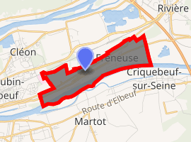
| |
 Freneuse  Freneuse | |
| Coordinates: 49°18′32″N 1°03′51″E | |
| Country | France |
| Region | Normandy |
| Department | Seine-Maritime |
| Arrondissement | Rouen |
| Canton | Caudebec-lès-Elbeuf |
| Intercommunality | Métropole Rouen Normandie |
| Government | |
| • Mayor | Monique Lemarié |
| Area 1 | 3.18 km2 (1.23 sq mi) |
| Population (2017-01-01)[1] | 932 |
| • Density | 290/km2 (760/sq mi) |
| Time zone | UTC+01:00 (CET) |
| • Summer (DST) | UTC+02:00 (CEST) |
| INSEE/Postal code | 76282 /76410 |
| Elevation | 3–75 m (9.8–246.1 ft) (avg. 11 m or 36 ft) |
| 1 French Land Register data, which excludes lakes, ponds, glaciers > 1 km2 (0.386 sq mi or 247 acres) and river estuaries. | |
Geography
A farming village situated in a meander of the river Seine some 8 miles (13 km) south of the centre of Rouen, at the junction of the D92 and the D292 roads.
Population
| Year | 1962 | 1968 | 1975 | 1982 | 1990 | 1999 | 2006 |
|---|---|---|---|---|---|---|---|
| Population | 560 | 575 | 730 | 1024 | 1033 | 951 | 948 |
| From the year 1962 on: No double counting—residents of multiple communes (e.g. students and military personnel) are counted only once. | |||||||
Places of interest
- The church of Notre-Dame, dating from the sixteenth century.
- The chateau at the hamlet of Beaudoin.
- The seventeenth-century chateau du Val-Freneuse
gollark: It's owned by Facebook.
gollark: Ugh. Whatsapp.
gollark: Wow, a starsinger on the hub now.
gollark: I'd be interested in a purebread, as in 2G from `bread` codes, but I don't think any exist.
gollark: Noninstagrabbed one!
References
- "Populations légales 2017". INSEE. Retrieved 6 January 2020.
| Wikimedia Commons has media related to Freneuse (Seine-Maritime). |
| Authority control |
|
|---|
This article is issued from Wikipedia. The text is licensed under Creative Commons - Attribution - Sharealike. Additional terms may apply for the media files.