Gueutteville
Gueutteville is a commune in the Seine-Maritime department in the Normandy region in northern France.
Gueutteville | |
|---|---|
Location of Gueutteville 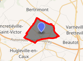
| |
 Gueutteville  Gueutteville | |
| Coordinates: 49°39′01″N 1°00′20″E | |
| Country | France |
| Region | Normandy |
| Department | Seine-Maritime |
| Arrondissement | Dieppe |
| Canton | Luneray |
| Intercommunality | CC Terroir de Caux |
| Government | |
| • Mayor (2008) | Gilbert Gohé |
| Area 1 | 2.99 km2 (1.15 sq mi) |
| Population (2017-01-01)[1] | 85 |
| • Density | 28/km2 (74/sq mi) |
| Time zone | UTC+01:00 (CET) |
| • Summer (DST) | UTC+02:00 (CEST) |
| INSEE/Postal code | 76335 /76890 |
| Elevation | 140–174 m (459–571 ft) (avg. 160 m or 520 ft) |
| 1 French Land Register data, which excludes lakes, ponds, glaciers > 1 km2 (0.386 sq mi or 247 acres) and river estuaries. | |
Geography
A very small farming village situated some 15 miles (24 km) north of Rouen, at the junction of the D22, D63 and the D253 roads. The A29 autoroute passes through the southern section of the commune's territory.
Population
| Year | 1962 | 1968 | 1975 | 1982 | 1990 | 1999 | 2006 |
|---|---|---|---|---|---|---|---|
| Population | 46 | 67 | 52 | 59 | 67 | 66 | 72 |
| From the year 1962 on: No double counting—residents of multiple communes (e.g. students and military personnel) are counted only once. | |||||||
Places of interest
- The church of Notre-Dame, dating from the thirteenth century.
- An eighteenth-century château.
gollark: Very easy.
gollark: APIONET has something like 5 channels. 3 used ones.
gollark: APIONET is perfect and without flaw.
gollark: This is why it is slightly out of sync.
gollark: Metadata is then shipped using JSON over HTTP/websockets.
References
- "Populations légales 2017". INSEE. Retrieved 6 January 2020.
| Wikimedia Commons has media related to Gueutteville. |
| Authority control |
|
|---|
This article is issued from Wikipedia. The text is licensed under Creative Commons - Attribution - Sharealike. Additional terms may apply for the media files.