Saint-Hellier
Saint-Hellier is a commune in the Seine-Maritime department in the Normandy region in northern France.
Saint-Hellier | |
|---|---|
Location of Saint-Hellier 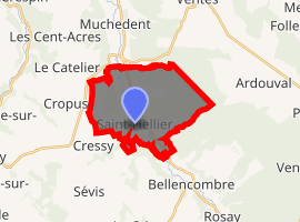
| |
 Saint-Hellier  Saint-Hellier | |
| Coordinates: 49°43′56″N 1°11′29″E | |
| Country | France |
| Region | Normandy |
| Department | Seine-Maritime |
| Arrondissement | Dieppe |
| Canton | Neufchâtel-en-Bray |
| Intercommunality | CC Bray-Eawy |
| Government | |
| • Mayor (2008–2014) | Alain Lucas |
| Area 1 | 14.22 km2 (5.49 sq mi) |
| Population (2017-01-01)[1] | 459 |
| • Density | 32/km2 (84/sq mi) |
| Time zone | UTC+01:00 (CET) |
| • Summer (DST) | UTC+02:00 (CEST) |
| INSEE/Postal code | 76588 /76680 |
| Elevation | 52–189 m (171–620 ft) (avg. 70 m or 230 ft) |
| 1 French Land Register data, which excludes lakes, ponds, glaciers > 1 km2 (0.386 sq mi or 247 acres) and river estuaries. | |
Geography
A forestry and farming village situated by the banks of the Varenne River in the Pays de Caux, at the junction of the D15, the D76 and the D154 road, some 16 miles (26 km) south of Dieppe.
Population
| 1962 | 1968 | 1975 | 1982 | 1990 | 1999 | 2006 |
|---|---|---|---|---|---|---|
| 327 | 348 | 334 | 404 | 405 | 419 | 420 |
| Starting in 1962: Population without duplicates | ||||||
Places of interest
- The church of St. Hellier, dating from the eleventh century.
- The chapel of Saint-Sauveur at La Frenaye built in 1788.
- The seventeenth century chapel of Saint-Paër at Orival-sous-Bellencombre.
gollark: Hmm. I wonder if that's actually enforceable anywhere.
gollark: Depends on the license, but I think the GPLs require that stuff linked with yours in some ways adopts the same license.
gollark: Copyleft forces all things using your thing to also be copyleft.
gollark: The entire thing.
gollark: Actually, it's the planet Mercury.
References
- "Populations légales 2017". INSEE. Retrieved 6 January 2020.
| Wikimedia Commons has media related to Saint-Hellier. |
| Authority control |
|
|---|
This article is issued from Wikipedia. The text is licensed under Creative Commons - Attribution - Sharealike. Additional terms may apply for the media files.