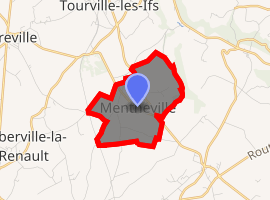
Mentheville
Mentheville is a commune in the Seine-Maritime department in the Normandy region in northern France.
Mentheville | |
|---|---|
Location of Mentheville 
| |
 Mentheville  Mentheville | |
| Coordinates: 49°41′31″N 0°24′36″E | |
| Country | France |
| Region | Normandy |
| Department | Seine-Maritime |
| Arrondissement | Le Havre |
| Canton | Saint-Romain-de-Colbosc |
| Intercommunality | CC Campagne de Caux |
| Government | |
| • Mayor (2008–2014) | Franck Remond |
| Area 1 | 3.08 km2 (1.19 sq mi) |
| Population (2017-01-01)[1] | 301 |
| • Density | 98/km2 (250/sq mi) |
| Time zone | UTC+01:00 (CET) |
| • Summer (DST) | UTC+02:00 (CEST) |
| INSEE/Postal code | 76425 /76110 |
| Elevation | 85–132 m (279–433 ft) (avg. 125 m or 410 ft) |
| 1 French Land Register data, which excludes lakes, ponds, glaciers > 1 km2 (0.386 sq mi or 247 acres) and river estuaries. | |
Geography
Mentheville is a small farming village in the Pays de Caux situated some 22 miles (35 km) northeast of Le Havre at the junction of the D11 and D75 roads.
Population
| 1962 | 1968 | 1975 | 1982 | 1990 | 1999 | 2006 |
|---|---|---|---|---|---|---|
| 152 | 166 | 127 | 137 | 133 | 158 | 213 |
| Starting in 1962: Population without duplicates | ||||||
Places of interest
- The church of Notre-Dame, dating from the seventeenth century.
- Two sixteenth-century houses.
- The seventeenth-century château.
gollark: Well, there are at least three separate ones for psychedelic drugs, what sound like NSFW ones, "conspiracy", Russian meshnet cryptolibertarians, some people working on adding more vegan locations to openstreetmap, bizarrely large amounts of activity from Perth, London biohackspace, "femboys", "science", and a weirdly popular bodyweight fitness one.
gollark: Matrix public rooms seem to be split between random open source projects and incredibly weird things
gollark: Mysterious.
gollark: With 443 members.
gollark: Hmm, there is an "applied category theory" room on matrix.
References
- "Populations légales 2017". INSEE. Retrieved 6 January 2020.
| Wikimedia Commons has media related to Mentheville. |
This article is issued from Wikipedia. The text is licensed under Creative Commons - Attribution - Sharealike. Additional terms may apply for the media files.