Les Ifs
Les Ifs is a commune in the Seine-Maritime department in the Normandy region in northern France.
Les Ifs | |
|---|---|
Location of Les Ifs 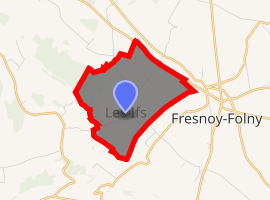
| |
 Les Ifs  Les Ifs | |
| Coordinates: 49°53′08″N 1°23′46″E | |
| Country | France |
| Region | Normandy |
| Department | Seine-Maritime |
| Arrondissement | Dieppe |
| Canton | Dieppe-2 |
| Intercommunality | CC Falaises du Talou |
| Government | |
| • Mayor | Michel Delrue |
| Area 1 | 4.03 km2 (1.56 sq mi) |
| Population (2017-01-01)[1] | 75 |
| • Density | 19/km2 (48/sq mi) |
| Time zone | UTC+01:00 (CET) |
| • Summer (DST) | UTC+02:00 (CEST) |
| INSEE/Postal code | 76371 /76630 |
| Elevation | 135–186 m (443–610 ft) (avg. 180 m or 590 ft) |
| 1 French Land Register data, which excludes lakes, ponds, glaciers > 1 km2 (0.386 sq mi or 247 acres) and river estuaries. | |
Geography
A tiny farming village situated in the Pays de Caux, some 16 miles (26 km) east of Dieppe just off the D115 road.
Population
| Year | 1962 | 1968 | 1975 | 1982 | 1990 | 1999 | 2006 |
|---|---|---|---|---|---|---|---|
| Population | 43 | 73 | 68 | 53 | 44 | 43 | 49 |
| From the year 1962 on: No double counting—residents of multiple communes (e.g. students and military personnel) are counted only once. | |||||||
Places of interest
- The church of St. Barthélemy, dating from the eighteenth century.
gollark: Oh please, Rust programs wouldn't fit in 8MB.
gollark: There are a few things which are reverse proxied and not exposed to the public, but which are accessible to programs on the same device.
gollark: No, I mean I need to stop you from accessing the ports behind the osmarksfirewall™, see.
gollark: I would also have to restrict disk space and network IO.
gollark: Potentially. I don't know.
References
- "Populations légales 2017". INSEE. Retrieved 6 January 2020.
External links
| Wikimedia Commons has media related to Les Ifs. |
| Authority control |
|
|---|
This article is issued from Wikipedia. The text is licensed under Creative Commons - Attribution - Sharealike. Additional terms may apply for the media files.