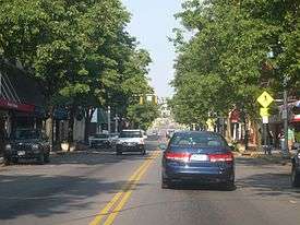
Bristol, Virginia
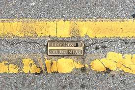
Bristol is an independent city in the Commonwealth of Virginia. As of the 2010 census, the population was 17,835.[6] It is the twin city of Bristol, Tennessee, just across the state line, which runs down the middle of its main street, State Street. The Bureau of Economic Analysis combines the city of Bristol, Virginia, with neighboring Washington County, Virginia, for statistical purposes. Bristol is a principal city of the Kingsport–Bristol–Bristol, TN-VA Metropolitan Statistical Area, which is a component of the Johnson City–Kingsport–Bristol, TN-VA Combined Statistical Area – commonly known as the "Tri-Cities" region.
Bristol, Virginia | |
|---|---|
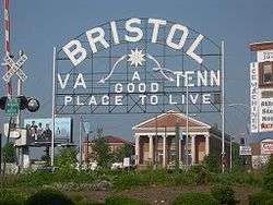 A sign welcomes visitors to the twin cities of Bristol, Virginia, and Bristol, Tennessee. | |
 Seal | |
| Nickname(s): The Birthplace of Country Music | |
| Motto(s): A Good Place to Live | |
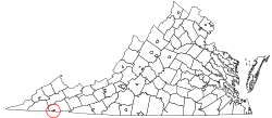 | |
| Coordinates: 36°36′N 82°11′W | |
| Country | United States |
| State | Virginia |
| County | Washington (Independent city) |
| Government | |
| • Type | Council-manager |
| • Mayor | Bill Hartley |
| • Vice Mayor | Anthony Farnum |
| • City Manager | Randall C. Eads |
| Area | |
| • Independent city | 13.00 sq mi (33.66 km2) |
| • Land | 12.87 sq mi (33.34 km2) |
| • Water | 0.12 sq mi (0.32 km2) |
| Elevation | 1,680 ft (512 m) |
| Population | |
| • Independent city | 17,835 |
| • Estimate (2019)[3] | 16,762 |
| • Density | 1,302.31/sq mi (502.82/km2) |
| • Metro | 500,901 |
| Time zone | UTC−5 (Eastern) |
| • Summer (DST) | UTC−4 (EDT) |
| ZIP code | 24201, 24202 |
| Area code(s) | 276 |
| FIPS code | 51-09816[4] |
| GNIS feature ID | 1492633[5] |
| Website | www |
History
Evan Shelby first appeared in what is now the Bristol area around 1765. In 1766, Shelby moved his family and settled at a place called Big Camp Meet (now Bristol, Tennessee/Virginia). It is said that Cherokee Indians once inhabited the area and the Indian village was named, according to legend, because numerous deer and buffalo met here to feast in the canebrakes. Shelby renamed the site Sapling Grove (which would later be changed to Bristol). In 1774, Shelby erected a fort on a hill overlooking what is now downtown Bristol. It was an important stopping-off place for notables such as Daniel Boone and George Rogers Clark, as well as hundreds of pioneers' en route to the interior of the developing nation. This fort, known as Shelby's Station was actually a combination trading post, way station, and stockade.[7]
By the mid-nineteenth century, when surveyors projected a junction of two railroad lines at the Virginia-Tennessee state line, Reverend James King conveyed much of his acreage to his son-in-law, Joseph R. Anderson. Anderson laid out the original town of Bristol, Tennessee/Virginia and building began in 1853.[7]
Samuel Goodson, who owned land that adjoined the original town of Bristol TN/VA at its northern boundary (Beaver Creek was the dividing line), started a development known as Goodsonville. Anderson was unable to incorporate Bristol across the state lines of Tennessee and Virginia. In 1856, Goodsonville and the original Bristol, Virginia were merged to form the composite town of Goodson, Virginia.[7]
Incorporation for Bristol, Tennessee and Goodson, Virginia occurred in 1856. The Virginia and Tennessee Railroads reached the cities in the late summer of 1856. Due to having two different railroads companies, two depots served the cities; one in Bristol, Tenn. and the other in Goodson, Va. However, the depot located in Goodson continued to be referred to as Bristol, Virginia. In 1890, Goodson, Virginia once again took the name Bristol.[7]
The Grove, Solar Hill Historic District, and Walnut Grove are listed on the National Register of Historic Places.[8]
Geography
Bristol is located in southwestern Virginia at 36°36′N 82°11′W (36.6111, -82.1762).[9] It is bordered to the west, north, and east by Washington County, Virginia, and to the south by the city of Bristol in Sullivan County, Tennessee.
According to the United States Census Bureau, the city has a total area of 13.2 square miles (34.1 km2), of which 13.0 square miles (33.7 km2) is land and 0.15 square miles (0.4 km2), or 1.07%, is water.[10] Little Creek and Beaver Creek flow south through the city; Little Creek flows into Beaver Creek two blocks south of the state line in Tennessee. Beaver Creek is a tributary of the South Fork Holston River.
The city is served by Interstates 81 and 381, and by U.S. Routes 11, 19, 58, and 421. I-81 leads northeast 149 miles (240 km) to Roanoke, Virginia, and southwest 113 miles (182 km) to Knoxville, Tennessee. Interstate 381 (I-381) is a spur from Interstate 81 that provides access to Bristol, Virginia, United States. It runs for 1.7 miles (2.7 kilometers) from the intersection of Commonwealth Avenue (State Route 381) and Keys/Church Streets in Bristol at exit 0 north to Interstate 81. The I-81 interchange, the only one on I-381, is signed as exits 1A (I-81 north) and 1B (I-81 south). US 11 and US 19, running parallel to I-81, lead northeast 15 miles (24 km) to Abingdon, Virginia. US 11 splits into routes 11W and 11E in Bristol; US 11W leads west-southwest 23 miles (37 km) to Kingsport, Tennessee, while US 11E and US 19 lead south-southwest 25 miles (40 km) to Johnson City, Tennessee. US 58 runs with I-81 northeast for 17 miles (27 km) before splitting off to the east just beyond Abingdon; US 58 and 421 together lead west 27 miles (43 km) to Weber City, Virginia. US 421 leads southeast 33 miles (53 km) to Mountain City, Tennessee.
Demographics
| Historical population | |||
|---|---|---|---|
| Census | Pop. | %± | |
| 1880 | 1,562 | — | |
| 1890 | 2,902 | 85.8% | |
| 1900 | 4,579 | 57.8% | |
| 1910 | 6,247 | 36.4% | |
| 1920 | 6,729 | 7.7% | |
| 1930 | 8,840 | 31.4% | |
| 1940 | 9,768 | 10.5% | |
| 1950 | 15,954 | 63.3% | |
| 1960 | 17,144 | 7.5% | |
| 1970 | 14,857 | −13.3% | |
| 1980 | 19,042 | 28.2% | |
| 1990 | 18,426 | −3.2% | |
| 2000 | 17,367 | −5.7% | |
| 2010 | 17,835 | 2.7% | |
| Est. 2019 | 16,762 | [3] | −6.0% |
| U.S. Decennial Census[11] 1790-1960[12] 1900-1990[13] 1990-2000[14] 2010-2019[6] | |||
As of the census[15] of 2000, there were 17,367 people, 7,678 households, and 4,798 families residing in the city. The population density was 1,346.4 people per square mile (519.8/km2). There were 8,469 housing units at an average density of 656.6 per square mile (253.5/km2). The racial makeup of the city was 92.54% White, 5.57% Black or African American, 0.25% Native American, 0.37% Asian, 0.01% Pacific Islander, 0.18% from other races, and 1.08% from two or more races. 0.97% of the population were Hispanic or Latino of any race.
There were 7,678 households, out of which 24.8% had children under the age of 18 living with them, 46.1% were married couples living together, 13.6% had a female householder with no husband present, and 37.5% were non-families. 34.3% of all households were made up of individuals, and 17.4% had someone living alone who was 65 years of age or older. The average household size was 2.18 and the average family size was 2.78.
In the city, the population was spread out, with 20.3% under the age of 18, 8.6% from 18 to 24, 26.2% from 25 to 44, 24.4% from 45 to 64, and 20.5% who were 65 years of age or older. The median age was 41 years. For every 100 females, there were 82.0 males. For every 100 females age 18 and over, there were 75.9 males.
The median income for a household in the city was $27,389, and the median income for a family was $34,266. Males had a median income of $28,420 versus $20,967 for females. The per capita income for the city was $17,311. About 13.2% of families and 16.2% of the population were below the poverty line, including 25.8% of those under age 18 and 12.4% of those age 65 or over.
Government
| Year | Republican | Democratic | Third Parties |
|---|---|---|---|
| 2016 | 69.6% 4,892 | 26.1% 1,835 | 4.3% 300 |
| 2012 | 64.7% 4,780 | 33.7% 2,492 | 1.6% 115 |
| 2008 | 62.2% 4,579 | 36.2% 2,665 | 1.6% 115 |
| 2004 | 63.6% 4,275 | 35.7% 2,400 | 0.7% 49 |
| 2000 | 55.7% 3,495 | 42.1% 2,646 | 2.2% 138 |
| 1996 | 49.5% 2,983 | 42.9% 2,586 | 7.6% 457 |
| 1992 | 48.5% 3,616 | 39.5% 2,948 | 12.0% 898 |
| 1988 | 63.9% 4,407 | 35.5% 2,446 | 0.6% 42 |
| 1984 | 67.1% 5,012 | 32.5% 2,429 | 0.4% 27 |
| 1980 | 52.7% 3,432 | 44.3% 2,889 | 3.0% 194 |
| 1976 | 46.3% 2,943 | 52.6% 3,343 | 1.2% 75 |
| 1972 | 68.5% 2,665 | 29.7% 1,157 | 1.8% 71 |
| 1968 | 44.1% 1,930 | 35.0% 1,531 | 20.9% 916 |
| 1964 | 34.6% 1,289 | 65.2% 2,429 | 0.1% 5 |
| 1960 | 52.4% 1,728 | 47.3% 1,561 | 0.3% 10 |
| 1956 | 51.9% 1,794 | 47.6% 1,645 | 0.5% 18 |
| 1952 | 52.3% 1,574 | 47.6% 1,432 | 0.1% 3 |
| 1948 | 35.7% 879 | 58.9% 1,451 | 5.4% 132 |
| 1944 | 28.6% 628 | 71.0% 1,561 | 0.4% 9 |
| 1940 | 22.2% 423 | 76.9% 1,465 | 0.8% 16 |
| 1936 | 18.5% 311 | 81.1% 1,364 | 0.4% 7 |
| 1932 | 19.4% 307 | 79.1% 1,252 | 1.5% 24 |
| 1928 | 40.6% 630 | 59.4% 922 | |
| 1924 | 29.2% 440 | 68.8% 1,036 | 2.0% 30 |
| 1920 | 30.3% 344 | 69.1% 784 | 0.5% 6 |
| 1916 | 27.2% 184 | 72.2% 489 | 0.6% 4 |
| 1912 | 15.2% 86 | 71.6% 405 | 13.3% 75 |
July 1, 2019 to June 30, 2020:
Government
- Mayor: Neal Osborne
- Vice Mayor: Bill Hartley
- Council Member: Kevin Wingard
- Council Member: Kevin Mumpower
- Council Member: Anthony Farnum
- Interim City Manager: Randall C. Eads
- Assistant City Manager:
Past mayors
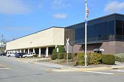
- Jerry Wolfe, 1992-1997
- Farham Jarrard, 1997-2000
- Jerry Wolfe, 2000-2001
- Douglas R. Weberling, 2001-2003
- Jerry Wolfe, 2003-2004
- Paul W. Hurley, 2004-2005
- Douglas R. Weberling, 2005-2006
- C. Farnham Jarrard, 2006-2007
- James Rector, 2007-2010
- Don Ashley, 2010-2011
- Ed Harlow, 2011-2012
- Jim Steele, 2012-2013
- Guy Odum, 2013-2014
- Catherine Brillhart, 2014-2015 (first female mayor)[17]
- Archie Hubbard, III, 2015-2016
- Bill Hartley, 2016-2017
- Kevin Mumpower, 2017-2019
Police
| Bristol Police Department | |
|---|---|
| Abbreviation | BPD |
| Jurisdictional structure | |
| Operations jurisdiction | Bristol, Virginia, United States |
| General nature | |
| Operational structure | |
| Sworn members | 53 |
| Unsworn members | 21 |
| Agency executive |
|
| Website | |
| [website] | |
Bristol is served by two law enforcement agencies: the city police and the city sheriff's department. Supporting the department is the city's E-911 Central Dispatch Emergency Communication Center which provides call taking and dispatch service for police, fire and EMS needs.
Technology
Despite its relatively small size, Bristol, Virginia, boasts one of the more advanced broadband networks in the country.[18] BVU Authority (formerly Bristol Virginia Utilities or BVU)[19] started planning a fiber optic deployment in the city in the late 1990s. By 2001, BVU had been granted approval by the city council for a full deployment of a Fiber to the premises (FTTP or FTTU, fiber to the user) project. This project was to offer competition to local incumbents and provide broadband Internet, cable TV, and telephone service to the residents of Bristol. This deployment was one of the first of its kind in the United States and was widely watched by the telecommunications industry. A system known as Passive optical network (PON) was successfully deployed to over 6,000 customers in a matter of two years.
In 2003, in the relatively isolated city of Bristol, Virginia, BVU, created a nonprofit division called "Optinet", a municipal broadband Internet service that covers Bristol as well as the Southwest portion of the state of Virginia. Serving around 12,500 customers,[20] BVU is recognized as the "first municipal utility in the United States to deploy an all-fiber network offering the triple play of video, voice and data services".[20] On October 29, 2009, BVU received US$3.5 million in grant funding from the Virginia Tobacco Indemnification and Community Revitalization Commission.[21] With these funds BVU will build "an additional 49 miles of its OptiNet fiber-optic backbone from Abingdon up I-81 to Virginia Route 16 from Marion into Grayson County".[21] This will also allow for BVU to make a second connection with Mid Atlantic Broadband, increasing communication between different businesses in Northern Virginia. The Virginia Tobacco Community funded this project because it provided their business with more connections in crucial areas of the southwest and southern part of Virginia.
The U.S. Department of Commerce also funded BVU. On July 3, 2010, it was reported that they gave US$22.7 million in stimulus funds to Southwest Virginia to create a "388-mile optic backbone through an eight-county region". This project will service over 120 institutions, such as schools, hospitals, government buildings, and many more besides.[22] This new municipals broadband service will also be within a two-mile distance of over 500 different businesses.[22] This project also created 295 new jobs.[22] BVU Optinet continues operate a strong municipal broadband Internet service for Bristol and many other counties in Virginia.
Bristol's twin city in Tennessee has deployed an FTTP system similar to its neighbor across the state line.
On August 2, 2018, BVU Authority completed a sale of the OptiNet FTTP network to a private company, Sunset Digital of Duffield, Virginia for $50 M.[23] The sale began in late 2015 and was publicly announced in early 2016. Along with the sale of OptiNet, BVU's joint network with Cumberland Plateau Co. was sold to Sunset Digital. In addition to the network assets, Sunset agreed to hire approximately 75 BVU employees from BVU.[24]
Transportation
Air transport
The Tri-Cities Regional Airport, with approximately 195,000 annual passengers, is 19 miles to the southwest of Bristol.[25]
Highways
U.S. Route 11, U.S. Route 19 and U.S. Route 421 run through the city.[26]
In the vicinity, to the northwest, is Interstate 81, which takes travelers northward to Roanoke, about 150 miles (240 km) away and southward to Knoxville about 113 miles (182 km) to the south. Nashville is 293 miles (472 km) southwest.
Rail
Until 1970 the Southern Railway ran a couple of trains through the city, making stops at Bristol station. The last trains being the Birmingham Special and the Pelican. Until 1968 the Memphis-bound Tennessean made a stop in the city.
Economy
Top employers
According to Bristol's 2011 Comprehensive Annual Financial Report,[27] the top employers in the city are:
| # | Employer | # of Employees |
|---|---|---|
| 1 | City of Bristol | 676 |
| 2 | Electro-Mechanical Corporation | 600 |
| 3 | OfficeMax | 500 |
| 4 | Sprint PCS | 428 |
| 5 | US Solutions | 367 |
| 6 | Strongwell | 350 |
| 7 | Commonwealth of Virginia | 250 |
| 8 | Shearer's Foods | 225 |
| 9 | Ball | 218 |
| 10 | Aerus | 201 |
| 11 | United Parcel Service | 193 |
Education
In 2007 and 2008, Bristol was named one of the Best 100 Communities for Music Education[28][29]
The city school division, Bristol Virginia Public Schools, operates Virginia High School and Virginia Middle School, together with four elementary schools: Highland View, Stonewall Jackson, Van Pelt, and Washington Lee. Three private schools — St. Anne Catholic, Sullins Academy, and Morrison — are operated within the city. Bristol was formerly home to two post-secondary institutions, Sullins College and Virginia Intermont College, but these colleges closed in 1978 and 2014 respectively.
Culture
"Birthplace of Country Music"
Bristol was recognized as the "Birthplace of Country Music", according to a resolution passed by the US Congress in 1998;[30] residents of the city had contributed to early country music recordings and influence, and the Birthplace of Country Music Museum is located in Bristol.
In 1927 record producer Ralph Peer of Victor Records began recording local musicians in Bristol to attempt to capture the local sound of traditional "folk" music of the region. One of these local sounds was created by the Carter Family. The Carter Family got their start on July 31, 1927, when A.P. Carter and his family journeyed from Maces Spring, Virginia, to Bristol, Tennessee, to audition for Peer who was seeking new talent for the relatively embryonic recording industry. They received $50 for each song they recorded.
Since 1994, the Birthplace of Country Music Alliance has promoted the city as a destination to learn about the history of the region and its role in the creation of an entire music genre. The Alliance is organizing the building of a new Cultural Heritage Center to help educate the public about the history of country music in the region.[31]
Professional sports
Bristol hosts the Bristol Pirates baseball team of the Appalachian League.
Former NASCAR driver Kelly Denton is from the city.
On the Tennessee side, Bristol is home to Bristol Motor Speedway, the "world's fastest half mile", which hosts two NASCAR CUP SERIES races , two races per year on the NASCAR Xfinity Series and one race per year on the GANDER RV and OUTDOORS Truck Series, and various other racing events. The complex includes the Bristol Dragway, nicknamed "Thunder Valley", referencing the hills that echo the engine noise back toward the crowd.
Media
Television:
- WCYB-TV in Bristol, VA (NBC Channel 5)
- WEMT-TV in Bristol, VA (Fox Channel 39)
- WJHL-TV in Johnson City, TN (CBS Channel 11; ABC on DT2)
Newspaper:
Radio:
References
- "2019 U.S. Gazetteer Files". United States Census Bureau. Retrieved August 7, 2020.
- "U.S. Census website". United States Census Bureau. Retrieved 2014-07-12.
- "Population and Housing Unit Estimates". United States Census Bureau. May 24, 2020. Retrieved May 27, 2020.
- "U.S. Census website". United States Census Bureau. Retrieved 2008-01-31.
- "US Board on Geographic Names". United States Geological Survey. 2007-10-25. Retrieved 2008-01-31.
- "State & County QuickFacts". United States Census Bureau. Archived from the original on January 6, 2014. Retrieved January 5, 2014.
- "The History of Bristol". Discover Bristol. Retrieved 14 December 2016.
- "National Register Information System". National Register of Historic Places. National Park Service. July 9, 2010.
- "US Gazetteer files: 2010, 2000, and 1990". United States Census Bureau. 2011-02-12. Retrieved 2011-04-23.
- "Geographic Identifiers: 2010 Demographic Profile Data (G001): Bristol city, Virginia". U.S. Census Bureau, American Factfinder. Retrieved August 20, 2015.
- "U.S. Decennial Census". United States Census Bureau. Retrieved January 5, 2014.
- "Historical Census Browser". University of Virginia Library. Retrieved January 5, 2014.
- "Population of Counties by Decennial Census: 1900 to 1990". United States Census Bureau. Retrieved January 5, 2014.
- "Census 2000 PHC-T-4. Ranking Tables for Counties: 1990 and 2000" (PDF). United States Census Bureau. Retrieved January 5, 2014.
- "U.S. Census website". United States Census Bureau. Retrieved 2011-05-14.
- "Dave Leip's Atlas of U.S. Presidential Elections". uselectionatlas.org.
- "Brillhart named Bristol, Virginia mayor". HeraldCourier.com. Retrieved 5 December 2015.
- "Broadband at the Speed of Light". Institute for Local Self-Reliance. 9 April 2012. Retrieved 4 December 2015.
- "Virginia SCC - Division of Public Utility Registration". SCC of Virginia. Retrieved 5 August 2018.
- "Bristol Virginia utilities: about us". Bvu-optinet.com. Archived from the original on 2017-06-06. Retrieved 2017-05-24.
- "Bristol Virginia Utilities receives $3.5 million for broadband construction". www.lightwaveonline.com. Retrieved 2016-02-29.
- Telegraph, CHARLES OWENSBluefield Daily. "Stimulus funding to stretch broadband through 8 Va. counties". Bluefield Daily Telegraph. Retrieved 2016-02-29.
- McGee, David. "Sunset, BVU OptiNet deal finalized". Bristol Herald Courier. Bristol Herald Courier. Retrieved 5 August 2018.
- Irby, Zach. "BVU OptiNet, Sunset deal moving forward". BRISTOL HERALD COURIER. BRISTOL HERALD COURIER. Retrieved 5 August 2018.
- U.S. Department of Transportation, Bureau of Transportation Statistics, Retrieved, 11/29/2018 https://www.transtats.bts.gov/airports.asp?pn=1&Airport=TRI&Airport_Name=Bristol/Johnson
- City location https://tools.wmflabs.org/geohack/geohack.php?pagename=Bristol,_Virginia¶ms=36_36_N_82_11_W_region:US-VA_type:city
- "Archived copy" (PDF). Archived from the original (PDF) on 2013-07-31. Retrieved 2012-12-03.CS1 maint: archived copy as title (link)
- "Archived copy". Archived from the original on 2008-05-16. Retrieved 2008-04-07.CS1 maint: archived copy as title (link)
- "Archived copy". Archived from the original on 2008-05-02. Retrieved 2008-05-07.CS1 maint: archived copy as title (link)
- Phillips, V.N. (Bud) (2006). A good place to live : Bristol, Tennessee/Virginia. Johnson City, Tenn.: Overmountain Press. p. 211. ISBN 9781570723148. Retrieved 14 June 2016.
- "Birthplace of Country Music". Retrieved 16 April 2015.
External links
| Wikisource has the text of the 1911 Encyclopædia Britannica article Bristol (Tennessee). |
| Wikimedia Commons has media related to Bristol, Virginia. |
