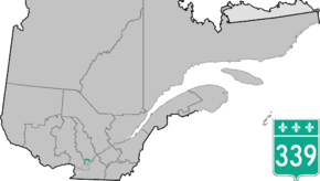
Quebec Route 339
Route 339 is a provincial highway that is situated in the Lanaudière region of Quebec. It runs from the junction of Route 344 in L'Assomption northeast of Montreal and ends at the junctions of Route 158, Route 335 and Route 337 in Saint-Lin-Laurentides, 32 kilometers to the north.
| ||||
|---|---|---|---|---|
 | ||||
| Route information | ||||
| Maintained by Transports Québec | ||||
| Length | 31.7 km[1] (19.7 mi) | |||
| Major junctions | ||||
| South end | ||||
| North end | ||||
| Location | ||||
| Major cities | L'Assomption, Saint-Roch-de-l'Achigan, Saint-Lin-Laurentides | |||
| Highway system | ||||
| ||||

Municipalities along Route 339
.jpg)
Quebec Route 339 in Saint-Lin-Laurentides
- L'Assomption
- L'Épiphanie
- Saint-Roch-de-l'Achigan
- Saint-Roch-Ouest
- Saint-Lin-Laurentides
Major intersections
| RCM | Location | km | mi | Destinations | Notes |
|---|---|---|---|---|---|
| L'Assomption | L'Assomption | 0 | 0.0 | Southern terminus | |
| 7.6 | 4.7 | ||||
| Montcalm | Saint-Roch-Ouest | 22.1 | 13.7 | Exit 44 (A-25) | |
| 22.7 | 14.1 | ||||
| Saint-Lin-Laurentides | 31.7 | 19.7 | Northern terminus | ||
| 1.000 mi = 1.609 km; 1.000 km = 0.621 mi | |||||
gollark: Just with odd path resolution.
gollark: In any case, `loadfile` *is* basically the same.
gollark: Besides, they can add require easily with a small polyfill or whatever.
gollark: Why should we support those fools on old versions?
gollark: And?
See also
References
- Ministère des transports, "Distances routières", page 98, Les Publications du Québec, 2005
This article is issued from Wikipedia. The text is licensed under Creative Commons - Attribution - Sharealike. Additional terms may apply for the media files.